Clifford Topo Map Michigan
To zoom in, hover over the map of Clifford
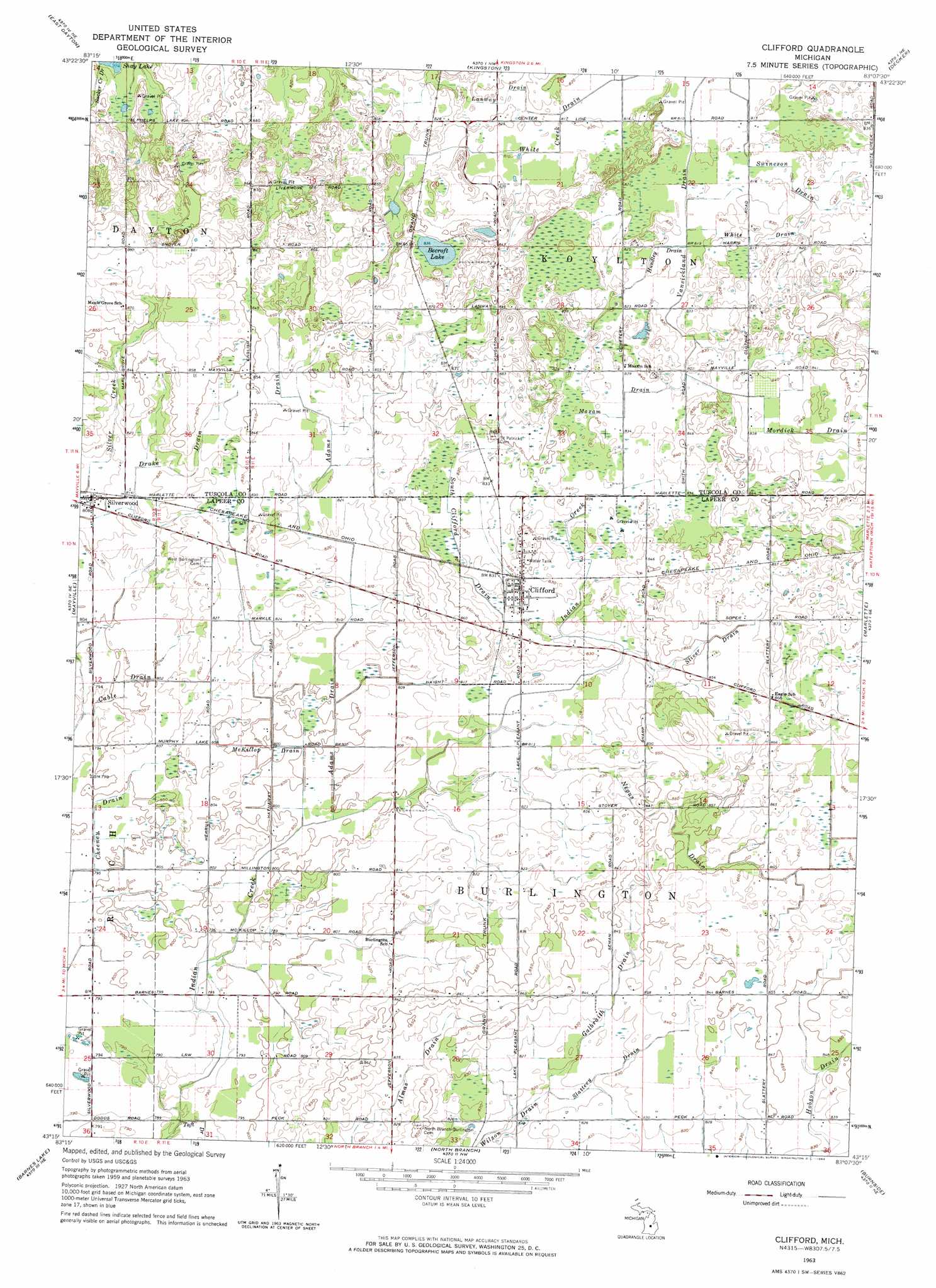
USGS Topo Quad 43083c2 - 1:24,000 scale
| Topo Map Name: | Clifford |
| USGS Topo Quad ID: | 43083c2 |
| Print Size: | ca. 21 1/4" wide x 27" high |
| Southeast Coordinates: | 43.25° N latitude / 83.125° W longitude |
| Map Center Coordinates: | 43.3125° N latitude / 83.1875° W longitude |
| U.S. State: | MI |
| Filename: | o43083c2.jpg |
| Download Map JPG Image: | Clifford topo map 1:24,000 scale |
| Map Type: | Topographic |
| Topo Series: | 7.5´ |
| Map Scale: | 1:24,000 |
| Source of Map Images: | United States Geological Survey (USGS) |
| Alternate Map Versions: |
Clifford MI 1963, updated 1964 Download PDF Buy paper map Clifford MI 2011 Download PDF Buy paper map Clifford MI 2014 Download PDF Buy paper map Clifford MI 2016 Download PDF Buy paper map |
1:24,000 Topo Quads surrounding Clifford
Colling |
Ellington |
Cass City |
Shabbona |
Argyle |
Caro |
East Dayton |
Kingston |
Decker |
Snover |
Juniata |
Mayville |
Clifford |
Marlette |
Juhl |
Columbiaville |
Barnes Lake |
North Branch |
Burnside |
Brown City |
Elba |
Lapeer |
Attica |
Imlay City |
Capac |
> Back to 43083a1 at 1:100,000 scale
> Back to 43082a1 at 1:250,000 scale
> Back to U.S. Topo Maps home
Clifford topo map: Gazetteer
Clifford: Canals
Adams Drain elevation 253m 830′Adams Drain elevation 244m 800′
Almas Drain elevation 250m 820′
Cheeney Drain elevation 241m 790′
Drake Drain elevation 250m 820′
Galbraith Drain elevation 253m 830′
Hobson Drain elevation 257m 843′
Hundley Drain elevation 250m 820′
Lanway Drain elevation 250m 820′
Maxam Drain elevation 253m 830′
McKillop Drain elevation 244m 800′
Negus Drain elevation 259m 849′
Slattery Drain elevation 251m 823′
South Clifford Drain elevation 250m 820′
Stiver Drain elevation 259m 849′
Swineson Drain elevation 250m 820′
Taft Drain elevation 239m 784′
Vansickland Drain elevation 247m 810′
White Drain elevation 250m 820′
Clifford: Lakes
Becroft Lake elevation 255m 836′Clifford: Parks
Saint Patrick Church Historical Marker elevation 260m 853′Clifford: Populated Places
Clifford elevation 253m 830′Silverwood elevation 245m 803′
Clifford: Post Offices
Clifford Post Office elevation 253m 830′Silverwood Post Office elevation 245m 803′
Clifford digital topo map on disk
Buy this Clifford topo map showing relief, roads, GPS coordinates and other geographical features, as a high-resolution digital map file on DVD:
 map DVD")