Inwood Topo Map Iowa
To zoom in, hover over the map of Inwood
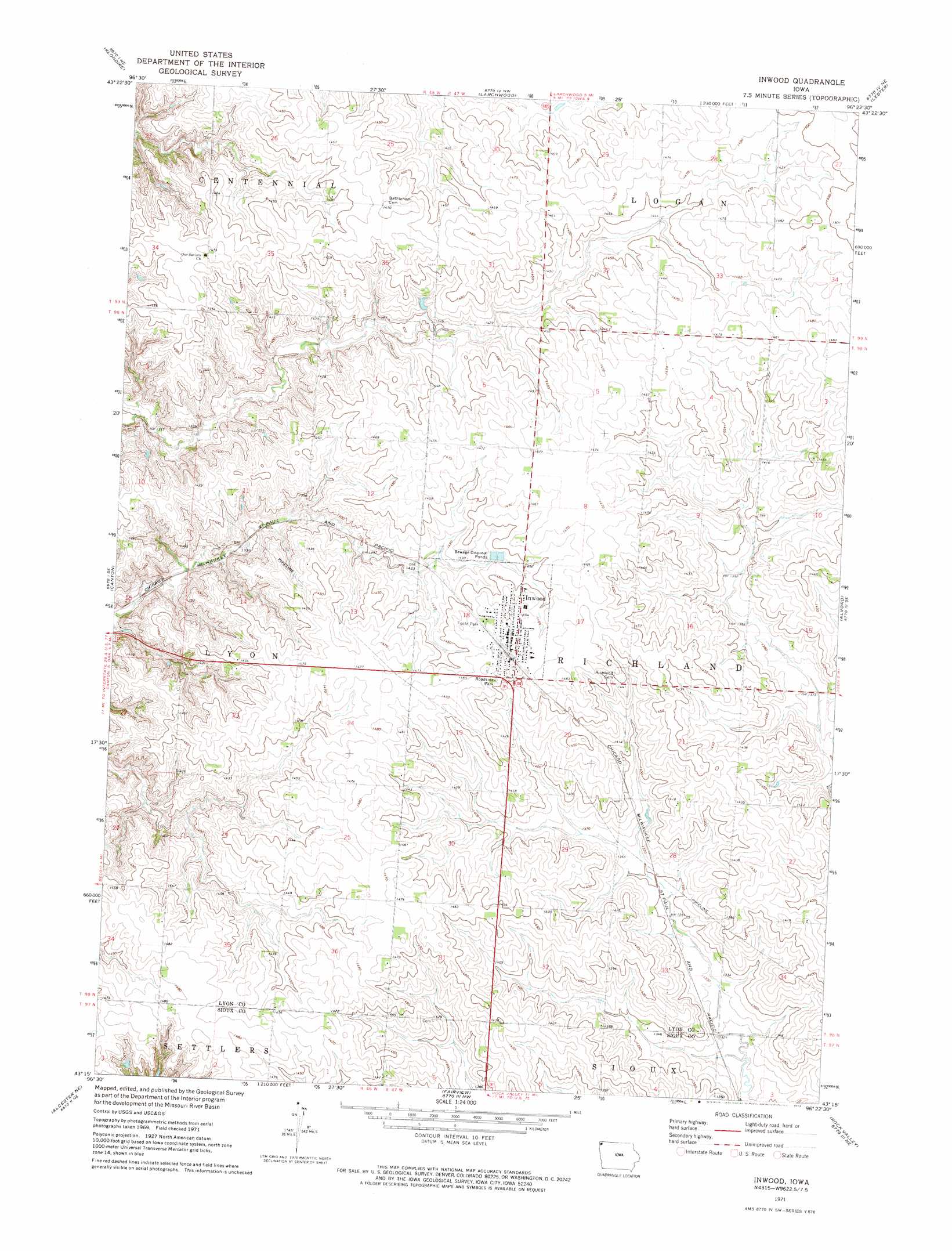
USGS Topo Quad 43096c4 - 1:24,000 scale
| Topo Map Name: | Inwood |
| USGS Topo Quad ID: | 43096c4 |
| Print Size: | ca. 21 1/4" wide x 27" high |
| Southeast Coordinates: | 43.25° N latitude / 96.375° W longitude |
| Map Center Coordinates: | 43.3125° N latitude / 96.4375° W longitude |
| U.S. State: | IA |
| Filename: | o43096c4.jpg |
| Download Map JPG Image: | Inwood topo map 1:24,000 scale |
| Map Type: | Topographic |
| Topo Series: | 7.5´ |
| Map Scale: | 1:24,000 |
| Source of Map Images: | United States Geological Survey (USGS) |
| Alternate Map Versions: |
Inwood IA 1971, updated 1973 Download PDF Buy paper map Inwood IA 2010 Download PDF Buy paper map Inwood IA 2013 Download PDF Buy paper map Inwood IA 2015 Download PDF Buy paper map |
1:24,000 Topo Quads surrounding Inwood
Sioux Falls East |
Brandon |
Valley Springs |
Hills |
Ash Creek |
Harrisburg |
Klondike |
Larchwood |
Lester |
Rock Rapids |
Canton Sw |
Canton |
Inwood |
Alvord |
Doon |
Alcester Nw |
Alcester Ne |
Fairview |
Rock Valley |
Hull |
Alcester |
Alcester Se |
Hawarden North |
Lebanon |
Sioux Center |
> Back to 43096a1 at 1:100,000 scale
> Back to 43096a1 at 1:250,000 scale
> Back to U.S. Topo Maps home
Inwood topo map: Gazetteer
Inwood: Parks
Foote Park elevation 445m 1459′Inwood: Populated Places
Elm Spring elevation 410m 1345′Inwood elevation 447m 1466′
Inwood: Post Offices
Inwood Post Office elevation 447m 1466′Krogness Post Office (historical) elevation 429m 1407′
Inwood digital topo map on disk
Buy this Inwood topo map showing relief, roads, GPS coordinates and other geographical features, as a high-resolution digital map file on DVD:
Eastern North Dakota & Eastern South Dakota
Buy digital topo maps: Eastern North Dakota & Eastern South Dakota