Firth Topo Map Idaho
To zoom in, hover over the map of Firth
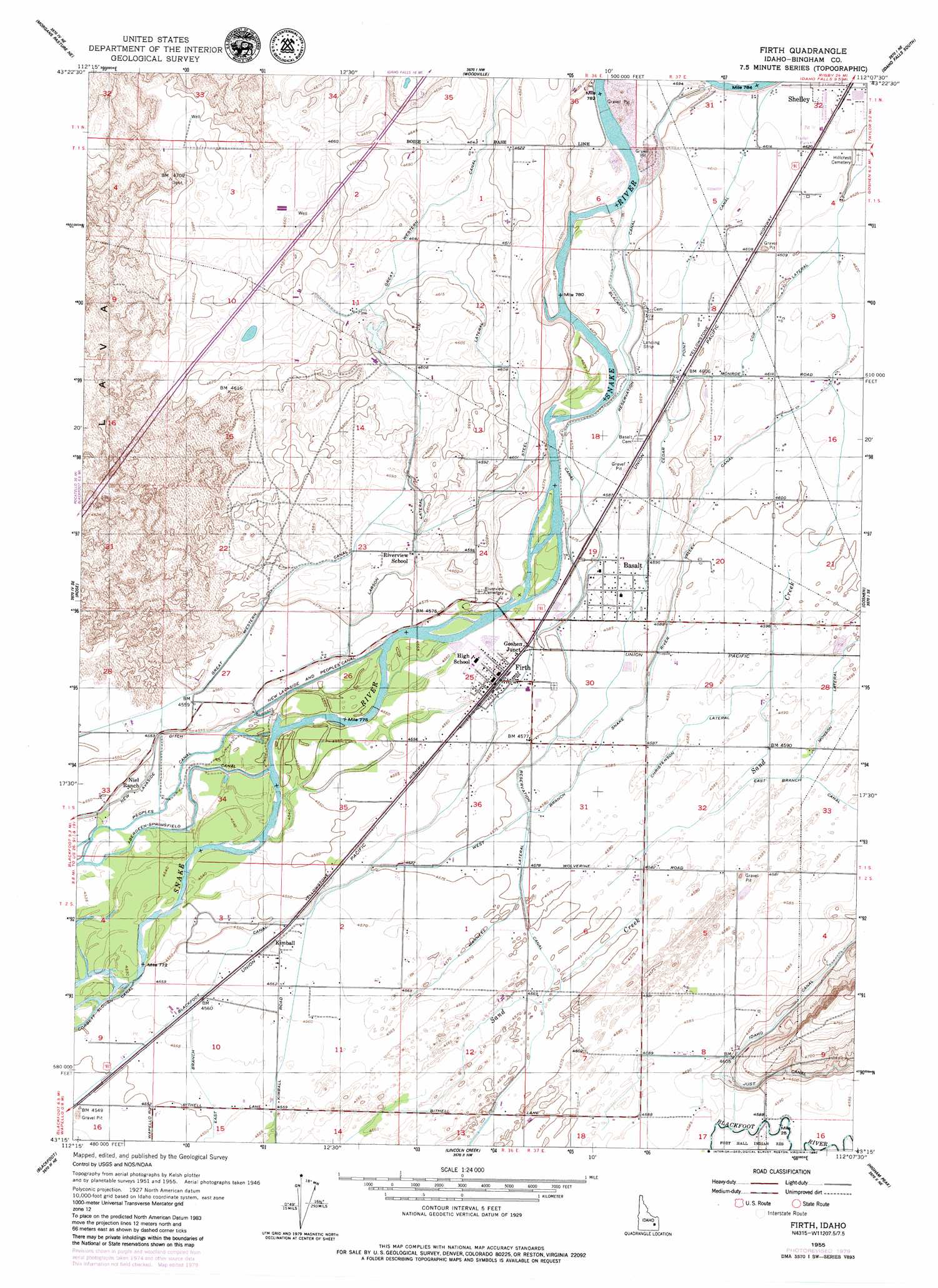
USGS Topo Quad 43112c2 - 1:24,000 scale
| Topo Map Name: | Firth |
| USGS Topo Quad ID: | 43112c2 |
| Print Size: | ca. 21 1/4" wide x 27" high |
| Southeast Coordinates: | 43.25° N latitude / 112.125° W longitude |
| Map Center Coordinates: | 43.3125° N latitude / 112.1875° W longitude |
| U.S. State: | ID |
| Filename: | o43112c2.jpg |
| Download Map JPG Image: | Firth topo map 1:24,000 scale |
| Map Type: | Topographic |
| Topo Series: | 7.5´ |
| Map Scale: | 1:24,000 |
| Source of Map Images: | United States Geological Survey (USGS) |
| Alternate Map Versions: |
Firth ID 1955, updated 1957 Download PDF Buy paper map Firth ID 1955, updated 1980 Download PDF Buy paper map Firth ID 2010 Download PDF Buy paper map Firth ID 2013 Download PDF Buy paper map |
1:24,000 Topo Quads surrounding Firth
Kettle Butte |
Butterfly Butte |
Shattuck Butte |
Idaho Falls North |
Ucon |
Morgans Pasture Nw |
Morgans Pasture Ne |
Woodville |
Idaho Falls South |
Ammon |
Baldy Knoll |
Rose |
Firth |
Goshen |
Wolverine |
Moreland |
Blackfoot |
Lincoln Creek |
Higham Peak |
Miner Creek |
Fort Hall |
Buckskin Basin |
Yandell Springs |
Lincoln Peak |
Dunn Basin |
> Back to 43112a1 at 1:100,000 scale
> Back to 43112a1 at 1:250,000 scale
> Back to U.S. Topo Maps home
Firth topo map: Gazetteer
Firth: Canals
Basalt Canal elevation 1414m 4639′Blackfoot Canal elevation 1392m 4566′
Cedar Point Canal elevation 1406m 4612′
Christenson Lateral elevation 1400m 4593′
Cox Lateral elevation 1408m 4619′
Jensen Lateral elevation 1399m 4589′
Larson Lateral elevation 1399m 4589′
New Lavaside and People Canal elevation 1389m 4557′
Reservation Canal elevation 1397m 4583′
Steel Lateral elevation 1405m 4609′
Warnett Lateral elevation 1396m 4580′
West Branch Snake River Valley Canal elevation 1402m 4599′
Firth: Populated Places
Basalt elevation 1399m 4589′Firth elevation 1393m 4570′
Goshen Junction elevation 1393m 4570′
Kimball elevation 1393m 4570′
Firth digital topo map on disk
Buy this Firth topo map showing relief, roads, GPS coordinates and other geographical features, as a high-resolution digital map file on DVD: