Sheep Creek Topo Map Idaho
To zoom in, hover over the map of Sheep Creek
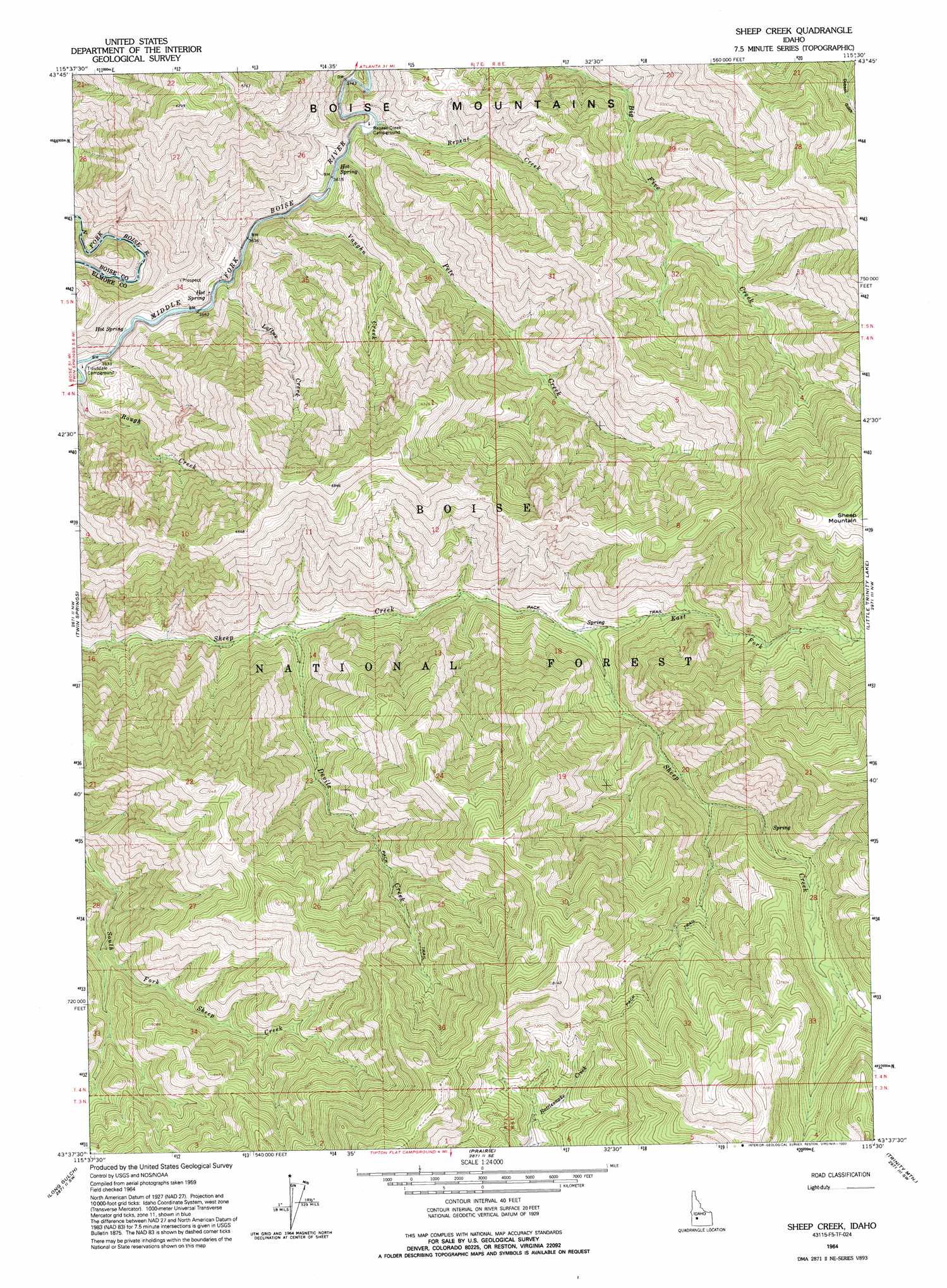
USGS Topo Quad 43115f5 - 1:24,000 scale
| Topo Map Name: | Sheep Creek |
| USGS Topo Quad ID: | 43115f5 |
| Print Size: | ca. 21 1/4" wide x 27" high |
| Southeast Coordinates: | 43.625° N latitude / 115.5° W longitude |
| Map Center Coordinates: | 43.6875° N latitude / 115.5625° W longitude |
| U.S. State: | ID |
| Filename: | o43115f5.jpg |
| Download Map JPG Image: | Sheep Creek topo map 1:24,000 scale |
| Map Type: | Topographic |
| Topo Series: | 7.5´ |
| Map Scale: | 1:24,000 |
| Source of Map Images: | United States Geological Survey (USGS) |
| Alternate Map Versions: |
Sheep Creek ID 1964, updated 1966 Download PDF Buy paper map Sheep Creek ID 2011 Download PDF Buy paper map Sheep Creek ID 2013 Download PDF Buy paper map |
| FStopo: | US Forest Service topo Sheep Creek is available: Download FStopo PDF Download FStopo TIF |
1:24,000 Topo Quads surrounding Sheep Creek
Pioneerville |
Sunset Mountain |
Big Owl Creek |
Bear River |
Swanholm Peak |
Idaho City |
Rabbit Creek Summit |
Barber Flat |
Grand Mountain |
Phifer Creek |
Arrowrock Reservoir Ne |
Twin Springs |
Sheep Creek |
Little Trinity Lake |
Rocky Bar |
Grape Mountain |
Long Gulch |
Prairie |
Trinity Mountain |
Featherville |
Braves Creek |
Danskin Peak |
Cathedral Rocks |
House Mountain |
Pine |
> Back to 43115e1 at 1:100,000 scale
> Back to 43114a1 at 1:250,000 scale
> Back to U.S. Topo Maps home
Sheep Creek topo map: Gazetteer
Sheep Creek: Streams
Breadwinner Creek elevation 1123m 3684′Devils Creek elevation 1379m 4524′
East Fork Sheep Creek elevation 1549m 5082′
Loftus Creek elevation 1086m 3562′
Pete Creek elevation 1106m 3628′
Repeat Creek elevation 1110m 3641′
Vaughn Creek elevation 1095m 3592′
Sheep Creek: Trails
Devils Creek Trail elevation 1676m 5498′Sheep Creek digital topo map on disk
Buy this Sheep Creek topo map showing relief, roads, GPS coordinates and other geographical features, as a high-resolution digital map file on DVD: