Pearl Topo Map Idaho
To zoom in, hover over the map of Pearl
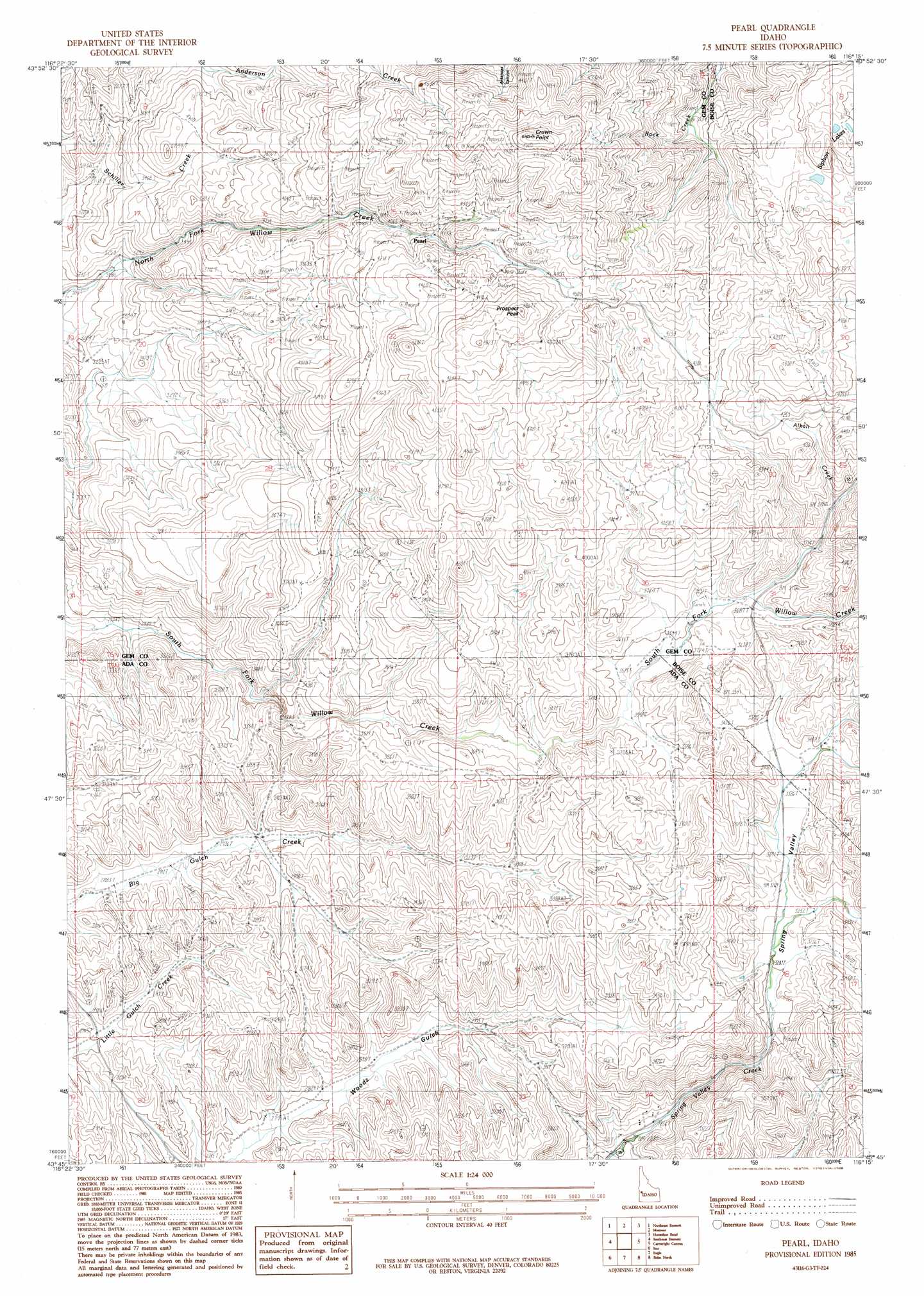
USGS Topo Quad 43116g3 - 1:24,000 scale
| Topo Map Name: | Pearl |
| USGS Topo Quad ID: | 43116g3 |
| Print Size: | ca. 21 1/4" wide x 27" high |
| Southeast Coordinates: | 43.75° N latitude / 116.25° W longitude |
| Map Center Coordinates: | 43.8125° N latitude / 116.3125° W longitude |
| U.S. State: | ID |
| Filename: | o43116g3.jpg |
| Download Map JPG Image: | Pearl topo map 1:24,000 scale |
| Map Type: | Topographic |
| Topo Series: | 7.5´ |
| Map Scale: | 1:24,000 |
| Source of Map Images: | United States Geological Survey (USGS) |
| Alternate Map Versions: |
Pearl ID 1985, updated 1986 Download PDF Buy paper map Pearl ID 2010 Download PDF Buy paper map Pearl ID 2013 Download PDF Buy paper map |
1:24,000 Topo Quads surrounding Pearl
Hog Cove Butte |
Squaw Butte |
Webb Creek |
Dry Buck Valley |
Banks |
Northwest Emmett |
Northeast Emmett |
Montour |
Horseshoe Bend |
Harris Creek Summit |
Southwest Emmett |
Southeast Emmett |
Pearl |
Cartwright Canyon |
Shafer Butte |
Middleton |
Star |
Eagle |
Boise North |
Robie Creek |
Nampa |
Meridian |
Cloverdale |
Boise South |
Lucky Peak |
> Back to 43116e1 at 1:100,000 scale
> Back to 43116a1 at 1:250,000 scale
> Back to U.S. Topo Maps home
Pearl topo map: Gazetteer
Pearl: Cliffs
Crown Point elevation 1566m 5137′Pearl: Lakes
Siphon Lakes elevation 1256m 4120′Pearl: Mines
Aspen Mine elevation 1345m 4412′Gem State Mine elevation 1259m 4130′
Lincoln Mine elevation 1179m 3868′
Middleman Mine elevation 1368m 4488′
Monroe Mine elevation 1461m 4793′
X L Mine elevation 1435m 4708′
Pearl: Populated Places
Howell (historical) elevation 1024m 3359′Pearl elevation 1266m 4153′
Pearl: Streams
Alkali Creek elevation 1115m 3658′Alkali Creek elevation 1113m 3651′
Pearl: Summits
Prospect Peak elevation 1466m 4809′Pearl: Valleys
Spring Valley elevation 971m 3185′Pearl digital topo map on disk
Buy this Pearl topo map showing relief, roads, GPS coordinates and other geographical features, as a high-resolution digital map file on DVD: