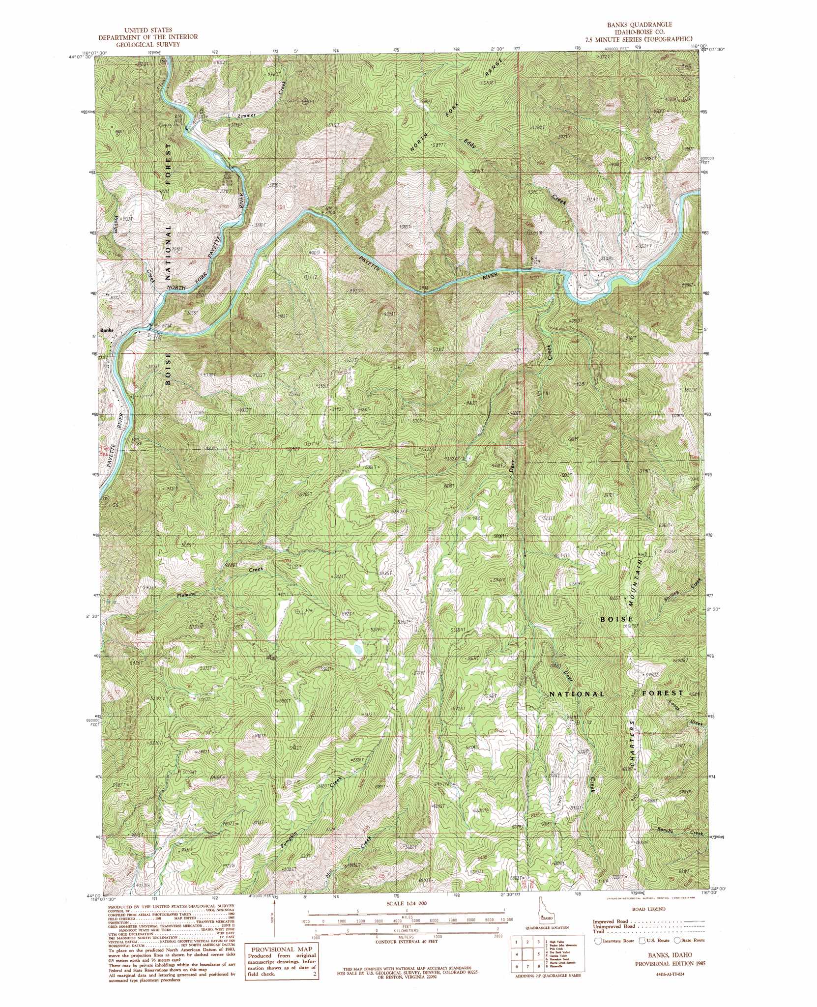
Banks Topo Map Idaho
To zoom in, hover over the map of Banks
USGS Topo Quad 44116a1 - 1:24,000 scale
| Topo Map Name: | Banks |
| USGS Topo Quad ID: | 44116a1 |
| Print Size: | ca. 21 1/4" wide x 27" high |
| Southeast Coordinates: | 44° N latitude / 116° W longitude |
| Map Center Coordinates: | 44.0625° N latitude / 116.0625° W longitude |
| U.S. State: | ID |
| Filename: | o44116a1.jpg |
| Download Map JPG Image: | Banks topo map 1:24,000 scale |
| Map Type: | Topographic |
| Topo Series: | 7.5´ |
| Map Scale: | 1:24,000 |
| Source of Map Images: | United States Geological Survey (USGS) |
| Alternate Map Versions: |
Banks ID 1985, updated 1986 Download PDF Buy paper map Banks ID 2011 Download PDF Buy paper map Banks ID 2013 Download PDF Buy paper map |
| FStopo: | US Forest Service topo Banks is available: Download FStopo PDF Download FStopo TIF |
1:24,000 Topo Quads surrounding Banks
Dodson Pass |
Sage Hen Reservoir |
Smiths Ferry |
Sixmile Point |
Boiling Springs |
Ola |
High Valley |
Packer John Mountain |
Pyle Creek |
Lightning Ridge |
Webb Creek |
Dry Buck Valley |
Banks |
Garden Valley |
Grimes Pass |
Montour |
Horseshoe Bend |
Harris Creek Summit |
Placerville |
Pioneerville |
Pearl |
Cartwright Canyon |
Shafer Butte |
Warm Springs Point |
Idaho City |
> Back to 44116a1 at 1:100,000 scale
> Back to 44116a1 at 1:250,000 scale
> Back to U.S. Topo Maps home
Banks topo map: Gazetteer
Banks: Lakes
Lone Pine Lake elevation 905m 2969′Banks: Populated Places
Banks elevation 878m 2880′Banks: Ridges
Charters Mountain elevation 1974m 6476′Banks: Streams
Deer Creek elevation 899m 2949′Eddy Creek elevation 903m 2962′
Middle Fork Payette River elevation 916m 3005′
North Fork Payette River elevation 861m 2824′
Phillips Creek elevation 872m 2860′
South Fork Payette River elevation 855m 2805′
Zimmer Creek elevation 958m 3143′
Banks digital topo map on disk
Buy this Banks topo map showing relief, roads, GPS coordinates and other geographical features, as a high-resolution digital map file on DVD: