Elevenmile Creek Topo Map Idaho
To zoom in, hover over the map of Elevenmile Creek
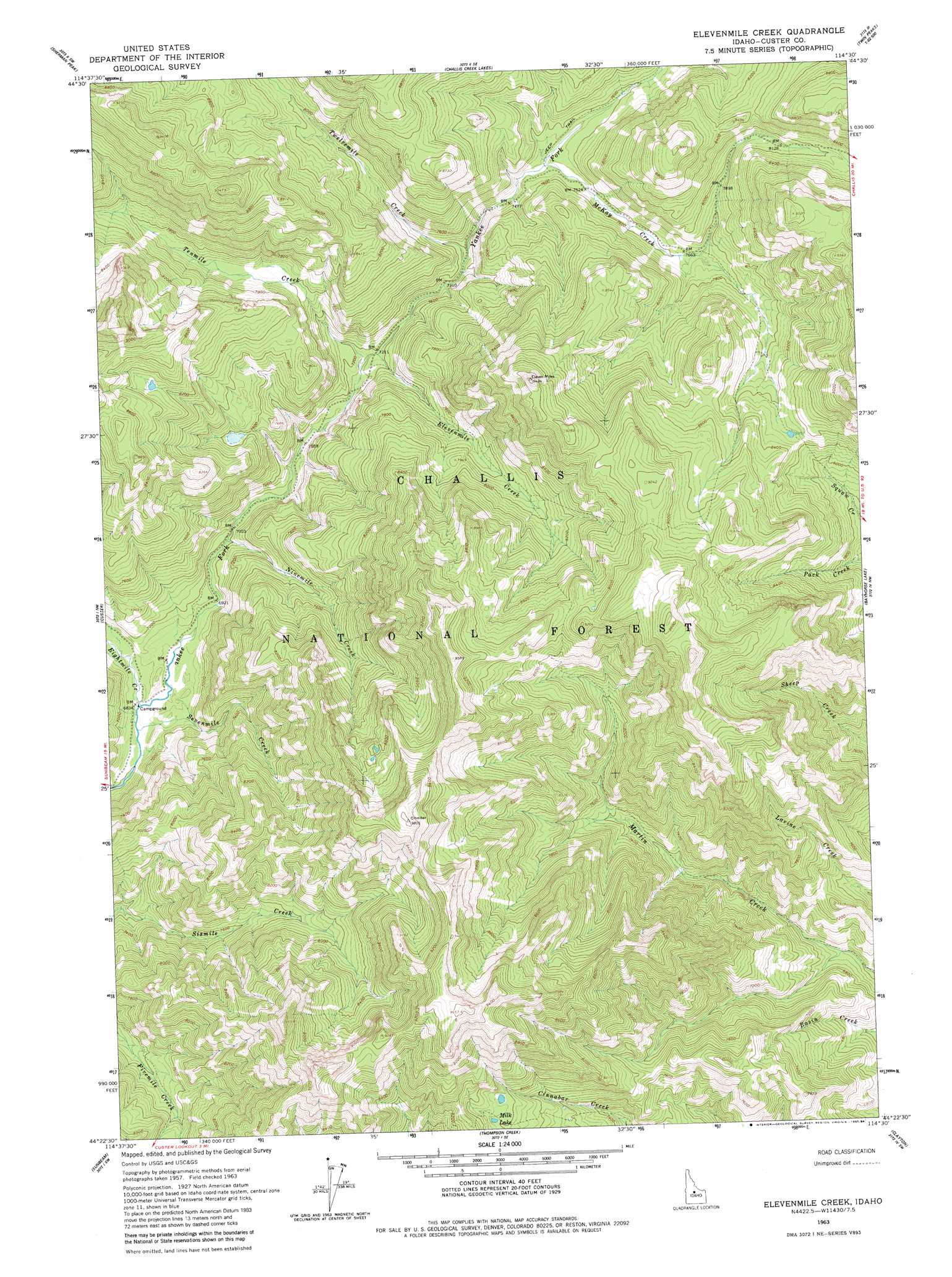
USGS Topo Quad 44114d5 - 1:24,000 scale
| Topo Map Name: | Elevenmile Creek |
| USGS Topo Quad ID: | 44114d5 |
| Print Size: | ca. 21 1/4" wide x 27" high |
| Southeast Coordinates: | 44.375° N latitude / 114.5° W longitude |
| Map Center Coordinates: | 44.4375° N latitude / 114.5625° W longitude |
| U.S. State: | ID |
| Filename: | o44114d5.jpg |
| Download Map JPG Image: | Elevenmile Creek topo map 1:24,000 scale |
| Map Type: | Topographic |
| Topo Series: | 7.5´ |
| Map Scale: | 1:24,000 |
| Source of Map Images: | United States Geological Survey (USGS) |
| Alternate Map Versions: |
Elevenmile Creek ID 1963, updated 1964 Download PDF Buy paper map Elevenmile Creek ID 1963, updated 1984 Download PDF Buy paper map Elevenmile Creek ID 2011 Download PDF Buy paper map Elevenmile Creek ID 2013 Download PDF Buy paper map |
| FStopo: | US Forest Service topo Elevenmile Creek is available: Download FStopo PDF Download FStopo TIF |
1:24,000 Topo Quads surrounding Elevenmile Creek
Falconberry Peak |
Rock Creek |
Sheldon Peak |
White Goat Mountain |
Blowfly Creek |
Casto |
Sherman Peak |
Challis Creek Lakes |
Twin Peaks |
Pats Creek |
Mount Jordan |
Custer |
Elevenmile Creek |
Bayhorse Lake |
Bayhorse |
East Basin Creek |
Sunbeam |
Thompson Creek |
Clayton |
Bald Mountain |
Casino Lakes |
Robinson Bar |
Livingston Creek |
Potaman Peak |
Ziegler Basin |
> Back to 44114a1 at 1:100,000 scale
> Back to 44114a1 at 1:250,000 scale
> Back to U.S. Topo Maps home
Elevenmile Creek topo map: Gazetteer
Elevenmile Creek: Lakes
Milk Lake elevation 2452m 8044′Elevenmile Creek: Streams
Eightmile Creek elevation 2080m 6824′Elevenmile Creek elevation 2188m 7178′
McKay Creek elevation 2277m 7470′
Ninemile Creek elevation 2132m 6994′
Sevenmile Creek elevation 2078m 6817′
Tenmile Creek elevation 2180m 7152′
Twelvemile Creek elevation 2237m 7339′
Elevenmile Creek digital topo map on disk
Buy this Elevenmile Creek topo map showing relief, roads, GPS coordinates and other geographical features, as a high-resolution digital map file on DVD: