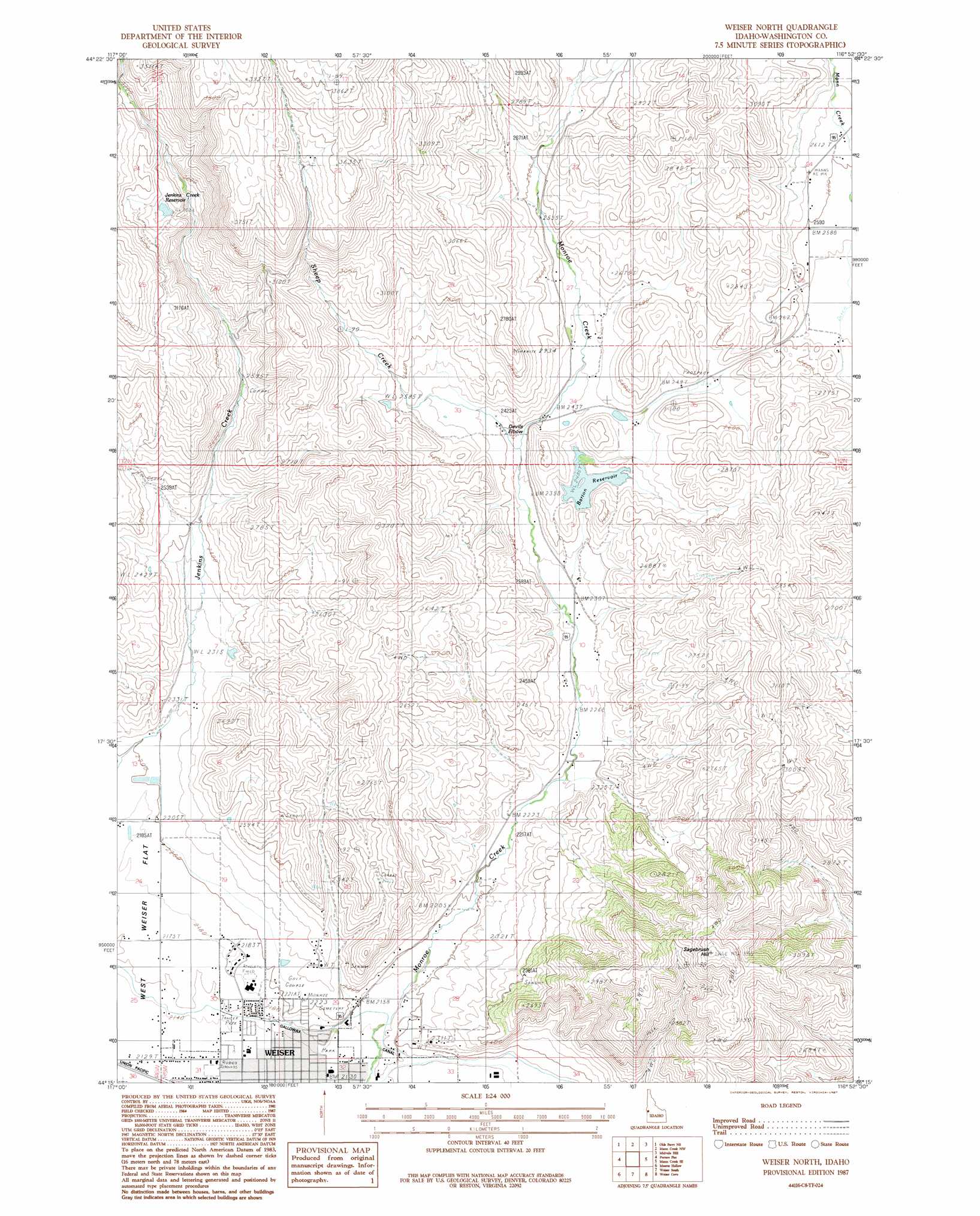
Weiser North Topo Map Idaho
To zoom in, hover over the map of Weiser North
USGS Topo Quad 44116c8 - 1:24,000 scale
| Topo Map Name: | Weiser North |
| USGS Topo Quad ID: | 44116c8 |
| Print Size: | ca. 21 1/4" wide x 27" high |
| Southeast Coordinates: | 44.25° N latitude / 116.875° W longitude |
| Map Center Coordinates: | 44.3125° N latitude / 116.9375° W longitude |
| U.S. State: | ID |
| Filename: | o44116c8.jpg |
| Download Map JPG Image: | Weiser North topo map 1:24,000 scale |
| Map Type: | Topographic |
| Topo Series: | 7.5´ |
| Map Scale: | 1:24,000 |
| Source of Map Images: | United States Geological Survey (USGS) |
| Alternate Map Versions: |
Mann Creek SW ID 1974, updated 1975 Download PDF Buy paper map Weiser North ID 1987, updated 1987 Download PDF Buy paper map Weiser North ID 2010 Download PDF Buy paper map Weiser North ID 2013 Download PDF Buy paper map |
1:24,000 Topo Quads surrounding Weiser North
Connor Creek |
Monroe Butte |
Sturgill Peak |
Hopper Creek |
Cambridge |
Henley Basin |
Olds Ferry Ne |
Mann Creek Nw |
Midvale Hill |
Midvale |
Olds Ferry |
Porters Flat |
Weiser North |
Mann Creek Se |
Nutmeg Flat |
Tub Mountain |
Moores Hollow |
Weiser South |
Weiser Cove |
Holland Gulch |
Henry Gulch |
Malheur Butte |
Payette |
Birding Island |
Sheep Ridge |
> Back to 44116a1 at 1:100,000 scale
> Back to 44116a1 at 1:250,000 scale
> Back to U.S. Topo Maps home
Weiser North topo map: Gazetteer
Weiser North: Canals
Galloway Canal elevation 657m 2155′Weiser North: Dams
Barton Dam elevation 744m 2440′Jenkins Creek Dam elevation 927m 3041′
Weiser North: Gaps
Devils Elbow elevation 729m 2391′Weiser North: Populated Places
Weiser elevation 649m 2129′Weiser North: Reservoirs
Barton Reservoir elevation 744m 2440′Jenkins Creek Reservoir elevation 927m 3041′
Weiser North: Streams
Sheep Creek elevation 725m 2378′Weiser North: Summits
Sagebrush Hill elevation 1005m 3297′Weiser North digital topo map on disk
Buy this Weiser North topo map showing relief, roads, GPS coordinates and other geographical features, as a high-resolution digital map file on DVD: