Hensley Butte Topo Map Oregon
To zoom in, hover over the map of Hensley Butte
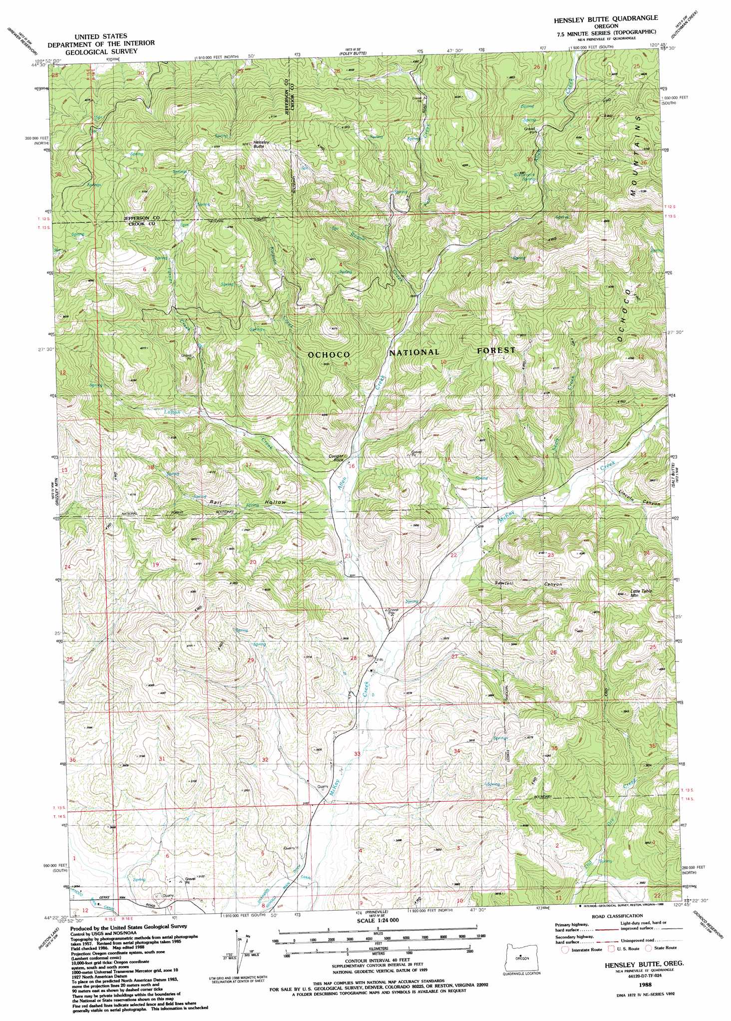
USGS Topo Quad 44120d7 - 1:24,000 scale
| Topo Map Name: | Hensley Butte |
| USGS Topo Quad ID: | 44120d7 |
| Print Size: | ca. 21 1/4" wide x 27" high |
| Southeast Coordinates: | 44.375° N latitude / 120.75° W longitude |
| Map Center Coordinates: | 44.4375° N latitude / 120.8125° W longitude |
| U.S. State: | OR |
| Filename: | o44120d7.jpg |
| Download Map JPG Image: | Hensley Butte topo map 1:24,000 scale |
| Map Type: | Topographic |
| Topo Series: | 7.5´ |
| Map Scale: | 1:24,000 |
| Source of Map Images: | United States Geological Survey (USGS) |
| Alternate Map Versions: |
Hensley Butte OR 1988, updated 1988 Download PDF Buy paper map Hensley Butte OR 1992, updated 1997 Download PDF Buy paper map Hensley Butte OR 2011 Download PDF Buy paper map Hensley Butte OR 2014 Download PDF Buy paper map |
| FStopo: | US Forest Service topo Hensley Butte is available: Download FStopo PDF Download FStopo TIF |
1:24,000 Topo Quads surrounding Hensley Butte
Madras East |
Teller Butte |
Ashwood |
Axehandle Butte |
Horse Heaven Creek |
Buck Butte |
Brewer Reservoir |
Foley Butte |
Dutchman Creek |
Opal Mountain |
Gray Butte |
Grizzly Mountain |
Hensley Butte |
Salt Butte |
Wildcat Mountain |
O'Neil |
Houston Lake |
Prineville |
Ochoco Reservoir |
Cadle Butte |
Powell Butte |
Powell Buttes |
Stearns Butte |
Eagle Rock |
Pilot Butte |
> Back to 44120a1 at 1:100,000 scale
> Back to 44120a1 at 1:250,000 scale
> Back to U.S. Topo Maps home
Hensley Butte topo map: Gazetteer
Hensley Butte: Ridges
Hensley Butte elevation 1553m 5095′Hensley Butte: Springs
Bottleneck Spring elevation 1269m 4163′Hensley Butte: Streams
Allen Creek elevation 967m 3172′Bogue Creek elevation 1084m 3556′
Fall Creek elevation 1111m 3645′
Kuiman Creek elevation 1025m 3362′
Lofton Creek elevation 997m 3270′
Sealy Creek elevation 1010m 3313′
Turner Creek elevation 1095m 3592′
Hensley Butte: Summits
Cougar Rock elevation 1028m 3372′Little Table Mountain elevation 1380m 4527′
Hensley Butte: Valleys
Lincoln Canyon elevation 1021m 3349′Rail Canyon elevation 1007m 3303′
Sawtell Canyon elevation 999m 3277′
Water Trough Canyon elevation 1068m 3503′
Hensley Butte digital topo map on disk
Buy this Hensley Butte topo map showing relief, roads, GPS coordinates and other geographical features, as a high-resolution digital map file on DVD: