Grizzly Mountain Topo Map Oregon
To zoom in, hover over the map of Grizzly Mountain
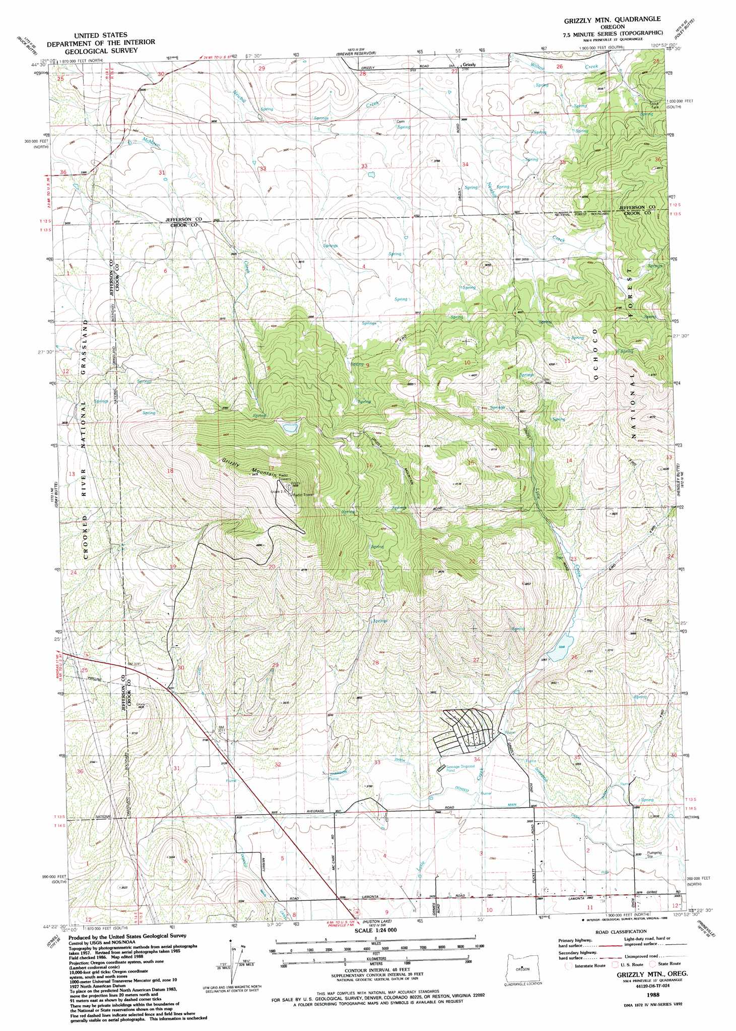
USGS Topo Quad 44120d8 - 1:24,000 scale
| Topo Map Name: | Grizzly Mountain |
| USGS Topo Quad ID: | 44120d8 |
| Print Size: | ca. 21 1/4" wide x 27" high |
| Southeast Coordinates: | 44.375° N latitude / 120.875° W longitude |
| Map Center Coordinates: | 44.4375° N latitude / 120.9375° W longitude |
| U.S. State: | OR |
| Filename: | o44120d8.jpg |
| Download Map JPG Image: | Grizzly Mountain topo map 1:24,000 scale |
| Map Type: | Topographic |
| Topo Series: | 7.5´ |
| Map Scale: | 1:24,000 |
| Source of Map Images: | United States Geological Survey (USGS) |
| Alternate Map Versions: |
Grizzly Mtn OR 1988, updated 1988 Download PDF Buy paper map Grizzly Mtn OR 1992, updated 1997 Download PDF Buy paper map Grizzly Mountain OR 2011 Download PDF Buy paper map Grizzly Mountain OR 2014 Download PDF Buy paper map |
| FStopo: | US Forest Service topo Grizzly Mountain is available: Download FStopo PDF Download FStopo TIF |
1:24,000 Topo Quads surrounding Grizzly Mountain
Madras West |
Madras East |
Teller Butte |
Ashwood |
Axehandle Butte |
Culver |
Buck Butte |
Brewer Reservoir |
Foley Butte |
Dutchman Creek |
Opal City |
Gray Butte |
Grizzly Mountain |
Hensley Butte |
Salt Butte |
Redmond |
O'Neil |
Houston Lake |
Prineville |
Ochoco Reservoir |
Forked Horn Butte |
Powell Butte |
Powell Buttes |
Stearns Butte |
Eagle Rock |
> Back to 44120a1 at 1:100,000 scale
> Back to 44120a1 at 1:250,000 scale
> Back to U.S. Topo Maps home
Grizzly Mountain topo map: Gazetteer
Grizzly Mountain: Dams
Fisher Dam elevation 988m 3241′Grizzly Mountain: Flats
Grimes Flat elevation 911m 2988′Grizzly Mountain: Populated Places
Grizzly elevation 1128m 3700′Grizzly Mountain: Post Offices
Grizzly Post Office (historical) elevation 1128m 3700′Grizzly Mountain: Reservoirs
Joe Fisher Reservoir elevation 988m 3241′Grizzly Mountain: Summits
Grizzly Mountain elevation 1710m 5610′Grizzly Mountain: Valleys
Grizzly Mountain Canyon elevation 999m 3277′Grizzly Mountain digital topo map on disk
Buy this Grizzly Mountain topo map showing relief, roads, GPS coordinates and other geographical features, as a high-resolution digital map file on DVD: