Foley Butte Topo Map Oregon
To zoom in, hover over the map of Foley Butte
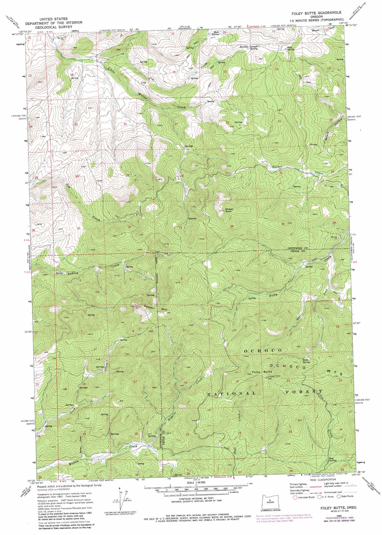
USGS Topo Quad 44120e7 - 1:24,000 scale
| Topo Map Name: | Foley Butte |
| USGS Topo Quad ID: | 44120e7 |
| Print Size: | ca. 21 1/4" wide x 27" high |
| Southeast Coordinates: | 44.5° N latitude / 120.75° W longitude |
| Map Center Coordinates: | 44.5625° N latitude / 120.8125° W longitude |
| U.S. State: | OR |
| Filename: | o44120e7.jpg |
| Download Map JPG Image: | Foley Butte topo map 1:24,000 scale |
| Map Type: | Topographic |
| Topo Series: | 7.5´ |
| Map Scale: | 1:24,000 |
| Source of Map Images: | United States Geological Survey (USGS) |
| Alternate Map Versions: |
Foley Butte OR 1969, updated 1972 Download PDF Buy paper map Foley Butte OR 1969, updated 1985 Download PDF Buy paper map Foley Butte OR 1992, updated 1997 Download PDF Buy paper map Foley Butte OR 2011 Download PDF Buy paper map Foley Butte OR 2014 Download PDF Buy paper map |
| FStopo: | US Forest Service topo Foley Butte is available: Download FStopo PDF Download FStopo TIF |
1:24,000 Topo Quads surrounding Foley Butte
Gateway |
Willowdale |
Degner Canyon |
Donnybrook |
Arrastra Butte |
Madras East |
Teller Butte |
Ashwood |
Axehandle Butte |
Horse Heaven Creek |
Buck Butte |
Brewer Reservoir |
Foley Butte |
Dutchman Creek |
Opal Mountain |
Gray Butte |
Grizzly Mountain |
Hensley Butte |
Salt Butte |
Wildcat Mountain |
O'Neil |
Houston Lake |
Prineville |
Ochoco Reservoir |
Cadle Butte |
> Back to 44120e1 at 1:100,000 scale
> Back to 44120a1 at 1:250,000 scale
> Back to U.S. Topo Maps home
Foley Butte topo map: Gazetteer
Foley Butte: Springs
Bills Spring elevation 1374m 4507′Bug Spring elevation 1352m 4435′
Butte Spring elevation 1430m 4691′
Eleven Spring elevation 1452m 4763′
Rail Spring elevation 1321m 4333′
Rainbow Trough Spring elevation 1350m 4429′
Foley Butte: Streams
East Fork Foley Creek elevation 1273m 4176′Higgins Creek elevation 1259m 4130′
Foley Butte: Summits
Awbrey Mountain elevation 1650m 5413′Foley Butte elevation 1673m 5488′
Sheep Rock elevation 1584m 5196′
Foley Butte: Valleys
Boiler Draw elevation 1199m 3933′Foley Butte digital topo map on disk
Buy this Foley Butte topo map showing relief, roads, GPS coordinates and other geographical features, as a high-resolution digital map file on DVD: