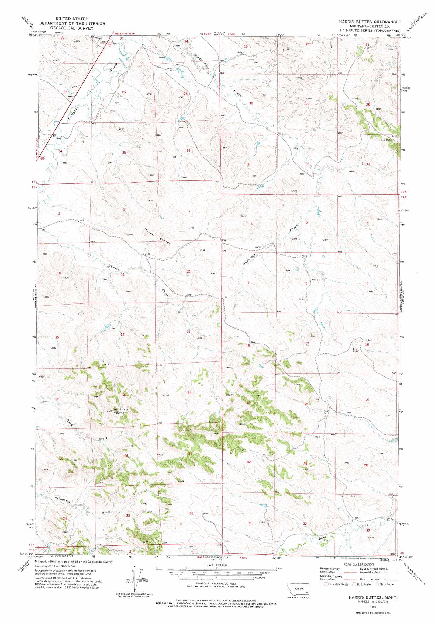
Harris Buttes Topo Map Montana
To zoom in, hover over the map of Harris Buttes
USGS Topo Quad 45105h5 - 1:24,000 scale
| Topo Map Name: | Harris Buttes |
| USGS Topo Quad ID: | 45105h5 |
| Print Size: | ca. 21 1/4" wide x 27" high |
| Southeast Coordinates: | 45.875° N latitude / 105.5° W longitude |
| Map Center Coordinates: | 45.9375° N latitude / 105.5625° W longitude |
| U.S. State: | MT |
| Filename: | o45105h5.jpg |
| Download Map JPG Image: | Harris Buttes topo map 1:24,000 scale |
| Map Type: | Topographic |
| Topo Series: | 7.5´ |
| Map Scale: | 1:24,000 |
| Source of Map Images: | United States Geological Survey (USGS) |
| Alternate Map Versions: |
Harris Buttes MT 1973, updated 1976 Download PDF Buy paper map Harris Buttes MT 2011 Download PDF Buy paper map Harris Buttes MT 2014 Download PDF Buy paper map |
1:24,000 Topo Quads surrounding Harris Buttes
Circle L Creek |
Horse Creek |
First Creek |
Loaf Of Bread Butte |
Mizpah |
Jack Creek |
Beebe Sw |
Beebe |
Miles City Creek |
Forty Creek |
Carey-Malone School |
Kirkpatrick Hill |
Harris Buttes |
Saddle Horse Butte |
Maxwell Butte |
Foster Creek School |
Volborg |
Divide School |
Witcher Reservoir |
Rattlesnake Hill |
Elk Ridge |
Box Elder Creek |
Coalwood |
Johnnie Creek |
Cross S School |
> Back to 45105e1 at 1:100,000 scale
> Back to 45104a1 at 1:250,000 scale
> Back to U.S. Topo Maps home
Harris Buttes topo map: Gazetteer
Harris Buttes: Streams
Chinnick Creek elevation 842m 2762′Harris Buttes: Summits
Harris Buttes elevation 997m 3270′Wild Horse Mountain elevation 1041m 3415′
Harris Buttes digital topo map on disk
Buy this Harris Buttes topo map showing relief, roads, GPS coordinates and other geographical features, as a high-resolution digital map file on DVD:
Eastern Montana & Western North Dakota
Buy digital topo maps: Eastern Montana & Western North Dakota