First Creek Topo Map Montana
To zoom in, hover over the map of First Creek
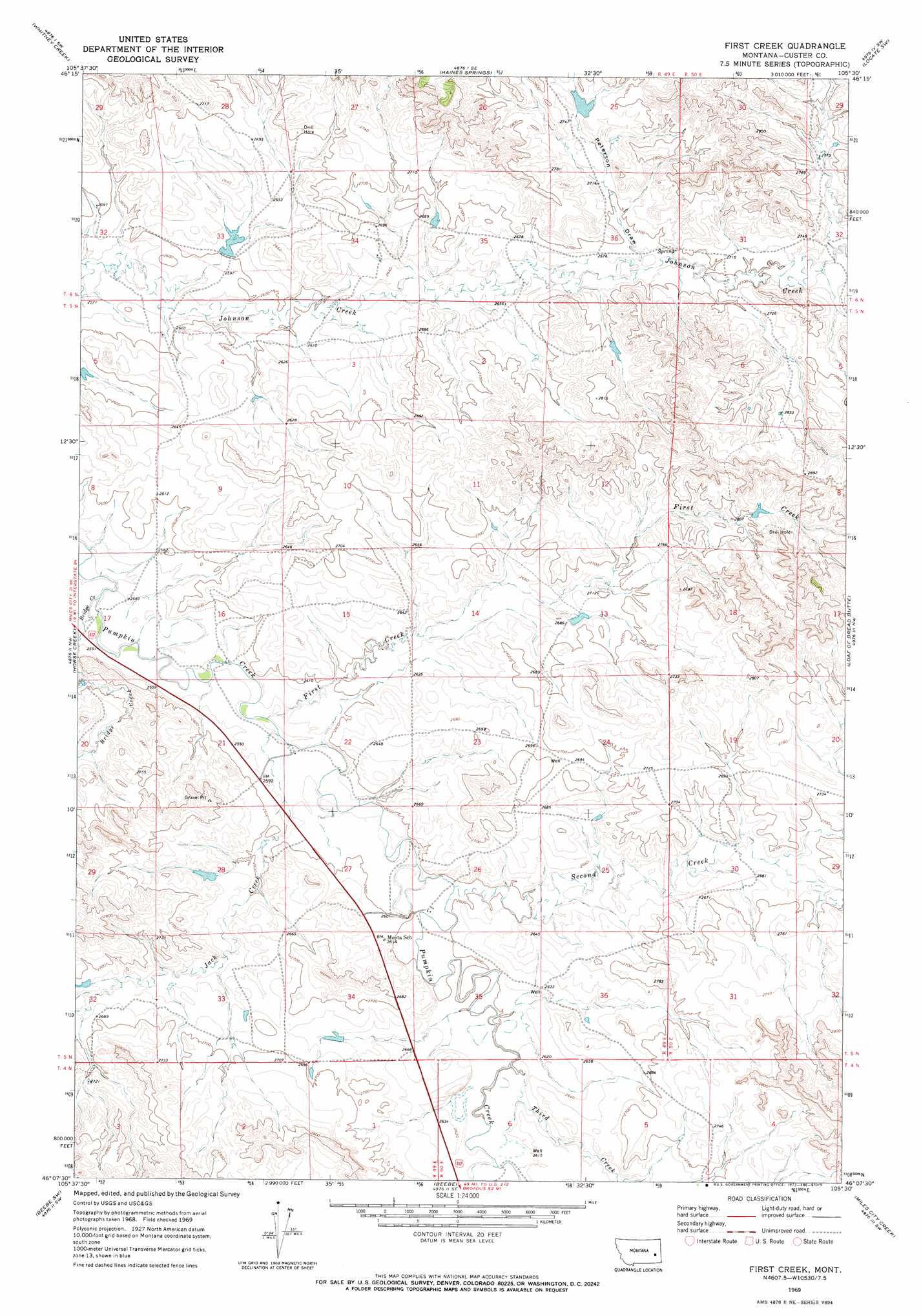
USGS Topo Quad 46105b5 - 1:24,000 scale
| Topo Map Name: | First Creek |
| USGS Topo Quad ID: | 46105b5 |
| Print Size: | ca. 21 1/4" wide x 27" high |
| Southeast Coordinates: | 46.125° N latitude / 105.5° W longitude |
| Map Center Coordinates: | 46.1875° N latitude / 105.5625° W longitude |
| U.S. State: | MT |
| Filename: | o46105b5.jpg |
| Download Map JPG Image: | First Creek topo map 1:24,000 scale |
| Map Type: | Topographic |
| Topo Series: | 7.5´ |
| Map Scale: | 1:24,000 |
| Source of Map Images: | United States Geological Survey (USGS) |
| Alternate Map Versions: |
First Creek MT 1969, updated 1973 Download PDF Buy paper map First Creek MT 2011 Download PDF Buy paper map First Creek MT 2014 Download PDF Buy paper map |
1:24,000 Topo Quads surrounding First Creek
Miles City |
Government Hill |
The Knob |
Buck Mountain |
Locate |
Paddy Fay Creek |
Whitney Creek |
Government Hill Se |
Locate Sw |
Locate Se |
Circle L Creek |
Horse Creek |
First Creek |
Loaf Of Bread Butte |
Mizpah |
Jack Creek |
Beebe Sw |
Beebe |
Miles City Creek |
Forty Creek |
Carey-Malone School |
Kirkpatrick Hill |
Harris Buttes |
Saddle Horse Butte |
Maxwell Butte |
> Back to 46105a1 at 1:100,000 scale
> Back to 46104a1 at 1:250,000 scale
> Back to U.S. Topo Maps home
First Creek topo map: Gazetteer
First Creek: Dams
Severson Number 2 Dam elevation 839m 2752′Tonn Number 2 Dam elevation 813m 2667′
First Creek: Post Offices
Hotchkiss Post Office (historical) elevation 787m 2582′First Creek: Streams
Bridge Creek elevation 774m 2539′First Creek elevation 785m 2575′
Jack Creek elevation 784m 2572′
Second Creek elevation 796m 2611′
Third Creek elevation 796m 2611′
First Creek: Valleys
Peterson Draw elevation 815m 2673′First Creek: Wells
05N49E22CBBD01 Well elevation 788m 2585′First Creek digital topo map on disk
Buy this First Creek topo map showing relief, roads, GPS coordinates and other geographical features, as a high-resolution digital map file on DVD:
Eastern Montana & Western North Dakota
Buy digital topo maps: Eastern Montana & Western North Dakota