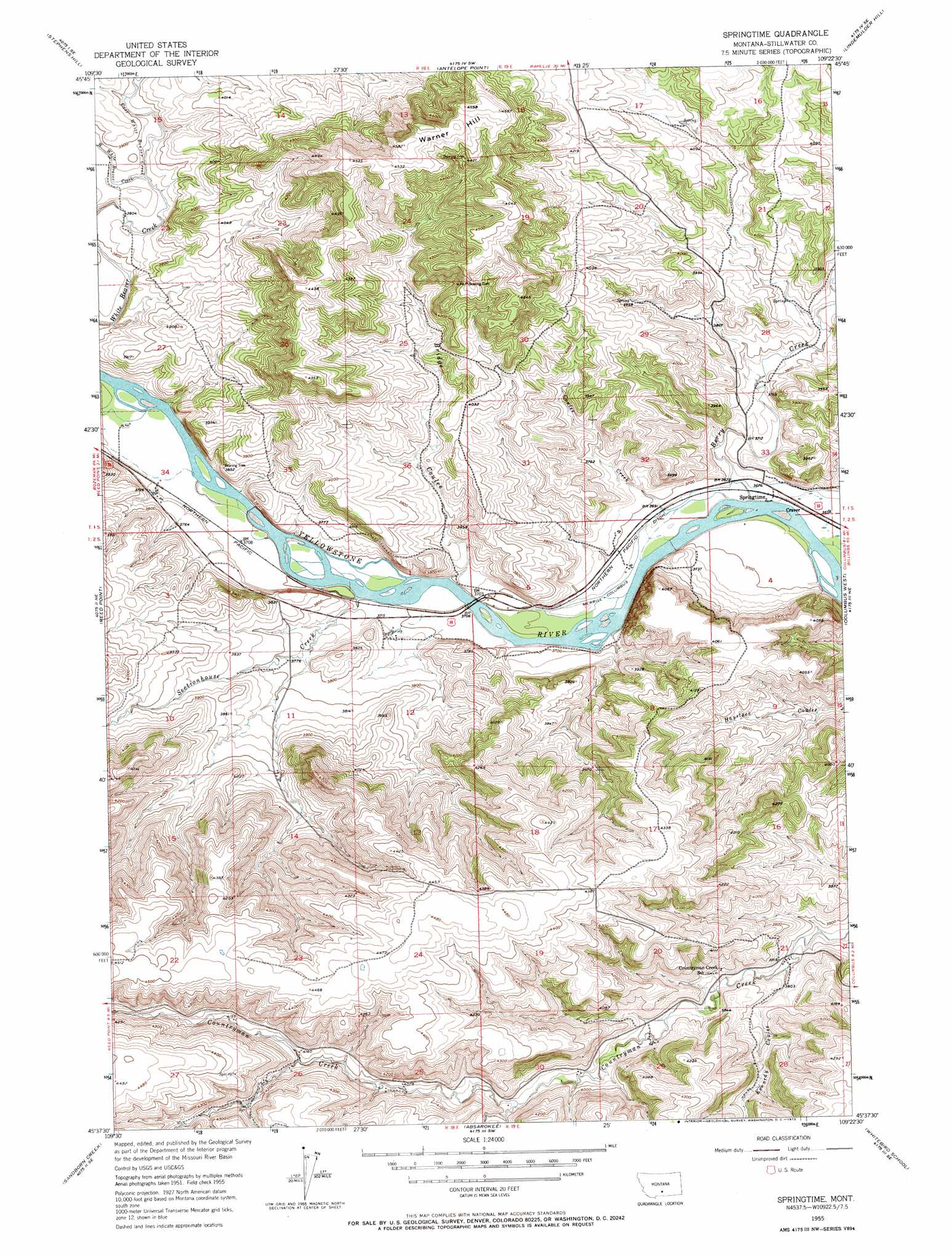
Springtime Topo Map Montana
To zoom in, hover over the map of Springtime
USGS Topo Quad 45109f4 - 1:24,000 scale
| Topo Map Name: | Springtime |
| USGS Topo Quad ID: | 45109f4 |
| Print Size: | ca. 21 1/4" wide x 27" high |
| Southeast Coordinates: | 45.625° N latitude / 109.375° W longitude |
| Map Center Coordinates: | 45.6875° N latitude / 109.4375° W longitude |
| U.S. State: | MT |
| Filename: | o45109f4.jpg |
| Download Map JPG Image: | Springtime topo map 1:24,000 scale |
| Map Type: | Topographic |
| Topo Series: | 7.5´ |
| Map Scale: | 1:24,000 |
| Source of Map Images: | United States Geological Survey (USGS) |
| Alternate Map Versions: |
Springtime MT 1955, updated 1957 Download PDF Buy paper map Springtime MT 1955, updated 1972 Download PDF Buy paper map Springtime MT 2011 Download PDF Buy paper map Springtime MT 2014 Download PDF Buy paper map |
1:24,000 Topo Quads surrounding Springtime
Sourdough School |
Stephens Hill Ne |
Russell Gulch |
Rapelje |
Battle Butte |
Lone Indian Butte |
Stephens Hill |
Antelope Point |
Lindemulder Hill |
Wheat Basin Sw |
Work Creek |
Reed Point |
Springtime |
Columbus West |
Columbus East |
Cow Face Hill |
Sandborn Creek |
Absarokee |
Whitebird School |
Shane Ridge |
Beehive |
Fishtail |
Roscoe Nw |
Roscoe Ne |
Cooney Reservoir |
> Back to 45109e1 at 1:100,000 scale
> Back to 45108a1 at 1:250,000 scale
> Back to U.S. Topo Maps home
Springtime topo map: Gazetteer
Springtime: Crossings
Interchange 400 elevation 1124m 3687′Springtime: Dams
Springtime Number 1 Dam elevation 1143m 3750′Springtime: Populated Places
Craver elevation 1117m 3664′Springtime elevation 1117m 3664′
Springtime: Post Offices
Merrill Post Office (historical) elevation 1123m 3684′Springtime Post Office (historical) elevation 1117m 3664′
Springtime: Streams
Berry Creek elevation 1116m 3661′Coulee Creek elevation 1116m 3661′
East White Beaver Creek elevation 1172m 3845′
Sectionhouse Creek elevation 1128m 3700′
West White Beaver Creek elevation 1171m 3841′
Whistle Creek elevation 1130m 3707′
Springtime: Summits
Warner Hill elevation 1398m 4586′Springtime: Valleys
Bridge Coulee elevation 1128m 3700′Kennedy Coulee elevation 1158m 3799′
Springtime digital topo map on disk
Buy this Springtime topo map showing relief, roads, GPS coordinates and other geographical features, as a high-resolution digital map file on DVD: