Roscoe Ne Topo Map Montana
To zoom in, hover over the map of Roscoe Ne
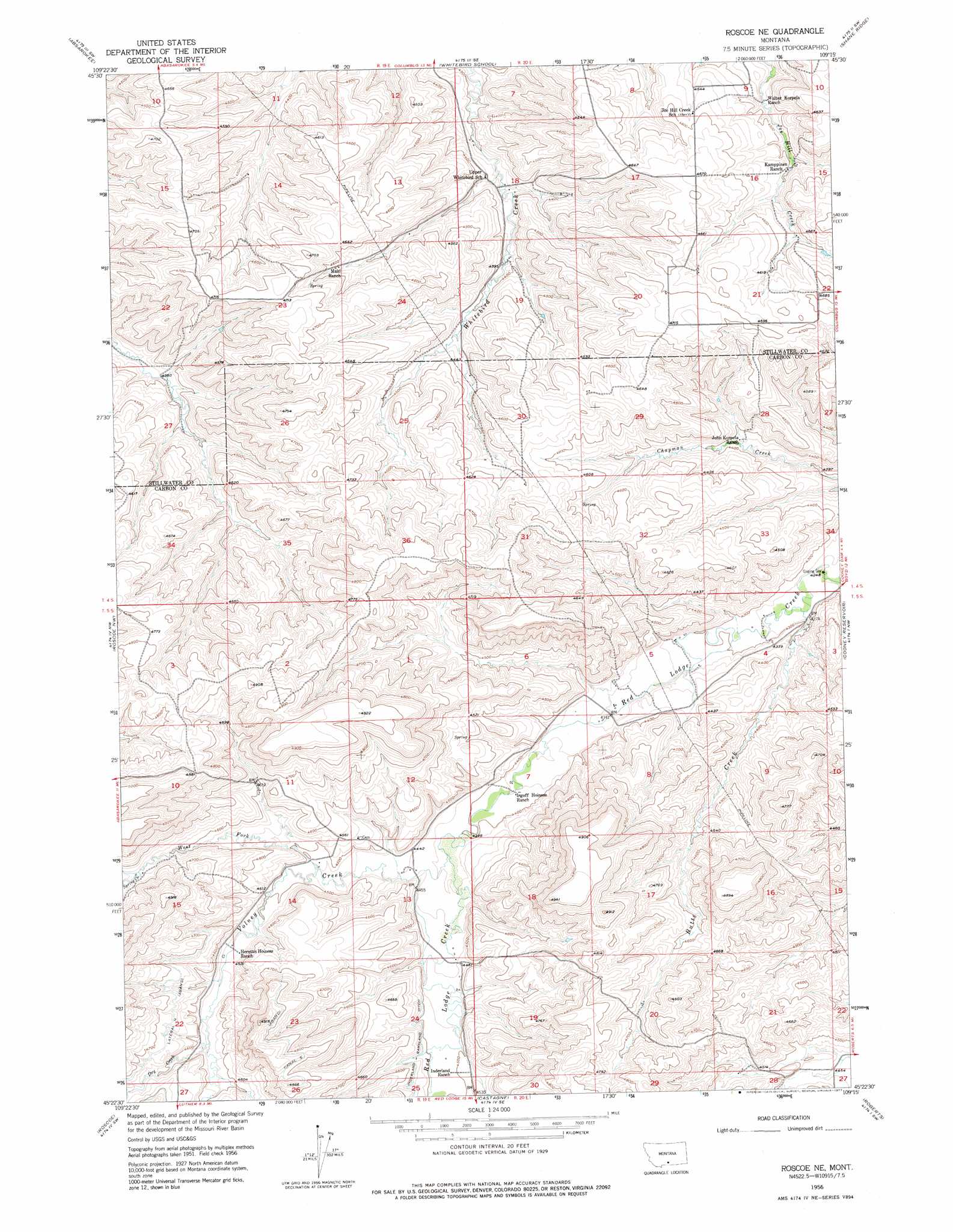
USGS Topo Quad 45109d3 - 1:24,000 scale
| Topo Map Name: | Roscoe Ne |
| USGS Topo Quad ID: | 45109d3 |
| Print Size: | ca. 21 1/4" wide x 27" high |
| Southeast Coordinates: | 45.375° N latitude / 109.25° W longitude |
| Map Center Coordinates: | 45.4375° N latitude / 109.3125° W longitude |
| U.S. State: | MT |
| Filename: | o45109d3.jpg |
| Download Map JPG Image: | Roscoe Ne topo map 1:24,000 scale |
| Map Type: | Topographic |
| Topo Series: | 7.5´ |
| Map Scale: | 1:24,000 |
| Source of Map Images: | United States Geological Survey (USGS) |
| Alternate Map Versions: |
Roscoe NE MT 1956, updated 1958 Download PDF Buy paper map Roscoe NE MT 1956, updated 1977 Download PDF Buy paper map Roscoe NE MT 1956, updated 1977 Download PDF Buy paper map Roscoe NE MT 2011 Download PDF Buy paper map Roscoe NE MT 2014 Download PDF Buy paper map |
1:24,000 Topo Quads surrounding Roscoe Ne
Reed Point |
Springtime |
Columbus West |
Columbus East |
Horse Butte |
Sandborn Creek |
Absarokee |
Whitebird School |
Shane Ridge |
Rapids |
Fishtail |
Roscoe Nw |
Roscoe Ne |
Cooney Reservoir |
Boyd |
Mackay Ranch |
Roscoe |
Castagne |
Roberts |
The Big Slide |
Sylvan Peak |
Bare Mountain |
Red Lodge West |
Red Lodge East |
Belfry |
> Back to 45109a1 at 1:100,000 scale
> Back to 45108a1 at 1:250,000 scale
> Back to U.S. Topo Maps home
Roscoe Ne topo map: Gazetteer
Roscoe Ne: Bridges
Red Lodge Creek Bridge elevation 1323m 4340′Roscoe Ne: Canals
Canal S elevation 1469m 4819′Lateral N elevation 1424m 4671′
Roscoe Ne: Dams
Dinsdale Dam elevation 1407m 4616′Roscoe Ne: Post Offices
Marne Post Office (historical) elevation 1328m 4356′Roscoe Ne: Streams
Butte Creek elevation 1303m 4274′Dry Creek elevation 1390m 4560′
Spring Creek elevation 1419m 4655′
Volney Creek elevation 1346m 4416′
West Fork Volney Creek elevation 1366m 4481′
Roscoe Ne: Wells
05S19E24ADAB01 Well elevation 1372m 4501′05S20E05DADB01 Well elevation 1322m 4337′
Roscoe Ne digital topo map on disk
Buy this Roscoe Ne topo map showing relief, roads, GPS coordinates and other geographical features, as a high-resolution digital map file on DVD: