Cabbage Hill Topo Map Oregon
To zoom in, hover over the map of Cabbage Hill
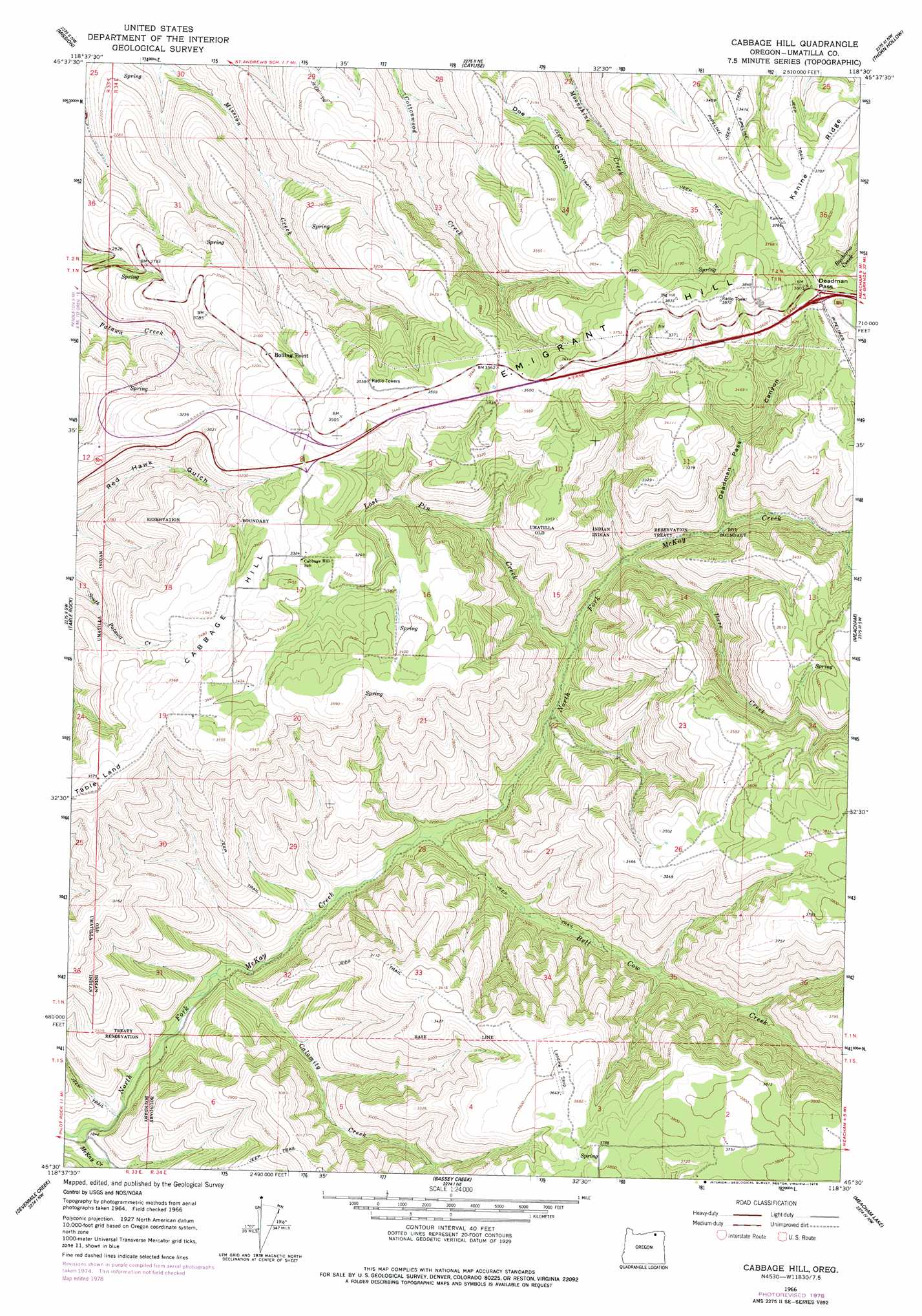
USGS Topo Quad 45118e5 - 1:24,000 scale
| Topo Map Name: | Cabbage Hill |
| USGS Topo Quad ID: | 45118e5 |
| Print Size: | ca. 21 1/4" wide x 27" high |
| Southeast Coordinates: | 45.5° N latitude / 118.5° W longitude |
| Map Center Coordinates: | 45.5625° N latitude / 118.5625° W longitude |
| U.S. State: | OR |
| Filename: | o45118e5.jpg |
| Download Map JPG Image: | Cabbage Hill topo map 1:24,000 scale |
| Map Type: | Topographic |
| Topo Series: | 7.5´ |
| Map Scale: | 1:24,000 |
| Source of Map Images: | United States Geological Survey (USGS) |
| Alternate Map Versions: |
Cabbage Hill OR 1966, updated 1967 Download PDF Buy paper map Cabbage Hill OR 1966, updated 1978 Download PDF Buy paper map Cabbage Hill OR 2011 Download PDF Buy paper map Cabbage Hill OR 2014 Download PDF Buy paper map |
1:24,000 Topo Quads surrounding Cabbage Hill
Holdman Se |
Helix |
Adams |
Athena |
Weston Mountain |
Pendleton |
Mission |
Cayuse |
Thorn Hollow |
Gibbon |
Mckay Reservoir |
Table Rock |
Cabbage Hill |
Meacham |
Duncan |
Pilot Rock |
Sevenmile Creek |
Bassey Creek |
Meacham Lake |
Huron |
Granite Meadows |
Tamarack Gulch |
Bally Mountain |
Mcintyre Creek |
Kamela Se |
> Back to 45118e1 at 1:100,000 scale
> Back to 45118a1 at 1:250,000 scale
> Back to U.S. Topo Maps home
Cabbage Hill topo map: Gazetteer
Cabbage Hill: Gaps
Deadman Pass elevation 1099m 3605′Cabbage Hill: Post Offices
Boiling Point Post Office (historical) elevation 982m 3221′Cabbage Hill: Streams
Bell Cow Creek elevation 654m 2145′Calamity Creek elevation 606m 1988′
Darr Creek elevation 745m 2444′
Lost Pin Creek elevation 714m 2342′
North Fork McKay Creek elevation 558m 1830′
Cabbage Hill: Summits
Cabbage Hill elevation 1089m 3572′Emigrant Hill elevation 1165m 3822′
Cabbage Hill: Valleys
Deadman Pass Canyon elevation 789m 2588′Cabbage Hill digital topo map on disk
Buy this Cabbage Hill topo map showing relief, roads, GPS coordinates and other geographical features, as a high-resolution digital map file on DVD: