York Ridge Topo Map Maine
To zoom in, hover over the map of York Ridge
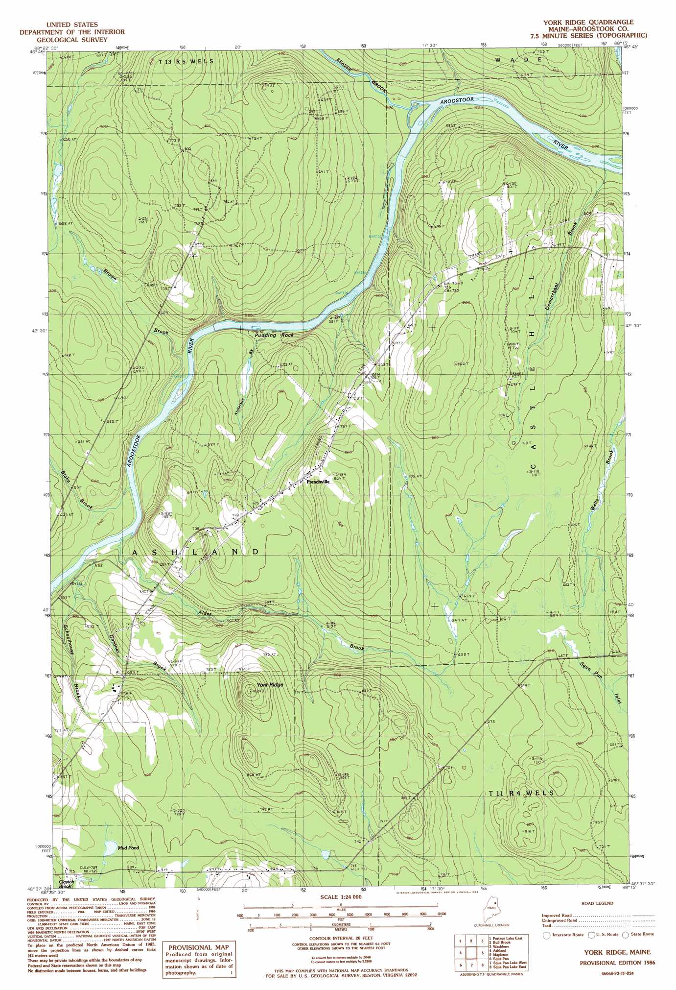
USGS Topo Quad 46068f3 - 1:24,000 scale
| Topo Map Name: | York Ridge |
| USGS Topo Quad ID: | 46068f3 |
| Print Size: | ca. 21 1/4" wide x 27" high |
| Southeast Coordinates: | 46.625° N latitude / 68.25° W longitude |
| Map Center Coordinates: | 46.6875° N latitude / 68.3125° W longitude |
| U.S. State: | ME |
| Filename: | o46068f3.jpg |
| Download Map JPG Image: | York Ridge topo map 1:24,000 scale |
| Map Type: | Topographic |
| Topo Series: | 7.5´ |
| Map Scale: | 1:24,000 |
| Source of Map Images: | United States Geological Survey (USGS) |
| Alternate Map Versions: |
Ashland NE ME 1975, updated 1981 Download PDF Buy paper map York Ridge ME 1986, updated 1986 Download PDF Buy paper map York Ridge ME 2011 Download PDF Buy paper map York Ridge ME 2014 Download PDF Buy paper map |
1:24,000 Topo Quads surrounding York Ridge
Winterville |
Mcclusky Lake |
Hanford |
Mud Lake |
New Sweden |
Portage Lake West |
Portage Lake East |
Bull Brook |
Washburn |
Caribou |
Little Machias Lake |
Ashland |
York Ridge |
Mapleton |
Presque Isle |
Forks Of Machias |
Squa Pan |
Squa Pan Lake West |
Squa Pan Lake East |
Echo Lake |
Oxbow West |
Oxbow East |
Griswold |
Spinney Brook |
Number Nine Lake |
> Back to 46068e1 at 1:100,000 scale
> Back to 46068a1 at 1:250,000 scale
> Back to U.S. Topo Maps home
York Ridge topo map: Gazetteer
York Ridge: Lakes
Mud Pond elevation 225m 738′York Ridge: Pillars
Pudding Rock elevation 179m 587′York Ridge: Populated Places
Frenchville elevation 222m 728′York Ridge: Streams
Alder Brook elevation 154m 505′Anderson Brook elevation 156m 511′
Beaver Brook elevation 147m 482′
Blake Brook elevation 165m 541′
Brown Brook elevation 171m 561′
Demarchant Brook elevation 147m 482′
Gardner Brook elevation 158m 518′
York Ridge: Summits
York Ridge elevation 291m 954′York Ridge digital topo map on disk
Buy this York Ridge topo map showing relief, roads, GPS coordinates and other geographical features, as a high-resolution digital map file on DVD:
Maine, New Hampshire, Rhode Island & Eastern Massachusetts
Buy digital topo maps: Maine, New Hampshire, Rhode Island & Eastern Massachusetts