South Long Lake Topo Map Minnesota
To zoom in, hover over the map of South Long Lake
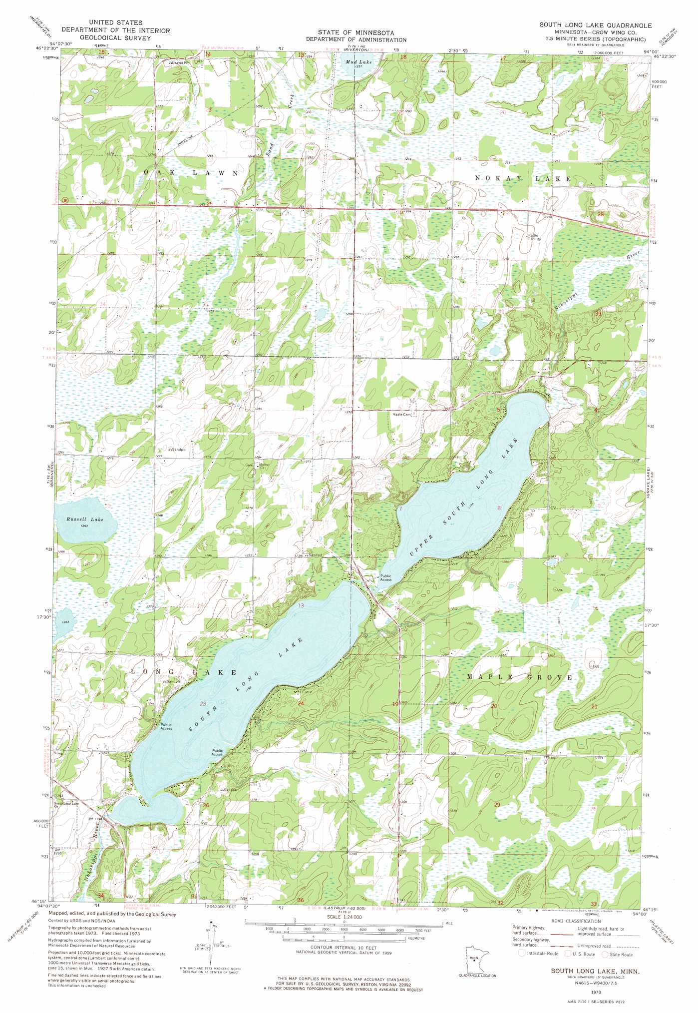
USGS Topo Quad 46094c1 - 1:24,000 scale
| Topo Map Name: | South Long Lake |
| USGS Topo Quad ID: | 46094c1 |
| Print Size: | ca. 21 1/4" wide x 27" high |
| Southeast Coordinates: | 46.25° N latitude / 94° W longitude |
| Map Center Coordinates: | 46.3125° N latitude / 94.0625° W longitude |
| U.S. State: | MN |
| Filename: | o46094c1.jpg |
| Download Map JPG Image: | South Long Lake topo map 1:24,000 scale |
| Map Type: | Topographic |
| Topo Series: | 7.5´ |
| Map Scale: | 1:24,000 |
| Source of Map Images: | United States Geological Survey (USGS) |
| Alternate Map Versions: |
South Long Lake MN 1973, updated 1976 Download PDF Buy paper map South Long Lake MN 2010 Download PDF Buy paper map South Long Lake MN 2013 Download PDF Buy paper map South Long Lake MN 2016 Download PDF Buy paper map |
1:24,000 Topo Quads surrounding South Long Lake
Nisswa |
Pelican Lake |
Trommald |
Cuyuna |
Iron Hub |
Gull Lake |
Merrifield |
Riverton |
Crosby |
Bay Lake |
Baxter |
Brainerd |
South Long Lake |
Grave Lake |
Garrison |
Fort Ripley |
Lastrup Nw |
Shephard |
Platte Lake |
Vineland |
Belle Prairie |
Freedhem |
Lastrup |
Hillman |
Hillman Se |
> Back to 46094a1 at 1:100,000 scale
> Back to 46094a1 at 1:250,000 scale
> Back to U.S. Topo Maps home
South Long Lake topo map: Gazetteer
South Long Lake: Dams
Long Lake Upper Dam elevation 366m 1200′Lower Long Lake Dam elevation 364m 1194′
South Long Lake: Lakes
Mud Lake elevation 377m 1236′Russell Lake elevation 385m 1263′
South Long Lake elevation 364m 1194′
Upper South Long Lake elevation 364m 1194′
South Long Lake: Reservoirs
Long Lake Upper elevation 366m 1200′Lower Long Lake elevation 364m 1194′
South Long Lake: Streams
Hay Creek elevation 371m 1217′South Long Lake digital topo map on disk
Buy this South Long Lake topo map showing relief, roads, GPS coordinates and other geographical features, as a high-resolution digital map file on DVD: