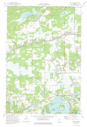
Iron Hub Topo Map Minnesota
To zoom in, hover over the map of Iron Hub
USGS Topo Quad 46093e7 - 1:24,000 scale
| Topo Map Name: | Iron Hub |
| USGS Topo Quad ID: | 46093e7 |
| Print Size: | ca. 21 1/4" wide x 27" high |
| Southeast Coordinates: | 46.5° N latitude / 93.75° W longitude |
| Map Center Coordinates: | 46.5625° N latitude / 93.8125° W longitude |
| U.S. State: | MN |
| Filename: | o46093e7.jpg |
| Download Map JPG Image: | Iron Hub topo map 1:24,000 scale |
| Map Type: | Topographic |
| Topo Series: | 7.5´ |
| Map Scale: | 1:24,000 |
| Source of Map Images: | United States Geological Survey (USGS) |
| Alternate Map Versions: |
Iron Hub MN 1973, updated 1975 Download PDF Buy paper map Iron Hub MN 2010 Download PDF Buy paper map Iron Hub MN 2013 Download PDF Buy paper map Iron Hub MN 2016 Download PDF Buy paper map |
1:24,000 Topo Quads surrounding Iron Hub
> Back to 46093e1 at 1:100,000 scale
> Back to 46092a1 at 1:250,000 scale
> Back to U.S. Topo Maps home
Iron Hub topo map: Gazetteer
Iron Hub: Islands
Grape Island elevation 366m 1200′Iron Hub: Lakes
Bass Lake elevation 367m 1204′Blue Lake elevation 386m 1266′
Casey Lake elevation 367m 1204′
Dogfish Lake elevation 367m 1204′
Nelson Lake elevation 370m 1213′
Poor Farm Lake elevation 367m 1204′
Rushmeyer Lake elevation 367m 1204′
Sullivan Lake elevation 370m 1213′
Terry Lake elevation 370m 1213′
Iron Hub: Populated Places
Pine Knoll elevation 367m 1204′Iron Hub: Post Offices
Iron Hub Post Office (historical) elevation 381m 1250′Pineknoll Post Office (historical) elevation 367m 1204′
Iron Hub: Reservoirs
Cedar Lake elevation 366m 1200′Iron Hub: Streams
Cedar Creek elevation 363m 1190′Dean Brook elevation 362m 1187′
Little Willow River elevation 361m 1184′
Iron Hub digital topo map on disk
Buy this Iron Hub topo map showing relief, roads, GPS coordinates and other geographical features, as a high-resolution digital map file on DVD:


