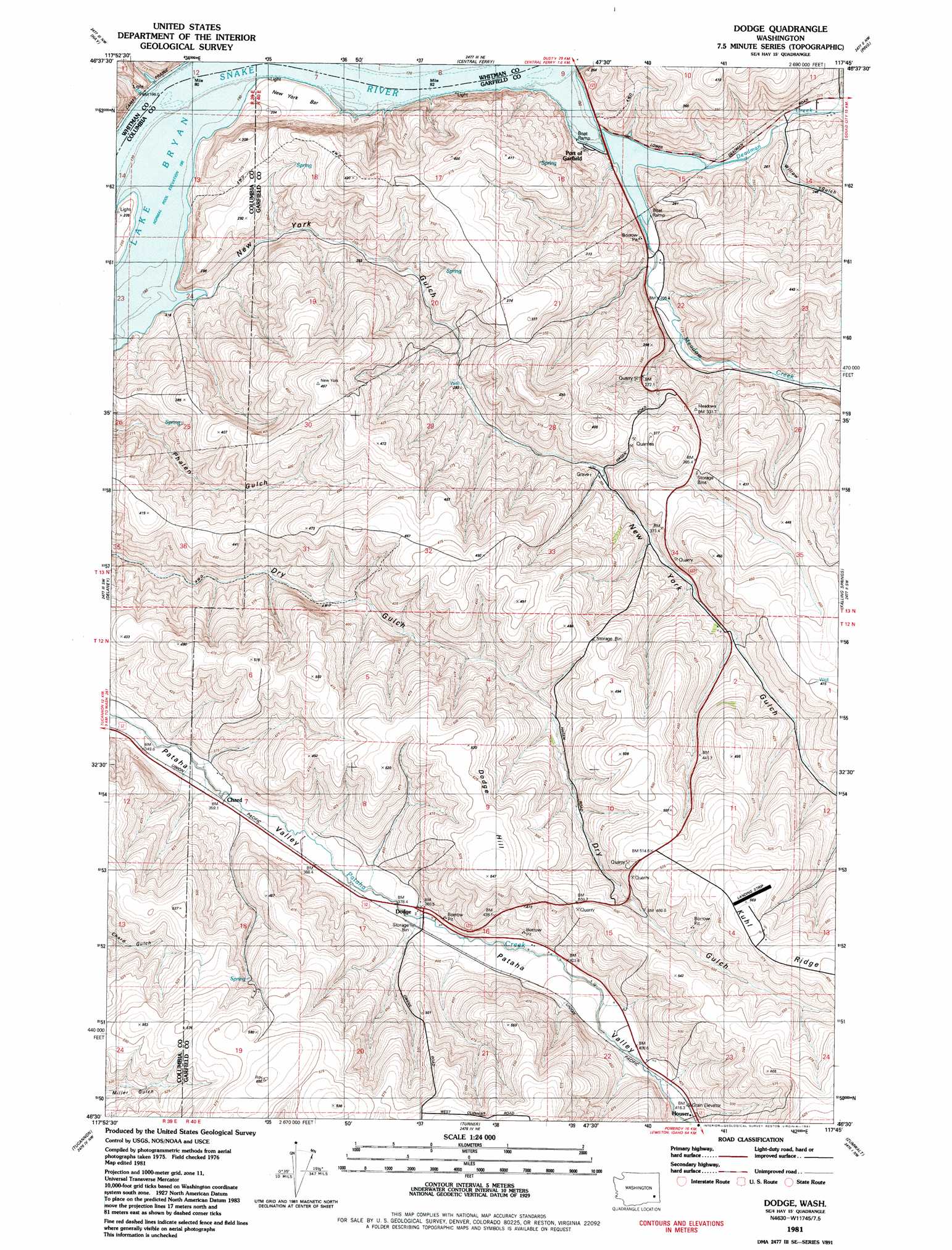
Dodge Topo Map Washington
To zoom in, hover over the map of Dodge
USGS Topo Quad 46117e7 - 1:24,000 scale
| Topo Map Name: | Dodge |
| USGS Topo Quad ID: | 46117e7 |
| Print Size: | ca. 21 1/4" wide x 27" high |
| Southeast Coordinates: | 46.5° N latitude / 117.75° W longitude |
| Map Center Coordinates: | 46.5625° N latitude / 117.8125° W longitude |
| U.S. State: | WA |
| Filename: | o46117e7.jpg |
| Download Map JPG Image: | Dodge topo map 1:24,000 scale |
| Map Type: | Topographic |
| Topo Series: | 7.5´ |
| Map Scale: | 1:24,000 |
| Source of Map Images: | United States Geological Survey (USGS) |
| Alternate Map Versions: |
Dodge WA 1981, updated 1981 Download PDF Buy paper map Dodge WA 2011 Download PDF Buy paper map Dodge WA 2014 Download PDF Buy paper map |
1:24,000 Topo Quads surrounding Dodge
Rattlesnake Canyon |
La Crosse West |
La Crosse East |
Dusty |
Little Penawawa Creek |
Hooper Lake |
Hay |
Central Ferry |
Ping |
Wades Bar |
Starbuck East |
Delaney |
Dodge |
Falling Springs |
Gould City |
Kellogg Creek |
Tucannon |
Turner |
Zumwalt |
Pomeroy |
Huntsville |
Dayton |
Cahill Mountain |
Hopkins Ridge |
Rose Springs |
> Back to 46117e1 at 1:100,000 scale
> Back to 46116a1 at 1:250,000 scale
> Back to U.S. Topo Maps home
Dodge topo map: Gazetteer
Dodge: Airports
Scott Seed Farm Airport elevation 569m 1866′Dodge: Flats
New York Bar elevation 196m 643′Dodge: Islands
New York Island elevation 196m 643′Dodge: Populated Places
Chard elevation 356m 1167′Dodge elevation 388m 1272′
Houser elevation 416m 1364′
Dodge: Ridges
Kuhl Ridge elevation 576m 1889′Dodge: Streams
Deadman Creek elevation 196m 643′Meadow Creek elevation 196m 643′
Dodge: Summits
Dodge Hill elevation 548m 1797′Dodge: Valleys
New York Gulch elevation 196m 643′Willow Gulch elevation 204m 669′
Dodge digital topo map on disk
Buy this Dodge topo map showing relief, roads, GPS coordinates and other geographical features, as a high-resolution digital map file on DVD: