Humorist Topo Map Washington
To zoom in, hover over the map of Humorist
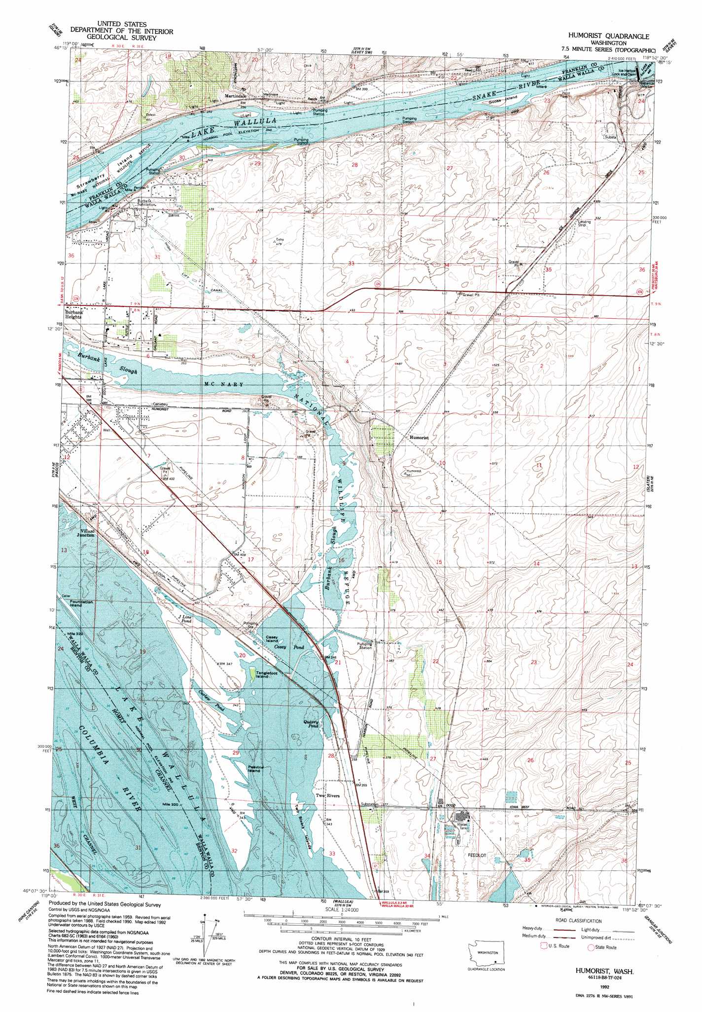
USGS Topo Quad 46118b8 - 1:24,000 scale
| Topo Map Name: | Humorist |
| USGS Topo Quad ID: | 46118b8 |
| Print Size: | ca. 21 1/4" wide x 27" high |
| Southeast Coordinates: | 46.125° N latitude / 118.875° W longitude |
| Map Center Coordinates: | 46.1875° N latitude / 118.9375° W longitude |
| U.S. State: | WA |
| Filename: | o46118b8.jpg |
| Download Map JPG Image: | Humorist topo map 1:24,000 scale |
| Map Type: | Topographic |
| Topo Series: | 7.5´ |
| Map Scale: | 1:24,000 |
| Source of Map Images: | United States Geological Survey (USGS) |
| Alternate Map Versions: |
Humorist WA 1964, updated 1965 Download PDF Buy paper map Humorist WA 1964, updated 1978 Download PDF Buy paper map Humorist WA 1992, updated 1992 Download PDF Buy paper map Humorist WA 2011 Download PDF Buy paper map Humorist WA 2014 Download PDF Buy paper map |
1:24,000 Topo Quads surrounding Humorist
Mathews Corner |
Eltopia |
Rye Grass Coulee |
Levey Ne |
Snake River |
Columbia Point |
Glade |
Levey Sw |
Levey Se |
Page |
Kennewick |
Pasco |
Humorist |
Slater |
Welland |
Johnson Butte |
Nine Canyon |
Wallula |
Zangar Junction |
Touchet |
Hat Rock |
Juniper |
Juniper Canyon |
Ring |
Smeltz |
> Back to 46118a1 at 1:100,000 scale
> Back to 46118a1 at 1:250,000 scale
> Back to U.S. Topo Maps home
Humorist topo map: Gazetteer
Humorist: Canals
High Lift Canal elevation 130m 426′Humorist: Channels
Homly Channel elevation 105m 344′West Channel elevation 105m 344′
Humorist: Dams
Ice Harbor Lock and Dam elevation 135m 442′Humorist: Guts
Burbank Slough elevation 106m 347′Humorist: Islands
Casey Island elevation 105m 344′Foundation Island elevation 105m 344′
Goose Island elevation 105m 344′
Peavine Island elevation 106m 347′
Strawberry Island elevation 106m 347′
Tanglefoot Island elevation 106m 347′
Two Rivers Islands elevation 106m 347′
Humorist: Lakes
Casey Pond elevation 105m 344′Curlew Pond elevation 105m 344′
J Line Pond elevation 105m 344′
Quarry Pond elevation 105m 344′
Humorist: Parks
McNary National Wildlife Refuge elevation 118m 387′Humorist: Populated Places
Humorist elevation 162m 531′Martindale elevation 116m 380′
Two Rivers elevation 106m 347′
Villard Junction elevation 120m 393′
Humorist: Post Offices
Two Rivers Post Office (historical) elevation 106m 347′Humorist: Reservoirs
Iowa Beef Processors Waste Pond elevation 184m 603′Lake Sacajawea elevation 135m 442′
Humorist digital topo map on disk
Buy this Humorist topo map showing relief, roads, GPS coordinates and other geographical features, as a high-resolution digital map file on DVD: