Burnt Peak Topo Map Washington
To zoom in, hover over the map of Burnt Peak
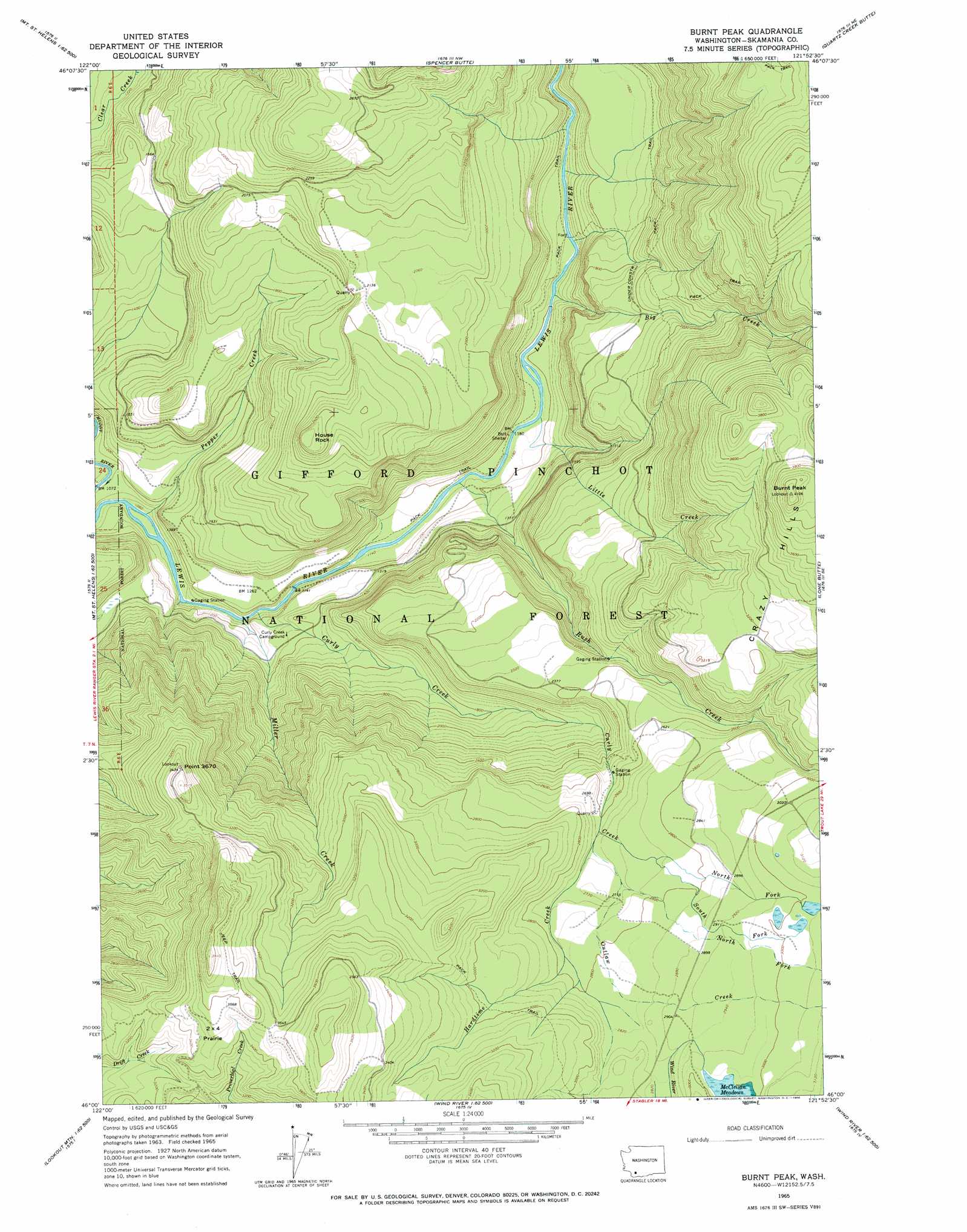
USGS Topo Quad 46121a8 - 1:24,000 scale
| Topo Map Name: | Burnt Peak |
| USGS Topo Quad ID: | 46121a8 |
| Print Size: | ca. 21 1/4" wide x 27" high |
| Southeast Coordinates: | 46° N latitude / 121.875° W longitude |
| Map Center Coordinates: | 46.0625° N latitude / 121.9375° W longitude |
| U.S. State: | WA |
| Filename: | o46121a8.jpg |
| Download Map JPG Image: | Burnt Peak topo map 1:24,000 scale |
| Map Type: | Topographic |
| Topo Series: | 7.5´ |
| Map Scale: | 1:24,000 |
| Source of Map Images: | United States Geological Survey (USGS) |
| Alternate Map Versions: |
Burnt Peak WA 1965, updated 1966 Download PDF Buy paper map Burnt Peak WA 1998, updated 2003 Download PDF Buy paper map Burnt Peak WA 2011 Download PDF Buy paper map Burnt Peak WA 2014 Download PDF Buy paper map |
| FStopo: | US Forest Service topo Burnt Peak is available: Download FStopo PDF Download FStopo TIF |
1:24,000 Topo Quads surrounding Burnt Peak
Spirit Lake West |
Spirit Lake East |
French Butte |
Mccoy Peak |
East Canyon Ridge |
Mount Sainte Helens |
Smith Creek Butte |
Spencer Butte |
Quartz Creek Butte |
Steamboat Mountain |
Mount Mitchell |
Cedar Flats |
Burnt Peak |
Lone Butte |
Sleeping Beauty |
Siouxon Peak |
Bare Mountain |
Termination Point |
Gifford Peak |
Little Huckleberry Mountain |
Gumboot Mountain |
Lookout Mountain |
Stabler |
Big Huckleberry Mountain |
Willard |
> Back to 46121a1 at 1:100,000 scale
> Back to 46120a1 at 1:250,000 scale
> Back to U.S. Topo Maps home
Burnt Peak topo map: Gazetteer
Burnt Peak: Cliffs
Point 3670 elevation 1029m 3375′Burnt Peak: Falls
Curly Creek Falls elevation 371m 1217′Burnt Peak: Flats
Two Times Four Prairie elevation 1082m 3549′Burnt Peak: Ranges
Crazy Hills elevation 1248m 4094′Burnt Peak: Streams
Big Creek elevation 372m 1220′Curly Creek elevation 335m 1099′
Hardtime Creek elevation 804m 2637′
Little Creek elevation 362m 1187′
Miller Creek elevation 334m 1095′
North Fork Curley Creek elevation 840m 2755′
North Fork Outlaw Creek elevation 823m 2700′
Outlaw Creek elevation 808m 2650′
Pepper Creek elevation 325m 1066′
Rush Creek elevation 352m 1154′
South Fork Curley Creek elevation 840m 2755′
Burnt Peak: Summits
Burnt Peak elevation 1248m 4094′House Rock elevation 773m 2536′
Burnt Peak digital topo map on disk
Buy this Burnt Peak topo map showing relief, roads, GPS coordinates and other geographical features, as a high-resolution digital map file on DVD: