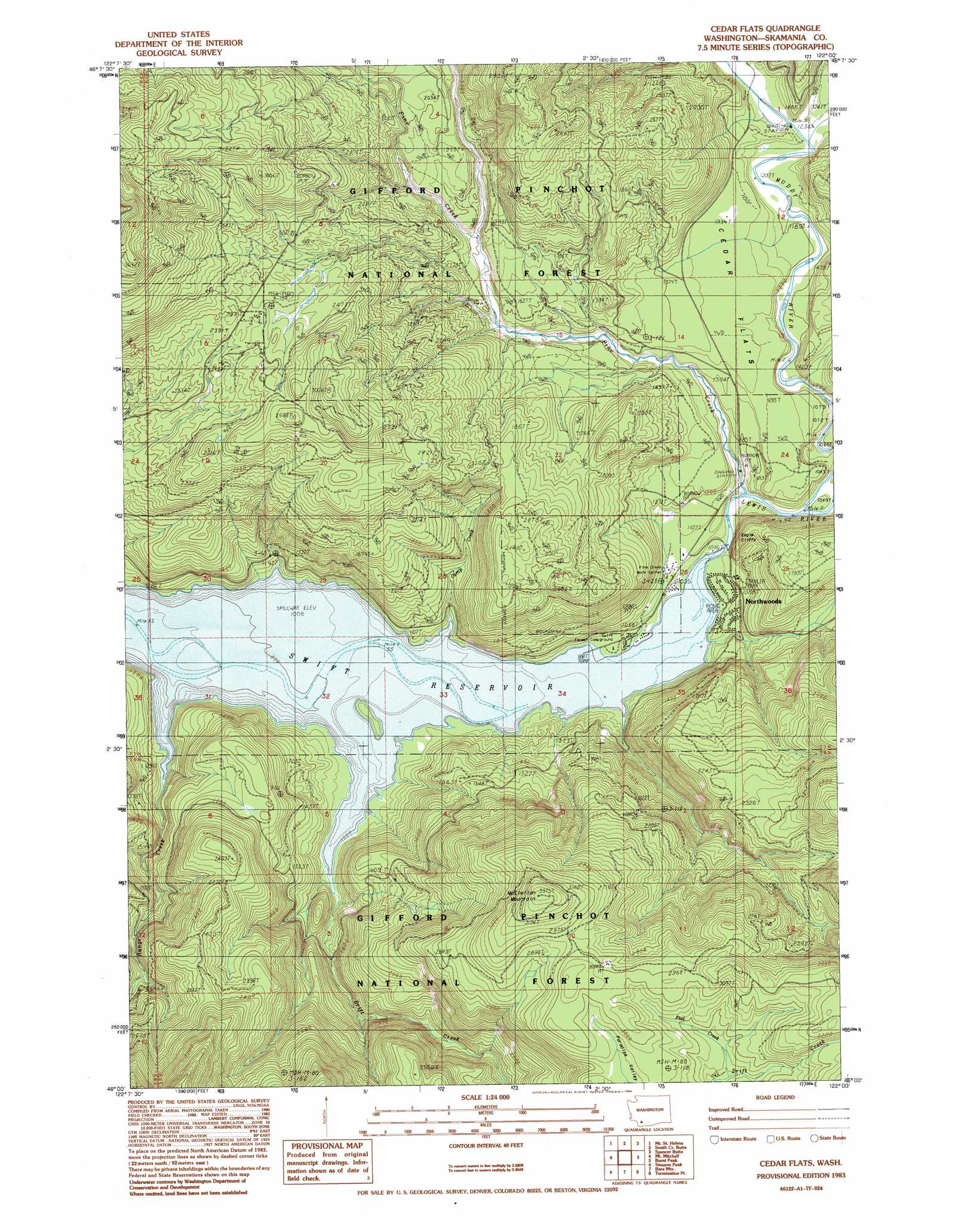
Cedar Flats Topo Map Washington
To zoom in, hover over the map of Cedar Flats
USGS Topo Quad 46122a1 - 1:24,000 scale
| Topo Map Name: | Cedar Flats |
| USGS Topo Quad ID: | 46122a1 |
| Print Size: | ca. 21 1/4" wide x 27" high |
| Southeast Coordinates: | 46° N latitude / 122° W longitude |
| Map Center Coordinates: | 46.0625° N latitude / 122.0625° W longitude |
| U.S. State: | WA |
| Filename: | o46122a1.jpg |
| Download Map JPG Image: | Cedar Flats topo map 1:24,000 scale |
| Map Type: | Topographic |
| Topo Series: | 7.5´ |
| Map Scale: | 1:24,000 |
| Source of Map Images: | United States Geological Survey (USGS) |
| Alternate Map Versions: |
Mt. St. Helens SE WA 1975, updated 1980 Download PDF Buy paper map Cedar Flats WA 1983, updated 1984 Download PDF Buy paper map Cedar Flats WA 1983, updated 1984 Download PDF Buy paper map Cedar Flats WA 1998, updated 2003 Download PDF Buy paper map Cedar Flats WA 2011 Download PDF Buy paper map Cedar Flats WA 2013 Download PDF Buy paper map |
| FStopo: | US Forest Service topo Cedar Flats is available: Download FStopo PDF Download FStopo TIF |
1:24,000 Topo Quads surrounding Cedar Flats
Elk Rock |
Spirit Lake West |
Spirit Lake East |
French Butte |
Mccoy Peak |
Goat Mountain |
Mount Sainte Helens |
Smith Creek Butte |
Spencer Butte |
Quartz Creek Butte |
Cougar |
Mount Mitchell |
Cedar Flats |
Burnt Peak |
Lone Butte |
Yale Dam |
Siouxon Peak |
Bare Mountain |
Termination Point |
Gifford Peak |
Dole |
Gumboot Mountain |
Lookout Mountain |
Stabler |
Big Huckleberry Mountain |
> Back to 46122a1 at 1:100,000 scale
> Back to 46122a1 at 1:250,000 scale
> Back to U.S. Topo Maps home
Cedar Flats topo map: Gazetteer
Cedar Flats: Cliffs
Eagle Cliffs elevation 442m 1450′Cedar Flats: Flats
Cedar Flats elevation 408m 1338′Cedar Flats: Parks
Cedar Flats Natural Area elevation 404m 1325′Cedar Flats: Populated Places
Northwoods elevation 313m 1026′Cedar Flats: Streams
Camp Creek elevation 310m 1017′Clear Creek elevation 369m 1210′
Drift Creek elevation 308m 1010′
Flat Creek elevation 815m 2673′
Muddy River elevation 317m 1040′
Pine Creek elevation 318m 1043′
Range Creek elevation 314m 1030′
Cedar Flats: Summits
McClellan Mountain elevation 1027m 3369′Cedar Flats: Trails
Cedar Flats Nature Trail elevation 406m 1332′Cedar Flats digital topo map on disk
Buy this Cedar Flats topo map showing relief, roads, GPS coordinates and other geographical features, as a high-resolution digital map file on DVD: