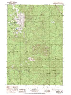
Wickiup Mountain Topo Map Oregon
To zoom in, hover over the map of Wickiup Mountain
USGS Topo Quad 46123a5 - 1:24,000 scale
| Topo Map Name: | Wickiup Mountain |
| USGS Topo Quad ID: | 46123a5 |
| Print Size: | ca. 21 1/4" wide x 27" high |
| Southeast Coordinates: | 46° N latitude / 123.5° W longitude |
| Map Center Coordinates: | 46.0625° N latitude / 123.5625° W longitude |
| U.S. State: | OR |
| Filename: | o46123a5.jpg |
| Download Map JPG Image: | Wickiup Mountain topo map 1:24,000 scale |
| Map Type: | Topographic |
| Topo Series: | 7.5´ |
| Map Scale: | 1:24,000 |
| Source of Map Images: | United States Geological Survey (USGS) |
| Alternate Map Versions: |
Wickiup Mtn OR 1985, updated 1985 Download PDF Buy paper map Wickiup Mountain OR 2011 Download PDF Buy paper map Wickiup Mountain OR 2014 Download PDF Buy paper map |
1:24,000 Topo Quads surrounding Wickiup Mountain
> Back to 46123a1 at 1:100,000 scale
> Back to 46122a1 at 1:250,000 scale
> Back to U.S. Topo Maps home
Wickiup Mountain topo map: Gazetteer
Wickiup Mountain: Dams
Middle Lake Dam elevation 394m 1292′Wickiup Lake Dam elevation 476m 1561′
Wickiup Mountain: Lakes
Middle Lake elevation 397m 1302′Wickiup Lake elevation 476m 1561′
Wickiup Mountain: Ridges
Wickiup Ridge elevation 822m 2696′Wickiup Mountain: Streams
Coon Creek elevation 186m 610′Elk Creek elevation 204m 669′
Mud Creek elevation 147m 482′
Pigpen Creek elevation 146m 479′
Wickiup Mountain: Summits
Elk Mountain elevation 817m 2680′Knob Point elevation 630m 2066′
Wickiup Mountain elevation 810m 2657′
Wickiup Mountain digital topo map on disk
Buy this Wickiup Mountain topo map showing relief, roads, GPS coordinates and other geographical features, as a high-resolution digital map file on DVD:


