Monarch Ne Topo Map Montana
To zoom in, hover over the map of Monarch Ne
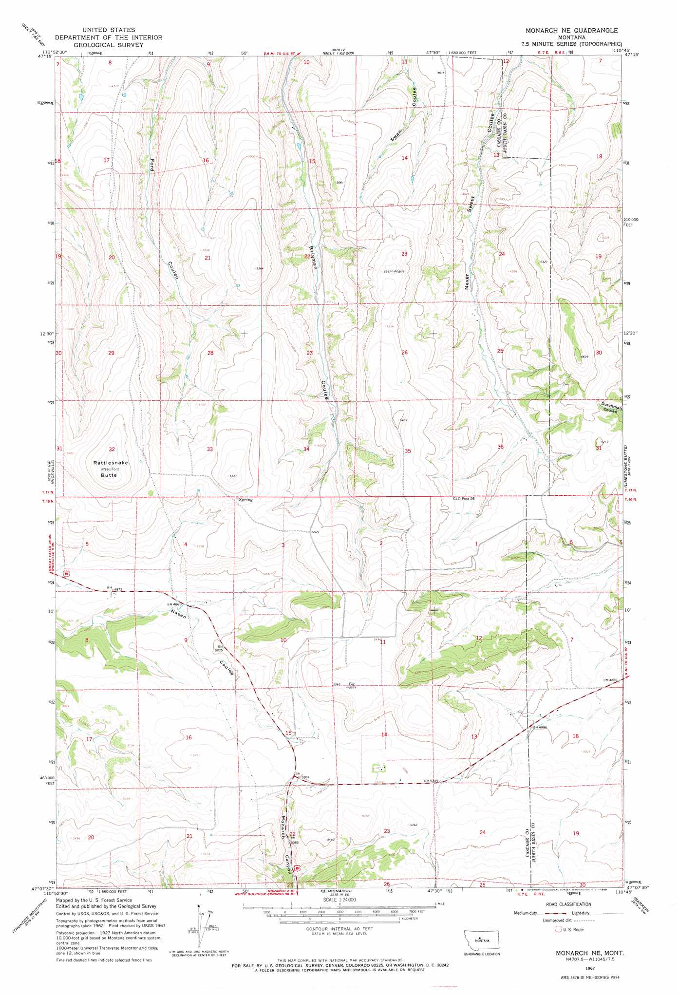
USGS Topo Quad 47110b7 - 1:24,000 scale
| Topo Map Name: | Monarch Ne |
| USGS Topo Quad ID: | 47110b7 |
| Print Size: | ca. 21 1/4" wide x 27" high |
| Southeast Coordinates: | 47.125° N latitude / 110.75° W longitude |
| Map Center Coordinates: | 47.1875° N latitude / 110.8125° W longitude |
| U.S. State: | MT |
| Filename: | o47110b7.jpg |
| Download Map JPG Image: | Monarch Ne topo map 1:24,000 scale |
| Map Type: | Topographic |
| Topo Series: | 7.5´ |
| Map Scale: | 1:24,000 |
| Source of Map Images: | United States Geological Survey (USGS) |
| Alternate Map Versions: |
Monarch NE MT 1967, updated 1969 Download PDF Buy paper map Monarch NE MT 1995, updated 1997 Download PDF Buy paper map Monarch NE MT 2011 Download PDF Buy paper map Monarch NE MT 2014 Download PDF Buy paper map |
| FStopo: | US Forest Service topo Monarch NE is available: Download FStopo PDF Download FStopo TIF |
1:24,000 Topo Quads surrounding Monarch Ne
Fife |
Belt |
Belt Ne |
Highwood Baldy |
Arrow Peak |
Mahoney Hill |
Armington |
Blythe |
Raynesford |
Byrne Creek |
Evans |
Riceville |
Monarch Ne |
Limestone Butte |
The Arch |
Blankenbaker Flats |
Thunder Mountain |
Monarch |
Barker |
Mixes Baldy |
Monument Peak |
Bubbling Springs |
Belt Park Butte |
Neihart |
Yogo Peak |
> Back to 47110a1 at 1:100,000 scale
> Back to 47110a1 at 1:250,000 scale
> Back to U.S. Topo Maps home
Monarch Ne topo map: Gazetteer
Monarch Ne: Populated Places
Michigan Settlement (historical) elevation 1623m 5324′Monarch Ne: Summits
Rattlesnake Butte elevation 1760m 5774′Monarch Ne: Valleys
Goodman Coulee elevation 1635m 5364′Monarch Ne digital topo map on disk
Buy this Monarch Ne topo map showing relief, roads, GPS coordinates and other geographical features, as a high-resolution digital map file on DVD: