Sunset Peak Topo Map Montana
To zoom in, hover over the map of Sunset Peak
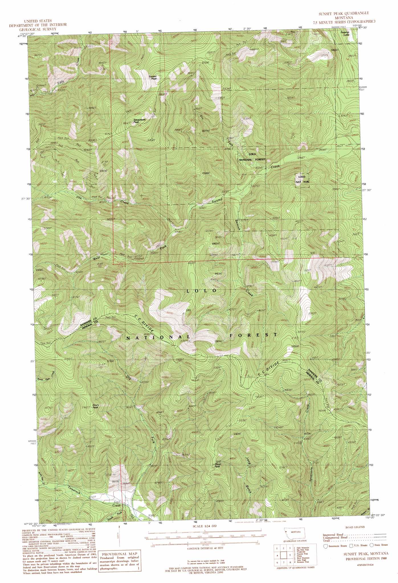
USGS Topo Quad 47115d1 - 1:24,000 scale
| Topo Map Name: | Sunset Peak |
| USGS Topo Quad ID: | 47115d1 |
| Print Size: | ca. 21 1/4" wide x 27" high |
| Southeast Coordinates: | 47.375° N latitude / 115° W longitude |
| Map Center Coordinates: | 47.4375° N latitude / 115.0625° W longitude |
| U.S. State: | MT |
| Filename: | o47115d1.jpg |
| Download Map JPG Image: | Sunset Peak topo map 1:24,000 scale |
| Map Type: | Topographic |
| Topo Series: | 7.5´ |
| Map Scale: | 1:24,000 |
| Source of Map Images: | United States Geological Survey (USGS) |
| Alternate Map Versions: |
Sunset Peak MT 1988, updated 1988 Download PDF Buy paper map Sunset Peak MT 1999, updated 2003 Download PDF Buy paper map Sunset Peak MT 2011 Download PDF Buy paper map Sunset Peak MT 2014 Download PDF Buy paper map |
| FStopo: | US Forest Service topo Sunset Peak is available: Download FStopo PDF Download FStopo TIF |
1:24,000 Topo Quads surrounding Sunset Peak
Mount Headley |
Priscilla Peak |
Calico Creek |
Loneman Creek |
Coney Peak |
Thompson Falls |
Eddy Mountain |
Big Hole Peak |
Weeksville |
Baldy Lake |
Deborgia North |
Penrose Peak |
Sunset Peak |
Plains |
Paradise |
Deborgia South |
Boyd Mountain |
Saint Regis |
Keystone Peak |
Quinns Hot Springs |
Berge Peak |
Torino Peak |
Wilson Gulch |
Superior |
Idaho Gulch |
> Back to 47115a1 at 1:100,000 scale
> Back to 47114a1 at 1:250,000 scale
> Back to U.S. Topo Maps home
Sunset Peak topo map: Gazetteer
Sunset Peak: Mines
Dee Creek Mine elevation 1315m 4314′Eddy Creek Mine elevation 1274m 4179′
Miller Mine elevation 1243m 4078′
Miller Mine elevation 1151m 3776′
Upper Dee Creek Mine elevation 1659m 5442′
Sunset Peak: Streams
Bemish Creek elevation 951m 3120′Dee Creek elevation 1049m 3441′
Dry Fork elevation 915m 3001′
Dry Fork elevation 944m 3097′
South Fork Tamarack Creek elevation 963m 3159′
Sunset Peak: Summits
Drury Peak elevation 1665m 5462′Olson Peak elevation 1601m 5252′
Sacajawea Peak elevation 2000m 6561′
Sunset Peak elevation 1908m 6259′
Sunset Peak digital topo map on disk
Buy this Sunset Peak topo map showing relief, roads, GPS coordinates and other geographical features, as a high-resolution digital map file on DVD: