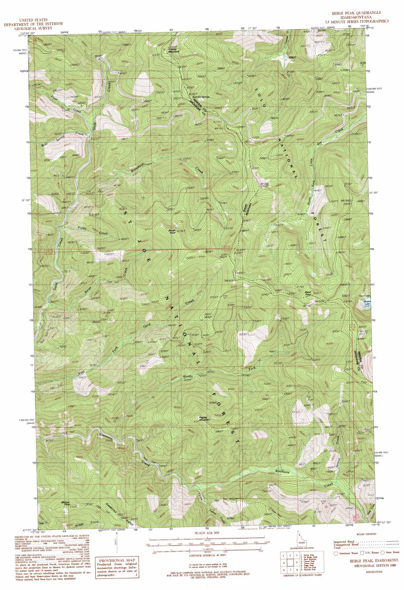
Berge Peak Topo Map Idaho
To zoom in, hover over the map of Berge Peak
USGS Topo Quad 47115b3 - 1:24,000 scale
| Topo Map Name: | Berge Peak |
| USGS Topo Quad ID: | 47115b3 |
| Print Size: | ca. 21 1/4" wide x 27" high |
| Southeast Coordinates: | 47.125° N latitude / 115.25° W longitude |
| Map Center Coordinates: | 47.1875° N latitude / 115.3125° W longitude |
| U.S. States: | ID, MT |
| Filename: | o47115b3.jpg |
| Download Map JPG Image: | Berge Peak topo map 1:24,000 scale |
| Map Type: | Topographic |
| Topo Series: | 7.5´ |
| Map Scale: | 1:24,000 |
| Source of Map Images: | United States Geological Survey (USGS) |
| Alternate Map Versions: |
Berge Peak ID 1988, updated 1988 Download PDF Buy paper map Berge Peak ID 1995, updated 1997 Download PDF Buy paper map Berge Peak ID 2011 Download PDF Buy paper map Berge Peak ID 2013 Download PDF Buy paper map |
| FStopo: | US Forest Service topo Berge Peak is available: Download FStopo PDF Download FStopo TIF |
1:24,000 Topo Quads surrounding Berge Peak
Saltese |
Haugan |
Deborgia North |
Penrose Peak |
Sunset Peak |
Adair |
Mcgee Peak |
Deborgia South |
Boyd Mountain |
Saint Regis |
Thor Mountain |
Conrad Peak |
Berge Peak |
Torino Peak |
Wilson Gulch |
Bathtub Mountain |
Peggy Peak |
Red Ives Peak |
Sherlock Peak |
Illinois Peak |
Mallard Peak |
Pole Mountain |
Bacon Peak |
Chamberlain Mountain |
Hoodoo Pass |
> Back to 47115a1 at 1:100,000 scale
> Back to 47114a1 at 1:250,000 scale
> Back to U.S. Topo Maps home
Berge Peak topo map: Gazetteer
Berge Peak: Lakes
Moore Lake elevation 1617m 5305′Berge Peak: Ridges
Leg Bone Ridge elevation 1607m 5272′Berge Peak: Springs
Summit Springs elevation 1813m 5948′Summit Springs elevation 1829m 6000′
Berge Peak: Streams
Bear Spring Creek elevation 1230m 4035′Berge Creek elevation 1119m 3671′
Broadaxe Creek elevation 1180m 3871′
Dolly Creek elevation 1343m 4406′
Float Creek elevation 1229m 4032′
North Fork Simmons Creek elevation 1161m 3809′
Pretty Creek elevation 1192m 3910′
Spruce Creek elevation 1315m 4314′
Three Lakes Creek elevation 1249m 4097′
Berge Peak: Summits
Berge Peak elevation 1883m 6177′Black Peak elevation 1978m 6489′
Black Peak elevation 1978m 6489′
Flattop Mountain elevation 1941m 6368′
Flattop Mountain elevation 1941m 6368′
Midget Peak elevation 1756m 5761′
Pegleg Mountain elevation 1748m 5734′
Berge Peak digital topo map on disk
Buy this Berge Peak topo map showing relief, roads, GPS coordinates and other geographical features, as a high-resolution digital map file on DVD: