Dahl Lake Topo Map Montana
To zoom in, hover over the map of Dahl Lake
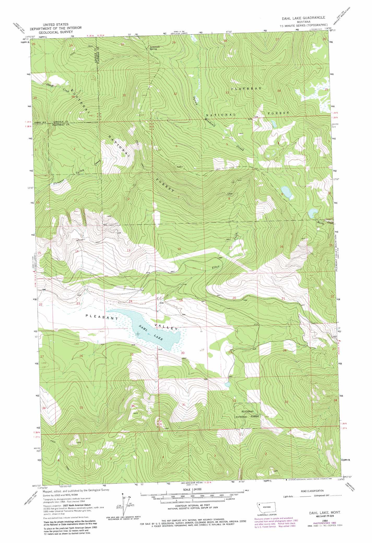
USGS Topo Quad 48114b7 - 1:24,000 scale
| Topo Map Name: | Dahl Lake |
| USGS Topo Quad ID: | 48114b7 |
| Print Size: | ca. 21 1/4" wide x 27" high |
| Southeast Coordinates: | 48.125° N latitude / 114.75° W longitude |
| Map Center Coordinates: | 48.1875° N latitude / 114.8125° W longitude |
| U.S. State: | MT |
| Filename: | o48114b7.jpg |
| Download Map JPG Image: | Dahl Lake topo map 1:24,000 scale |
| Map Type: | Topographic |
| Topo Series: | 7.5´ |
| Map Scale: | 1:24,000 |
| Source of Map Images: | United States Geological Survey (USGS) |
| Alternate Map Versions: |
Dahl Lake MT 1964, updated 1967 Download PDF Buy paper map Dahl Lake MT 1964, updated 1984 Download PDF Buy paper map Dahl Lake MT 1997, updated 2000 Download PDF Buy paper map Dahl Lake MT 2011 Download PDF Buy paper map Dahl Lake MT 2014 Download PDF Buy paper map |
| FStopo: | US Forest Service topo Dahl Lake is available: Download FStopo PDF Download FStopo TIF |
1:24,000 Topo Quads surrounding Dahl Lake
Warland Peak |
Bowen Lake |
Dunsire Point |
Johnson Peak |
Tally Lake |
Wolf Prairie |
Horse Hill |
Sylvia Lake |
Ashley Mountain |
Lost Creek Divide |
Deer Creek |
Lynch Lake |
Dahl Lake |
Pleasant Valley Mountain |
Lone Lake |
Thompson Lakes |
Meadow Peak |
Mcgregor Peak |
Marion |
Haskill Mountain |
Bend |
Shroder Creek |
Murr Peak |
Hubbart Reservoir |
Kofford Ridge |
> Back to 48114a1 at 1:100,000 scale
> Back to 48114a1 at 1:250,000 scale
> Back to U.S. Topo Maps home
Dahl Lake topo map: Gazetteer
Dahl Lake: Lakes
Dahl Lake elevation 1071m 3513′Dahl Lake: Springs
Lemonade Spring elevation 1520m 4986′Dahl Lake: Streams
Elbow Creek elevation 1079m 3540′Dahl Lake digital topo map on disk
Buy this Dahl Lake topo map showing relief, roads, GPS coordinates and other geographical features, as a high-resolution digital map file on DVD: