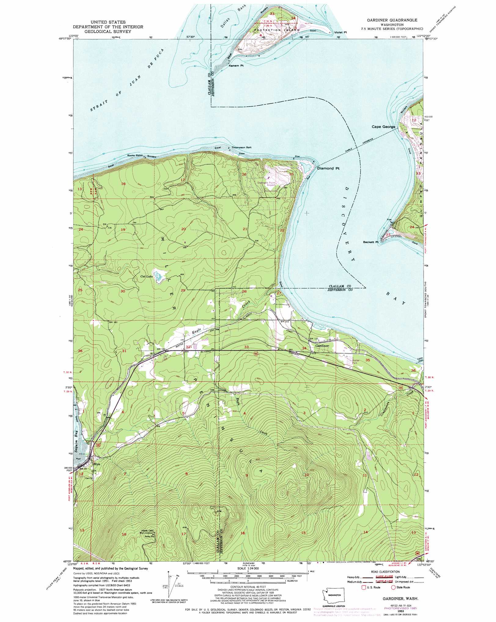
Gardiner Topo Map Washington
To zoom in, hover over the map of Gardiner
USGS Topo Quad 48122a8 - 1:24,000 scale
| Topo Map Name: | Gardiner |
| USGS Topo Quad ID: | 48122a8 |
| Print Size: | ca. 21 1/4" wide x 27" high |
| Southeast Coordinates: | 48° N latitude / 122.875° W longitude |
| Map Center Coordinates: | 48.0625° N latitude / 122.9375° W longitude |
| U.S. State: | WA |
| Filename: | o48122a8.jpg |
| Download Map JPG Image: | Gardiner topo map 1:24,000 scale |
| Map Type: | Topographic |
| Topo Series: | 7.5´ |
| Map Scale: | 1:24,000 |
| Source of Map Images: | United States Geological Survey (USGS) |
| Alternate Map Versions: |
Gardiner WA 1953, updated 1955 Download PDF Buy paper map Gardiner WA 1953, updated 1971 Download PDF Buy paper map Gardiner WA 1953, updated 1976 Download PDF Buy paper map Gardiner WA 1953, updated 1985 Download PDF Buy paper map Gardiner WA 1953, updated 1985 Download PDF Buy paper map Gardiner WA 2011 Download PDF Buy paper map Gardiner WA 2014 Download PDF Buy paper map |
| FStopo: | US Forest Service topo Gardiner is available: Download FStopo PDF Download FStopo TIF |
1:24,000 Topo Quads surrounding Gardiner
Smith Island |
Oak Harbor |
|||
Dungeness |
Port Townsend North |
Coupeville |
||
Carlsborg |
Sequim |
Gardiner |
Port Townsend South |
Nordland |
Tyler Peak |
Mount Zion |
Uncas |
Center |
Port Ludlow |
Mount Deception |
Mount Townsend |
Mount Walker |
Quilcene |
Lofall |
> Back to 48122a1 at 1:100,000 scale
> Back to 48122a1 at 1:250,000 scale
> Back to U.S. Topo Maps home
Gardiner topo map: Gazetteer
Gardiner: Airports
Diamond Point Airstrip elevation 81m 265′Protection Island Landing Strip (historical) elevation 44m 144′
Gardiner: Bars
Thompson Spit elevation 2m 6′Gardiner: Capes
Beckett Point elevation 2m 6′Cape George elevation 6m 19′
Diamond Point elevation 2m 6′
Kanem Point elevation 2m 6′
Miller Peninsula elevation 530m 1738′
Rocky Point elevation 22m 72′
Gardiner: Lakes
Cat Lake elevation 105m 344′Gardiner: Populated Places
Gardiner elevation 62m 203′Gardiner: Streams
Eagle Creek elevation 2m 6′Gardiner digital topo map on disk
Buy this Gardiner topo map showing relief, roads, GPS coordinates and other geographical features, as a high-resolution digital map file on DVD: