Karval Topo Map Colorado

To zoom in, hover over the map of Karval

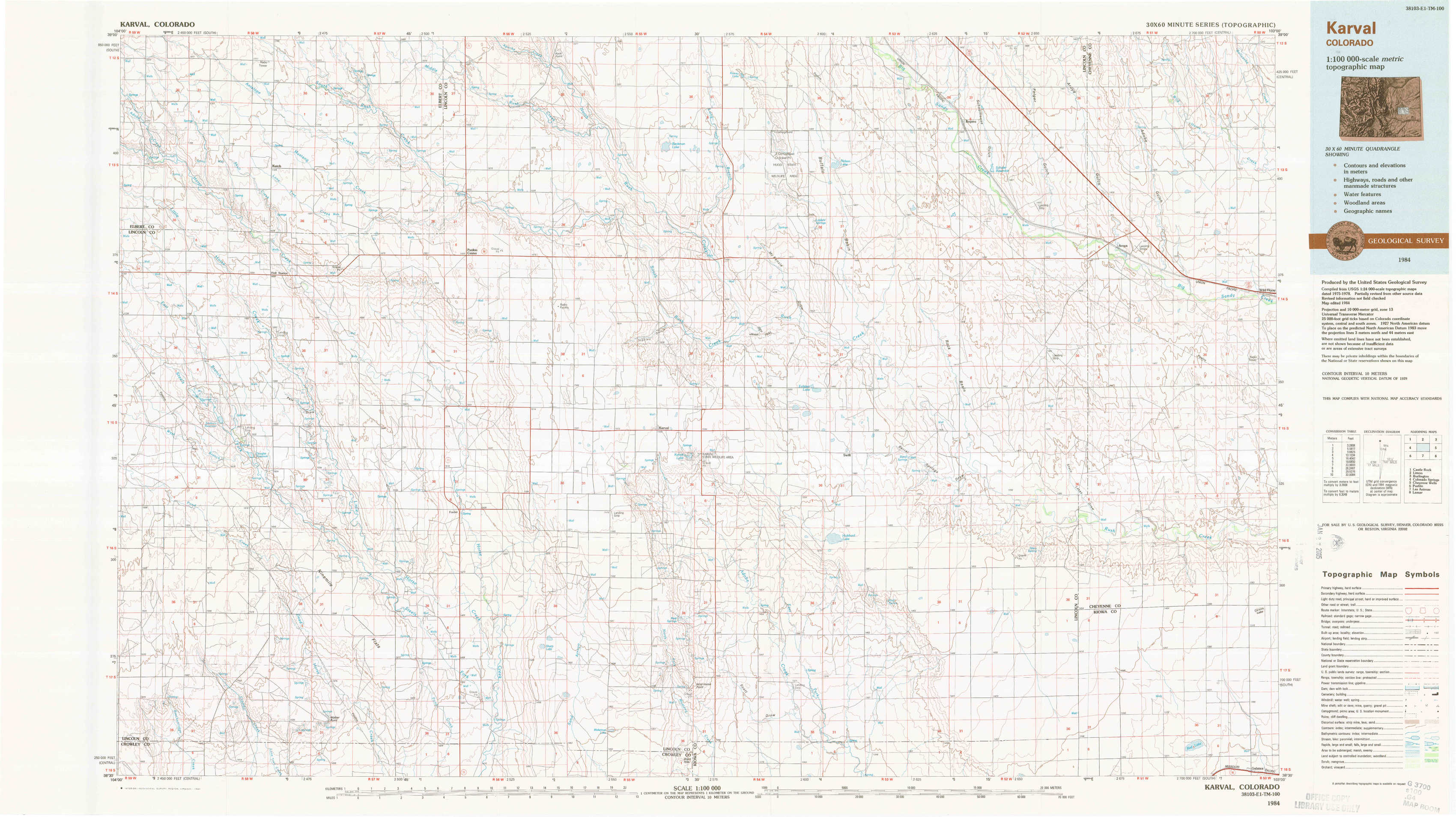
USGS Topo Map 38103e1 - 1:100,000 scale

Topo Map Name: Karval
USGS Topo Quad ID: 38103e1
Print Size: ca. 39" wide x 24" high
Southeast Coordinates: 38.5° N latitude / 103° W longitude
Map Center Coordinates: 38.75° N latitude / 103.5° W longitude
U.S. State: CO
Filename: 38103e1.jpg
Download Map JPG Image: Karval topo map 1:100,000 scale
Map Type: Topographic
Topo Series: 30´x60´
Map Scale: 1:100,000
Source of Map Images: United States Geological Survey (USGS)
Alternate Map Versions: Karval CO 1984, updated 1984 Download PDF Buy paper map

1:100,000 Topos surrounding Karval

Castle Rock
Castle Rock USGS topographic map 39104a1
Limon
Limon USGS topographic map 39103a1
Burlington
Burlington USGS topographic map 39102a1
Colorado Springs
Colorado Springs USGS topographic map 38104e1
Karval
Karval USGS topographic map 38103e1
Cheyenne Wells
Cheyenne Wells USGS topographic map 38102e1
Pueblo
Pueblo USGS topographic map 38104a1
Las Animas
Las Animas USGS topographic map 38103a1
Lamar
Lamar USGS topographic map 38102a1

> Back to 38102a1 at 1:250,000 scale
> Back to U.S. Topo Maps home

1:24,000 Topo Quads covered by the spatial extent of this 100k map (Karval)

Kutch Nw
Kutch Nw USGS topographic map 38103h8
Kutch
Kutch USGS topographic map 38103h7
Punkin Center Nw
Punkin Center Nw USGS topographic map 38103h6
Beckman Lake
Beckman Lake USGS topographic map 38103h5
Kinney Lake
Kinney Lake USGS topographic map 38103h4
Boyero
Boyero USGS topographic map 38103h3
Schafer Reservoir
Schafer Reservoir USGS topographic map 38103h2
Sanders Ranch
Sanders Ranch USGS topographic map 38103h1
Kutch Sw
Kutch Sw USGS topographic map 38103g8
Kutch Se
Kutch Se USGS topographic map 38103g7
Punkin Center
Punkin Center USGS topographic map 38103g6
Stanley Gulch
Stanley Gulch USGS topographic map 38103g5
Mckenzie Draw
Mckenzie Draw USGS topographic map 38103g4
Rock Basin
Rock Basin USGS topographic map 38103g3
Aroya
Aroya USGS topographic map 38103g2
Wild Horse
Wild Horse USGS topographic map 38103g1
Sanborn Reservoir
Sanborn Reservoir USGS topographic map 38103f8
Peace Valley
Peace Valley USGS topographic map 38103f7
Forder
Forder USGS topographic map 38103f6
Karval
Karval USGS topographic map 38103f5
Hubbard Lake
Hubbard Lake USGS topographic map 38103f4
Barrel Springs Draw
Barrel Springs Draw USGS topographic map 38103f3
Stacy Lakes Draw
Stacy Lakes Draw USGS topographic map 38103f2
Galatea Ne
Galatea Ne USGS topographic map 38103f1
Cockleburr Springs
Cockleburr Springs USGS topographic map 38103e8
Walker Point
Walker Point USGS topographic map 38103e7
Sharp Lake
Sharp Lake USGS topographic map 38103e6
Metz Springs
Metz Springs USGS topographic map 38103e5
Scott Draw
Scott Draw USGS topographic map 38103e4
Bluff Spring
Bluff Spring USGS topographic map 38103e3
Galatea Sw
Galatea Sw USGS topographic map 38103e2
Galatea
Galatea USGS topographic map 38103e1
Karval topographical map