Bergheim Topo Map Texas
To zoom in, hover over the map of Bergheim
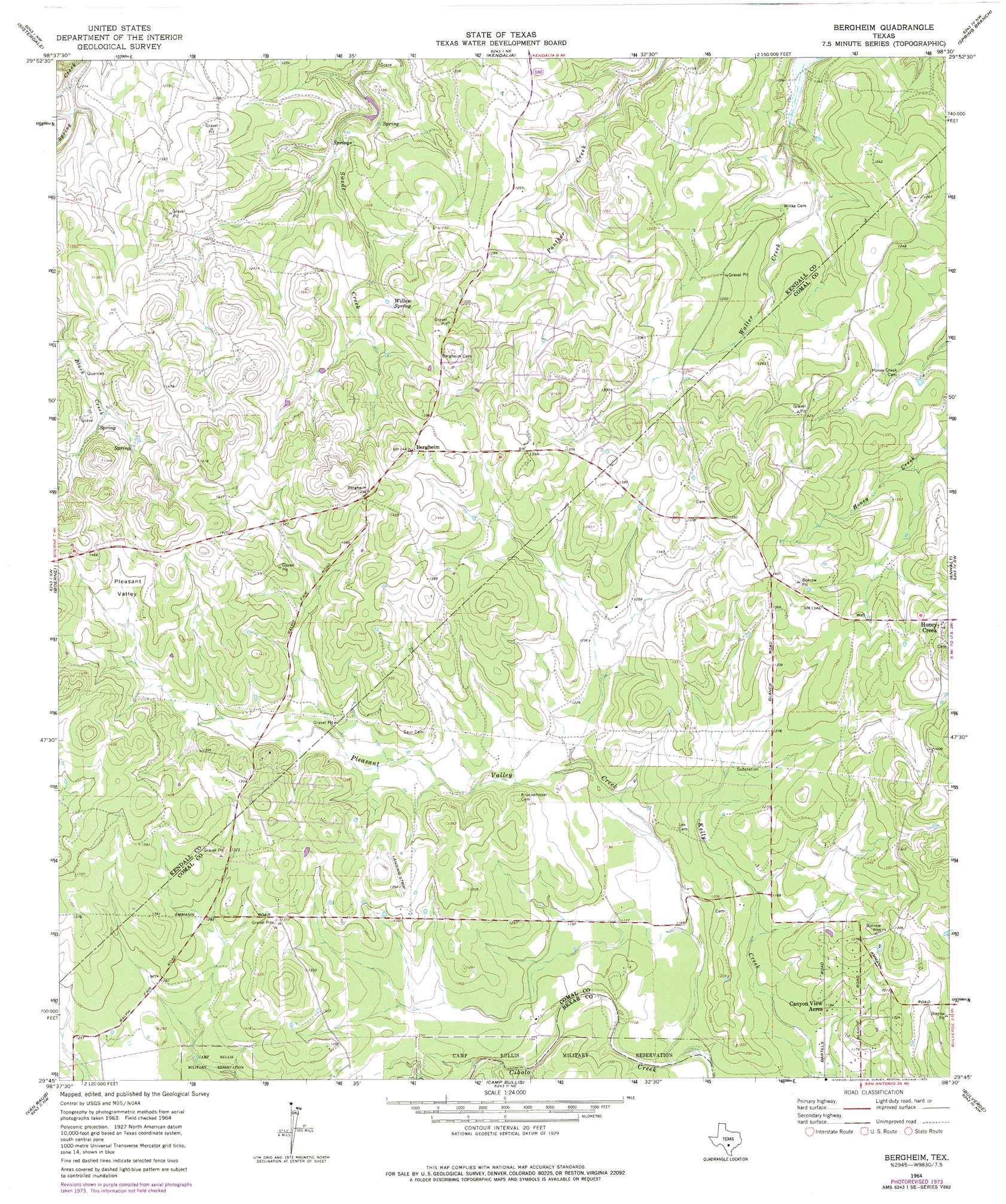
USGS Topo Quad 29098g5 - 1:24,000 scale
| Topo Map Name: | Bergheim |
| USGS Topo Quad ID: | 29098g5 |
| Print Size: | ca. 21 1/4" wide x 27" high |
| Southeast Coordinates: | 29.75° N latitude / 98.5° W longitude |
| Map Center Coordinates: | 29.8125° N latitude / 98.5625° W longitude |
| U.S. State: | TX |
| Filename: | o29098g5.jpg |
| Download Map JPG Image: | Bergheim topo map 1:24,000 scale |
| Map Type: | Topographic |
| Topo Series: | 7.5´ |
| Map Scale: | 1:24,000 |
| Source of Map Images: | United States Geological Survey (USGS) |
| Alternate Map Versions: |
Bergheim TX 1964, updated 1967 Download PDF Buy paper map Bergheim TX 1964, updated 1975 Download PDF Buy paper map Bergheim TX 2010 Download PDF Buy paper map Bergheim TX 2013 Download PDF Buy paper map Bergheim TX 2016 Download PDF Buy paper map |
1:24,000 Topo Quads surrounding Bergheim
Rafter Hollow |
Whitworth Ranch |
Crabapple Creek |
Blanco |
Payton |
Waring |
Sisterdale |
Kendalia |
Spring Branch |
Fischer |
Ranger Creek |
Boerne |
Bergheim |
Anhalt |
Smithson Valley |
Jack Mountain |
Van Raub |
Camp Bullis |
Bulverde |
Bat Cave |
San Geronimo |
Helotes |
Castle Hills |
Longhorn |
Schertz |
> Back to 29098e1 at 1:100,000 scale
> Back to 29098a1 at 1:250,000 scale
> Back to U.S. Topo Maps home
Bergheim topo map: Gazetteer
Bergheim: Airports
Grosser Airport elevation 414m 1358′Bergheim: Parks
Guadalupe River State Park elevation 334m 1095′Bergheim: Populated Places
Bergheim elevation 438m 1437′Bulverde West (historical) elevation 363m 1190′
Honey Creek elevation 425m 1394′
Oak Cliff Acres elevation 397m 1302′
Silver Hills elevation 407m 1335′
Bergheim: Post Offices
Bergheim Post Office elevation 439m 1440′Bergheim: Springs
Honey Creek Spring elevation 370m 1213′Willow Spring elevation 390m 1279′
Bergheim: Streams
Pleasant Valley Creek elevation 348m 1141′Bergheim: Valleys
Pleasant Valley elevation 415m 1361′Bergheim digital topo map on disk
Buy this Bergheim topo map showing relief, roads, GPS coordinates and other geographical features, as a high-resolution digital map file on DVD: