Baxterville Topo Map Mississippi
To zoom in, hover over the map of Baxterville
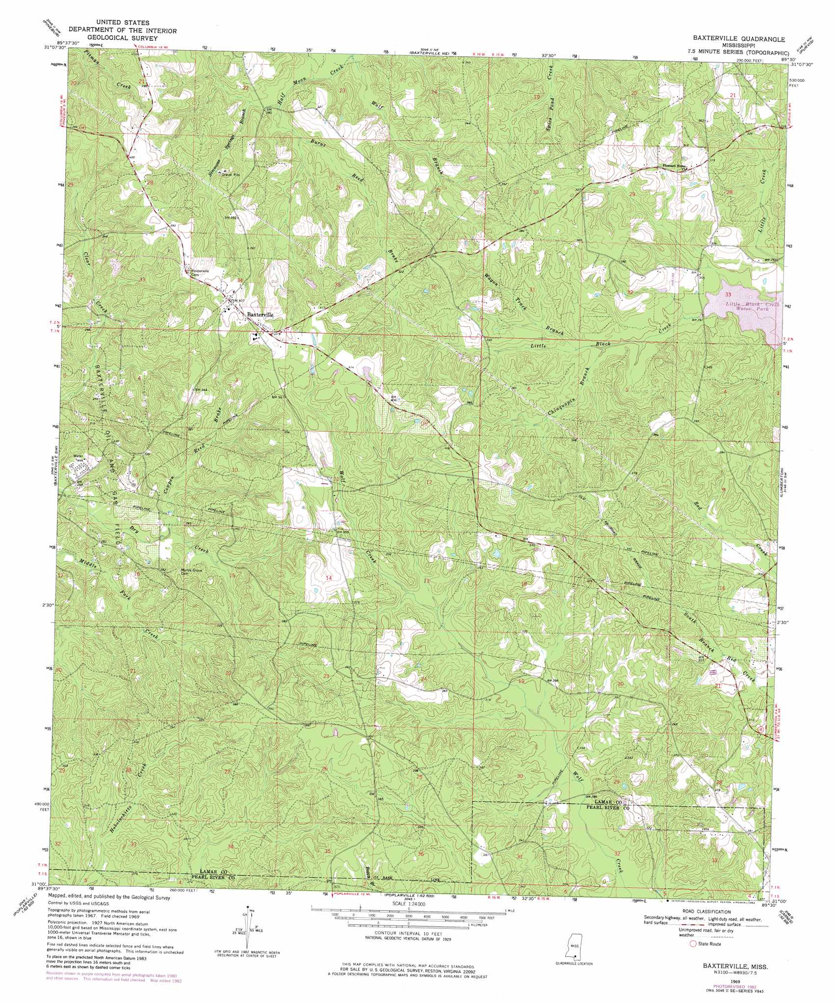
USGS Topo Quad 31089a5 - 1:24,000 scale
| Topo Map Name: | Baxterville |
| USGS Topo Quad ID: | 31089a5 |
| Print Size: | ca. 21 1/4" wide x 27" high |
| Southeast Coordinates: | 31° N latitude / 89.5° W longitude |
| Map Center Coordinates: | 31.0625° N latitude / 89.5625° W longitude |
| U.S. State: | MS |
| Filename: | o31089a5.jpg |
| Download Map JPG Image: | Baxterville topo map 1:24,000 scale |
| Map Type: | Topographic |
| Topo Series: | 7.5´ |
| Map Scale: | 1:24,000 |
| Source of Map Images: | United States Geological Survey (USGS) |
| Alternate Map Versions: |
Baxterville MS 1969, updated 1971 Download PDF Buy paper map Baxterville MS 1969, updated 1982 Download PDF Buy paper map Baxterville MS 2012 Download PDF Buy paper map Baxterville MS 2015 Download PDF Buy paper map |
1:24,000 Topo Quads surrounding Baxterville
Columbia North |
Improve |
Oloh |
Hattiesburg Sw |
Hattiesburg |
Columbia South |
Pinebur |
Baxterville Ne |
Purvis |
Dixie |
Sandy Hook |
Baxterville Sw |
Baxterville |
Lumberton |
Rock Hill |
Angie |
Fords Creek |
Orvisburg |
Hillsdale |
Carnes |
Bogalusa East |
White Sand |
Poplarville |
Big Swamp |
Browns Lake |
> Back to 31089a1 at 1:100,000 scale
> Back to 31088a1 at 1:250,000 scale
> Back to U.S. Topo Maps home
Baxterville topo map: Gazetteer
Baxterville: Dams
Charlie Johnson Pond Dam elevation 122m 400′Baxterville: Populated Places
Baxterville elevation 125m 410′Fanning elevation 109m 357′
Baxterville: Streams
Burnt Reed Brake elevation 78m 255′Chinquapin Branch elevation 88m 288′
Cowpen Reed Brake elevation 76m 249′
Simmons Springs Branch elevation 84m 275′
Wagon Track Branch elevation 95m 311′
Baxterville digital topo map on disk
Buy this Baxterville topo map showing relief, roads, GPS coordinates and other geographical features, as a high-resolution digital map file on DVD:
Gulf Coast (LA, MS, AL, FL) & Southwestern Georgia
Buy digital topo maps: Gulf Coast (LA, MS, AL, FL) & Southwestern Georgia
 & Southwestern Georgia map DVD")