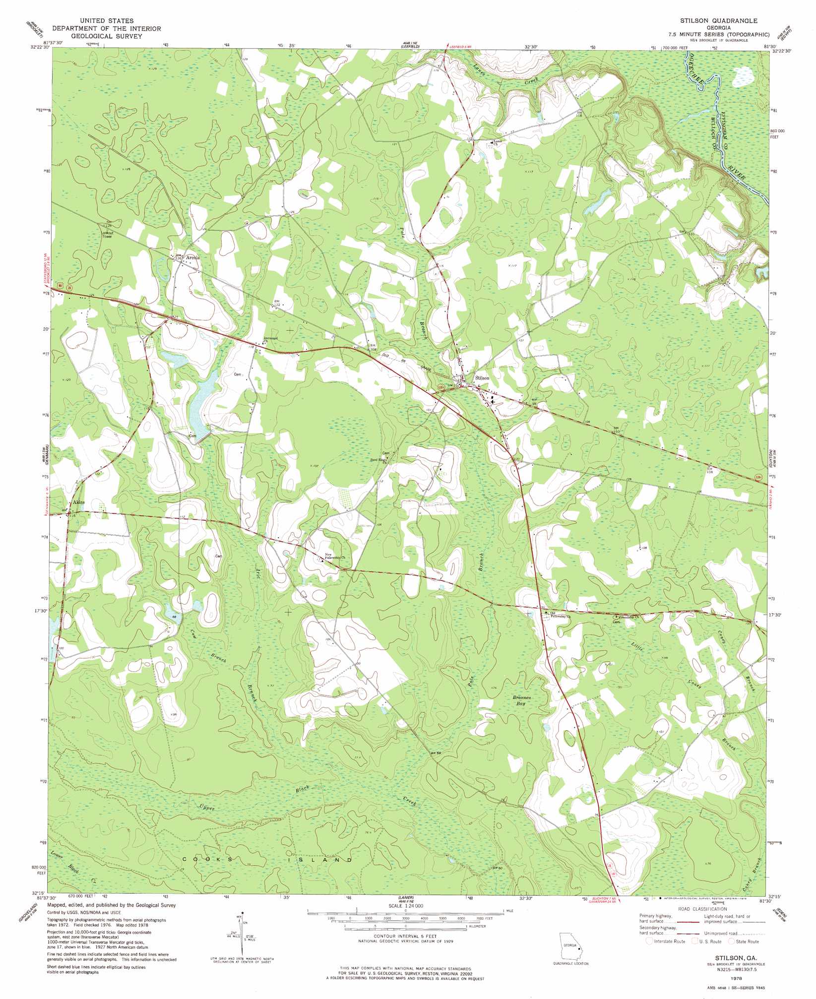
Stilson Topo Map Georgia
To zoom in, hover over the map of Stilson
USGS Topo Quad 32081c5 - 1:24,000 scale
| Topo Map Name: | Stilson |
| USGS Topo Quad ID: | 32081c5 |
| Print Size: | ca. 21 1/4" wide x 27" high |
| Southeast Coordinates: | 32.25° N latitude / 81.5° W longitude |
| Map Center Coordinates: | 32.3125° N latitude / 81.5625° W longitude |
| U.S. State: | GA |
| Filename: | o32081c5.jpg |
| Download Map JPG Image: | Stilson topo map 1:24,000 scale |
| Map Type: | Topographic |
| Topo Series: | 7.5´ |
| Map Scale: | 1:24,000 |
| Source of Map Images: | United States Geological Survey (USGS) |
| Alternate Map Versions: |
Stilson GA 1978, updated 1978 Download PDF Buy paper map Stilson GA 2011 Download PDF Buy paper map Stilson GA 2014 Download PDF Buy paper map |
1:24,000 Topo Quads surrounding Stilson
Hopeulikit |
Dover |
Oliver |
Kildare |
Brighton |
Statesboro |
Brooklet |
Leefield |
Egypt |
Springfield North |
Nevils |
Denmark |
Stilson |
Guyton |
Springfield South |
Daisy |
Groveland |
Lanier |
Eden |
Meldrim |
Glissons Millpond |
Willie |
Letford |
Meldrim Sw |
Meldrim Se |
> Back to 32081a1 at 1:100,000 scale
> Back to 32080a1 at 1:250,000 scale
> Back to U.S. Topo Maps home
Stilson topo map: Gazetteer
Stilson: Bays
Brannen Bay elevation 22m 72′Stilson: Bridges
Flat Ford Bridge (historical) elevation 15m 49′Stilson: Crossings
Lower Dugger Ford elevation 17m 55′Upper Dugger Ford elevation 20m 65′
Stilson: Dams
Kendrick Pond Dam elevation 28m 91′Lester Pond Dam elevation 34m 111′
Rozier Pond Dam elevation 30m 98′
Stilson: Islands
Cooks Island elevation 22m 72′Stilson: Populated Places
Akins elevation 35m 114′Arcola elevation 38m 124′
Stilson elevation 31m 101′
Stilson: Reservoirs
Kendrick Pond elevation 28m 91′Lester Pond elevation 34m 111′
Rozier Pond elevation 30m 98′
Stilson: Streams
Cow Branch elevation 22m 72′Iric Branch elevation 19m 62′
Little Caney Branch elevation 22m 72′
Pole Branch elevation 19m 62′
Stilson digital topo map on disk
Buy this Stilson topo map showing relief, roads, GPS coordinates and other geographical features, as a high-resolution digital map file on DVD:
South Carolina, Western North Carolina & Northeastern Georgia
Buy digital topo maps: South Carolina, Western North Carolina & Northeastern Georgia