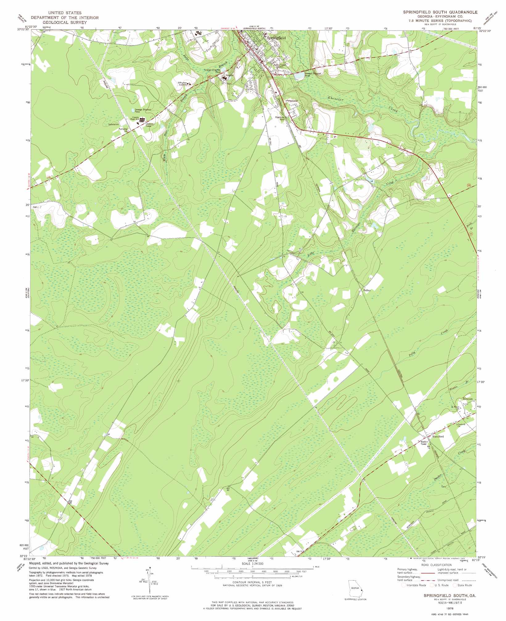
Springfield South Topo Map Georgia
To zoom in, hover over the map of Springfield South
USGS Topo Quad 32081c3 - 1:24,000 scale
| Topo Map Name: | Springfield South |
| USGS Topo Quad ID: | 32081c3 |
| Print Size: | ca. 21 1/4" wide x 27" high |
| Southeast Coordinates: | 32.25° N latitude / 81.25° W longitude |
| Map Center Coordinates: | 32.3125° N latitude / 81.3125° W longitude |
| U.S. State: | GA |
| Filename: | o32081c3.jpg |
| Download Map JPG Image: | Springfield South topo map 1:24,000 scale |
| Map Type: | Topographic |
| Topo Series: | 7.5´ |
| Map Scale: | 1:24,000 |
| Source of Map Images: | United States Geological Survey (USGS) |
| Alternate Map Versions: |
Springfield South GA 1978, updated 1978 Download PDF Buy paper map Springfield South GA 2011 Download PDF Buy paper map Springfield South GA 2014 Download PDF Buy paper map |
1:24,000 Topo Quads surrounding Springfield South
Oliver |
Kildare |
Brighton |
Pineland |
Calfpen Bay |
Leefield |
Egypt |
Springfield North |
Hardeeville Nw |
Tillman |
Stilson |
Guyton |
Springfield South |
Rincon |
Hardeeville |
Lanier |
Eden |
Meldrim |
Port Wentworth |
Limehouse |
Letford |
Meldrim Sw |
Meldrim Se |
Garden City |
Savannah |
> Back to 32081a1 at 1:100,000 scale
> Back to 32080a1 at 1:250,000 scale
> Back to U.S. Topo Maps home
Springfield South topo map: Gazetteer
Springfield South: Airports
Effingham County Hospital Heliport elevation 28m 91′Springfield South: Populated Places
Blandford elevation 23m 75′Rahns elevation 21m 68′
Spring Branch elevation 27m 88′
Springfield elevation 24m 78′
Springfield South: Post Offices
Springfield Post Office elevation 23m 75′Springfield South: Streams
Jacks Branch elevation 6m 19′Little Ebenezer Creek elevation 4m 13′
White Deer Branch elevation 15m 49′
Springfield South digital topo map on disk
Buy this Springfield South topo map showing relief, roads, GPS coordinates and other geographical features, as a high-resolution digital map file on DVD:
South Carolina, Western North Carolina & Northeastern Georgia
Buy digital topo maps: South Carolina, Western North Carolina & Northeastern Georgia