Red Lake Se Topo Map New Mexico
To zoom in, hover over the map of Red Lake Se
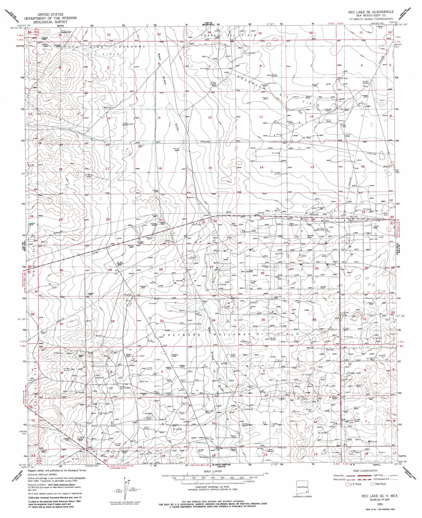
USGS Topo Quad 32104g1 - 1:24,000 scale
| Topo Map Name: | Red Lake Se |
| USGS Topo Quad ID: | 32104g1 |
| Print Size: | ca. 21 1/4" wide x 27" high |
| Southeast Coordinates: | 32.75° N latitude / 104° W longitude |
| Map Center Coordinates: | 32.8125° N latitude / 104.0625° W longitude |
| U.S. State: | NM |
| Filename: | o32104g1.jpg |
| Download Map JPG Image: | Red Lake Se topo map 1:24,000 scale |
| Map Type: | Topographic |
| Topo Series: | 7.5´ |
| Map Scale: | 1:24,000 |
| Source of Map Images: | United States Geological Survey (USGS) |
| Alternate Map Versions: |
Red Lake SE NM 1955, updated 1956 Download PDF Buy paper map Red Lake SE NM 1955, updated 1986 Download PDF Buy paper map Red Lake SE NM 2010 Download PDF Buy paper map Red Lake SE NM 2013 Download PDF Buy paper map Red Lake SE NM 2017 Download PDF Buy paper map |
1:24,000 Topo Quads surrounding Red Lake Se
Hagerman |
Derrick Draw |
King Camp |
Cedar Point |
Cedar Point Se |
Artesia Ne |
Diamond Mound |
Basin Well |
Henshaw Tank |
Maljamar Ne |
Spring Lake |
Red Lake |
Red Lake Se |
Loco Hills |
Maljamar |
Lake Mcmillan North |
Illinois Camp |
Illinois Camp Ne |
Hackberry Lake |
Greenwood Lake |
Lake Mcmillan South |
Angel Draw |
Illinois Camp Se |
Tower Hill North |
Williams Sink |
> Back to 32104e1 at 1:100,000 scale
> Back to 32104a1 at 1:250,000 scale
> Back to U.S. Topo Maps home
Red Lake Se topo map: Gazetteer
Red Lake Se: Oilfields
Anderson Oil Field elevation 1114m 3654′Forrest Oil Field elevation 1109m 3638′
Greybug Maljamar Oil Field elevation 1079m 3540′
Greyburg Maljamar Oil Field elevation 1076m 3530′
South High Lonesome Oil Field elevation 1106m 3628′
Red Lake Se: Valleys
Bear Grass Draw elevation 1057m 3467′Red Lake Se digital topo map on disk
Buy this Red Lake Se topo map showing relief, roads, GPS coordinates and other geographical features, as a high-resolution digital map file on DVD: