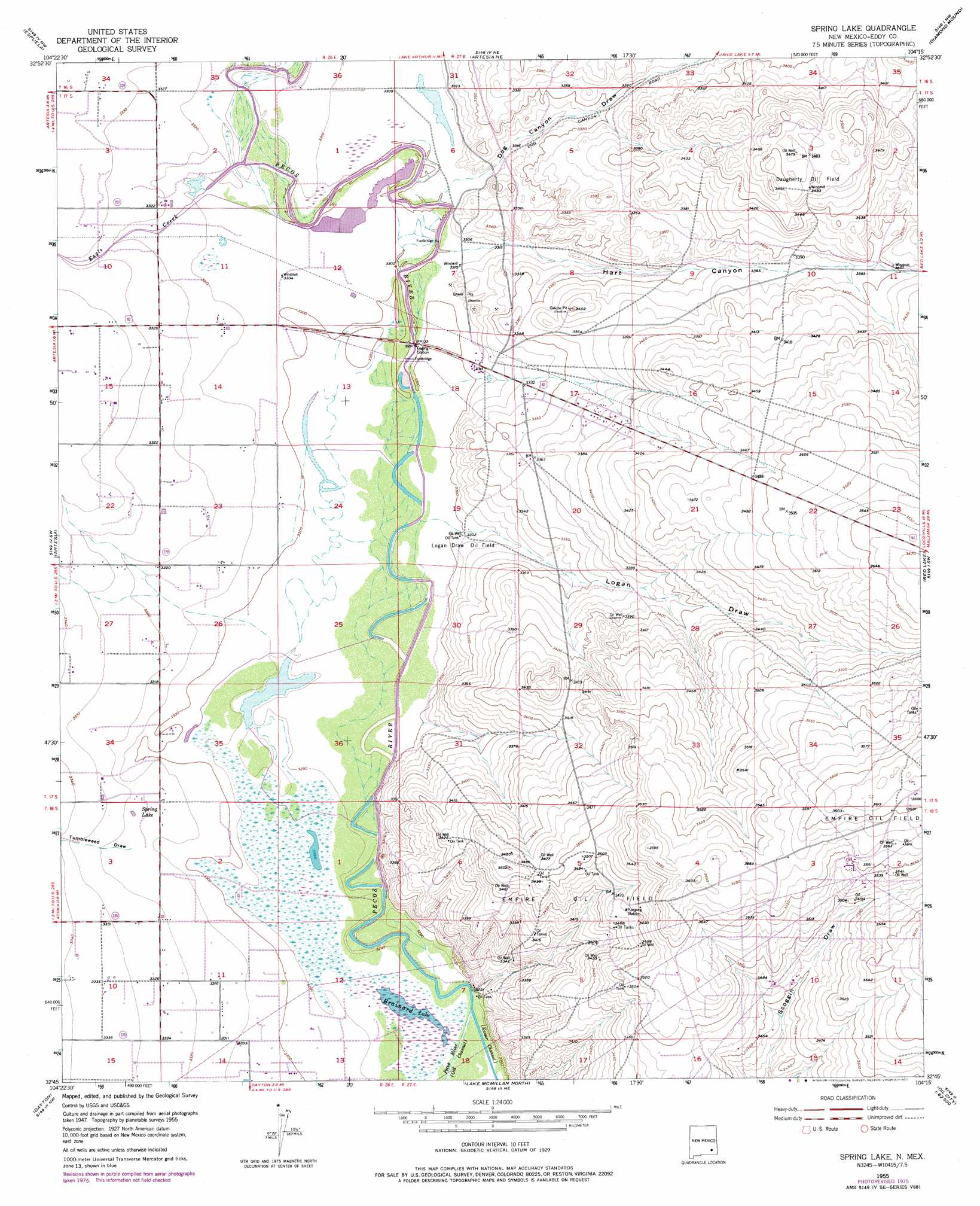
Spring Lake Topo Map New Mexico
To zoom in, hover over the map of Spring Lake
USGS Topo Quad 32104g3 - 1:24,000 scale
| Topo Map Name: | Spring Lake |
| USGS Topo Quad ID: | 32104g3 |
| Print Size: | ca. 21 1/4" wide x 27" high |
| Southeast Coordinates: | 32.75° N latitude / 104.25° W longitude |
| Map Center Coordinates: | 32.8125° N latitude / 104.3125° W longitude |
| U.S. State: | NM |
| Filename: | o32104g3.jpg |
| Download Map JPG Image: | Spring Lake topo map 1:24,000 scale |
| Map Type: | Topographic |
| Topo Series: | 7.5´ |
| Map Scale: | 1:24,000 |
| Source of Map Images: | United States Geological Survey (USGS) |
| Alternate Map Versions: |
Spring Lake NM 1955, updated 1956 Download PDF Buy paper map Spring Lake NM 1955, updated 1974 Download PDF Buy paper map Spring Lake NM 1955, updated 1977 Download PDF Buy paper map Spring Lake NM 2010 Download PDF Buy paper map Spring Lake NM 2013 Download PDF Buy paper map Spring Lake NM 2017 Download PDF Buy paper map |
1:24,000 Topo Quads surrounding Spring Lake
Hackberry Ranch |
Hagerman Sw |
Hagerman |
Derrick Draw |
King Camp |
Hope Ne |
Espuela |
Artesia Ne |
Diamond Mound |
Basin Well |
Hope Se |
Artesia |
Spring Lake |
Red Lake |
Red Lake Se |
Parish Ranch |
Dayton |
Lake Mcmillan North |
Illinois Camp |
Illinois Camp Ne |
Foster Ranch |
Seven Rivers |
Lake Mcmillan South |
Angel Draw |
Illinois Camp Se |
> Back to 32104e1 at 1:100,000 scale
> Back to 32104a1 at 1:250,000 scale
> Back to U.S. Topo Maps home
Spring Lake topo map: Gazetteer
Spring Lake: Lakes
Brainard Lake elevation 1002m 3287′Spring Lake elevation 1012m 3320′
Spring Lake: Mines
Empire ABO Sulphur Plant elevation 1089m 3572′Spring Lake: Oilfields
Daugherty Oil Field elevation 1063m 3487′Logan Draw Oil Field elevation 1007m 3303′
Spring Lake: Populated Places
Riverside elevation 1051m 3448′Spring Lake: Streams
Eagle Creek elevation 1009m 3310′Spring Lake: Valleys
Dog Canyon Draw elevation 1006m 3300′Hart Canyon elevation 1006m 3300′
Logan Draw elevation 1004m 3293′
Tumbleweed Draw elevation 1006m 3300′
Spring Lake digital topo map on disk
Buy this Spring Lake topo map showing relief, roads, GPS coordinates and other geographical features, as a high-resolution digital map file on DVD: