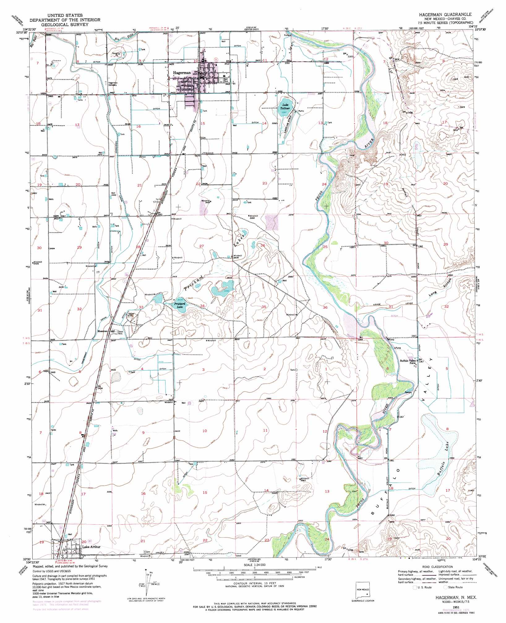
Hagerman Topo Map New Mexico
To zoom in, hover over the map of Hagerman
USGS Topo Quad 33104a3 - 1:24,000 scale
| Topo Map Name: | Hagerman |
| USGS Topo Quad ID: | 33104a3 |
| Print Size: | ca. 21 1/4" wide x 27" high |
| Southeast Coordinates: | 33° N latitude / 104.25° W longitude |
| Map Center Coordinates: | 33.0625° N latitude / 104.3125° W longitude |
| U.S. State: | NM |
| Filename: | o33104a3.jpg |
| Download Map JPG Image: | Hagerman topo map 1:24,000 scale |
| Map Type: | Topographic |
| Topo Series: | 7.5´ |
| Map Scale: | 1:24,000 |
| Source of Map Images: | United States Geological Survey (USGS) |
| Alternate Map Versions: |
Hagerman NM 1951, updated 1953 Download PDF Buy paper map Hagerman NM 1951, updated 1978 Download PDF Buy paper map Hagerman NM 2010 Download PDF Buy paper map Hagerman NM 2013 Download PDF Buy paper map Hagerman NM 2017 Download PDF Buy paper map |
1:24,000 Topo Quads surrounding Hagerman
Roswell South |
South Spring |
Bottomless Lakes |
Wade Ranch |
Malstrom Ranch |
Peters Lake |
Dexter West |
Dexter East |
Bar C Bar Ranch |
Conner Well |
Hackberry Ranch |
Hagerman Sw |
Hagerman |
Derrick Draw |
King Camp |
Hope Ne |
Espuela |
Artesia Ne |
Diamond Mound |
Basin Well |
Hope Se |
Artesia |
Spring Lake |
Red Lake |
Red Lake Se |
> Back to 33104a1 at 1:100,000 scale
> Back to 33104a1 at 1:250,000 scale
> Back to U.S. Topo Maps home
Hagerman topo map: Gazetteer
Hagerman: Bridges
Rio Feliz Bridge elevation 1043m 3421′Hagerman: Lakes
Buffalo Lake elevation 1024m 3359′Lake Tolliver elevation 1033m 3389′
Prichard Lake elevation 1039m 3408′
Prichard Lakes elevation 1037m 3402′
Hagerman: Populated Places
Hagerman elevation 1043m 3421′Mossman elevation 1052m 3451′
Hagerman: Post Offices
Hagerman Post Office elevation 1043m 3421′Hagerman: Reservoirs
Lake Arthur elevation 1034m 3392′Hagerman: Streams
Long Arroyo elevation 1025m 3362′Hagerman: Valleys
Buffalo Valley elevation 1022m 3353′Hagerman digital topo map on disk
Buy this Hagerman topo map showing relief, roads, GPS coordinates and other geographical features, as a high-resolution digital map file on DVD: