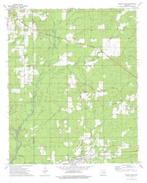
Wilmar North Topo Map Arkansas
To zoom in, hover over the map of Wilmar North
USGS Topo Quad 33091f8 - 1:24,000 scale
| Topo Map Name: | Wilmar North |
| USGS Topo Quad ID: | 33091f8 |
| Print Size: | ca. 21 1/4" wide x 27" high |
| Southeast Coordinates: | 33.625° N latitude / 91.875° W longitude |
| Map Center Coordinates: | 33.6875° N latitude / 91.9375° W longitude |
| U.S. State: | AR |
| Filename: | o33091f8.jpg |
| Download Map JPG Image: | Wilmar North topo map 1:24,000 scale |
| Map Type: | Topographic |
| Topo Series: | 7.5´ |
| Map Scale: | 1:24,000 |
| Source of Map Images: | United States Geological Survey (USGS) |
| Alternate Map Versions: |
Wilmar North AR 1973, updated 1975 Download PDF Buy paper map Wilmar North AR 2011 Download PDF Buy paper map Wilmar North AR 2014 Download PDF Buy paper map |
1:24,000 Topo Quads surrounding Wilmar North
> Back to 33091e1 at 1:100,000 scale
> Back to 33090a1 at 1:250,000 scale
> Back to U.S. Topo Maps home
Wilmar North topo map: Gazetteer
Wilmar North: Crossings
Bradley Ford elevation 33m 108′Wilmar North: Dams
Hopper Pond Dam elevation 48m 157′Marsh Lake Dam elevation 43m 141′
Wilmar North: Populated Places
Allis elevation 61m 200′Barkada elevation 68m 223′
Brandon elevation 52m 170′
Rye elevation 55m 180′
Wilmar elevation 46m 150′
Wilmar North: Reservoirs
Hopper Pond elevation 48m 157′Marsh Lake elevation 43m 141′
Wilmar North: Streams
Franklin Creek elevation 31m 101′Handly Creek elevation 41m 134′
Hudgens Creek elevation 33m 108′
Hungry Run Creek elevation 40m 131′
Langford Creek elevation 31m 101′
Sevenmile Creek elevation 44m 144′
Wilmar North digital topo map on disk
Buy this Wilmar North topo map showing relief, roads, GPS coordinates and other geographical features, as a high-resolution digital map file on DVD:


