Glendale Topo Map Arkansas
To zoom in, hover over the map of Glendale
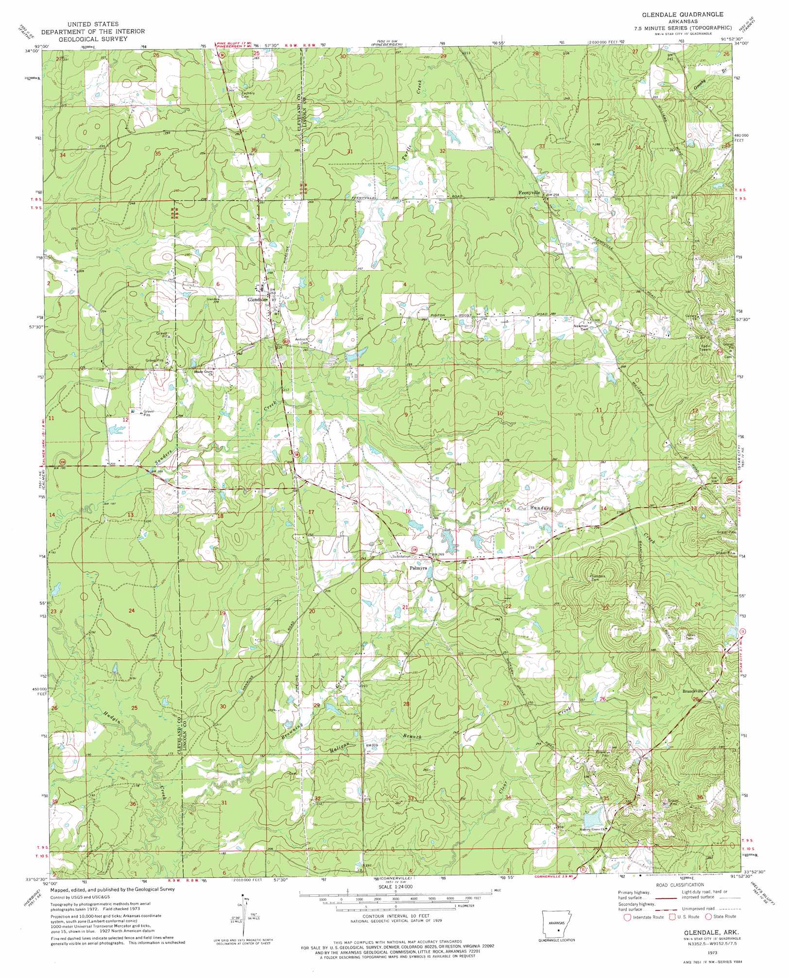
USGS Topo Quad 33091h8 - 1:24,000 scale
| Topo Map Name: | Glendale |
| USGS Topo Quad ID: | 33091h8 |
| Print Size: | ca. 21 1/4" wide x 27" high |
| Southeast Coordinates: | 33.875° N latitude / 91.875° W longitude |
| Map Center Coordinates: | 33.9375° N latitude / 91.9375° W longitude |
| U.S. State: | AR |
| Filename: | o33091h8.jpg |
| Download Map JPG Image: | Glendale topo map 1:24,000 scale |
| Map Type: | Topographic |
| Topo Series: | 7.5´ |
| Map Scale: | 1:24,000 |
| Source of Map Images: | United States Geological Survey (USGS) |
| Alternate Map Versions: |
Glendale AR 1973, updated 1975 Download PDF Buy paper map Glendale AR 2011 Download PDF Buy paper map Glendale AR 2014 Download PDF Buy paper map |
1:24,000 Topo Quads surrounding Glendale
Pine Bluff Nw |
Pine Bluff |
Ladd |
Moscow |
Cornerstone |
Kedron |
Faith |
Pinebergen |
Tarry |
Grady |
Rison |
Calmer |
Glendale |
Star City |
Avery |
New Edinburg |
Herbine |
Cornerville |
Relfs Bluff |
Tyro |
Mckinney |
Warren Ne |
Wilmar North |
Monticello North |
Collins Nw |
> Back to 33091e1 at 1:100,000 scale
> Back to 33090a1 at 1:250,000 scale
> Back to U.S. Topo Maps home
Glendale topo map: Gazetteer
Glendale: Dams
Capps Lake Dam elevation 72m 236′Glover Lake Dam elevation 82m 269′
Patocca Upper Lake Dam elevation 95m 311′
Glendale: Populated Places
Branchville elevation 94m 308′Feenyville elevation 78m 255′
Glendale elevation 81m 265′
Palmyra elevation 77m 252′
Rest (historical) elevation 83m 272′
Glendale: Reservoirs
Capps Lake elevation 72m 236′Glover Lake elevation 82m 269′
Patocca Upper Lake elevation 95m 311′
Glendale: Streams
Haligan Branch elevation 57m 187′Glendale digital topo map on disk
Buy this Glendale topo map showing relief, roads, GPS coordinates and other geographical features, as a high-resolution digital map file on DVD: