Cooper North Topo Map Texas
To zoom in, hover over the map of Cooper North
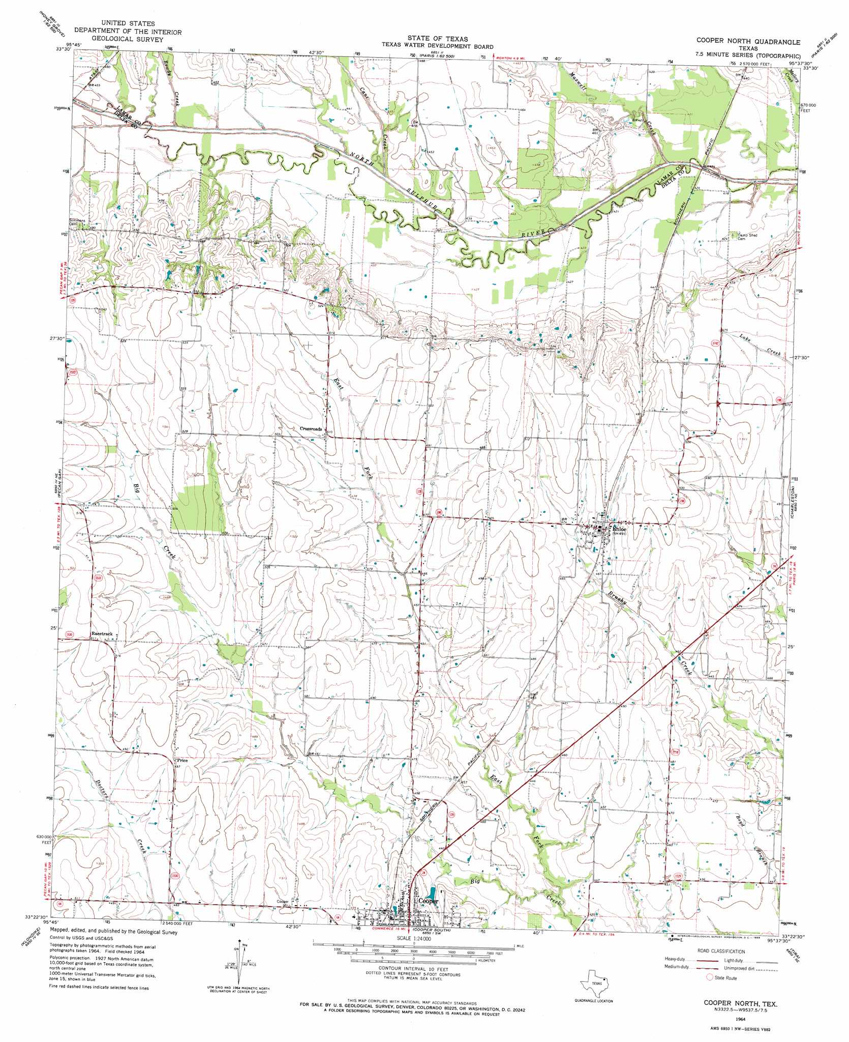
USGS Topo Quad 33095d6 - 1:24,000 scale
| Topo Map Name: | Cooper North |
| USGS Topo Quad ID: | 33095d6 |
| Print Size: | ca. 21 1/4" wide x 27" high |
| Southeast Coordinates: | 33.375° N latitude / 95.625° W longitude |
| Map Center Coordinates: | 33.4375° N latitude / 95.6875° W longitude |
| U.S. State: | TX |
| Filename: | o33095d6.jpg |
| Download Map JPG Image: | Cooper North topo map 1:24,000 scale |
| Map Type: | Topographic |
| Topo Series: | 7.5´ |
| Map Scale: | 1:24,000 |
| Source of Map Images: | United States Geological Survey (USGS) |
| Alternate Map Versions: |
Cooper North TX 1964, updated 1968 Download PDF Buy paper map Cooper North TX 2010 Download PDF Buy paper map Cooper North TX 2013 Download PDF Buy paper map Cooper North TX 2016 Download PDF Buy paper map |
1:24,000 Topo Quads surrounding Cooper North
Selfs |
Tigertown |
Toco |
Paris |
Blossom |
Honey Grove |
Petty |
Roxton |
Biardstown |
Pattonville |
Ladonia |
Pecan Gap |
Cooper North |
Charleston |
Minter |
Commerce North |
Klondike |
Cooper South |
Tira |
Sulphur Bluff |
Commerce South |
Cumby |
Gafford Chapel |
Sulphur Springs |
Dike |
> Back to 33095a1 at 1:100,000 scale
> Back to 33094a1 at 1:250,000 scale
> Back to U.S. Topo Maps home
Cooper North topo map: Gazetteer
Cooper North: Populated Places
Crossroads elevation 156m 511′Enloe elevation 151m 495′
Price elevation 151m 495′
Cooper North: Streams
Cane Creek elevation 133m 436′East Fork Big Creek elevation 125m 410′
Maxwell Creek elevation 125m 410′
Rowdy Creek elevation 132m 433′
Cooper North digital topo map on disk
Buy this Cooper North topo map showing relief, roads, GPS coordinates and other geographical features, as a high-resolution digital map file on DVD: