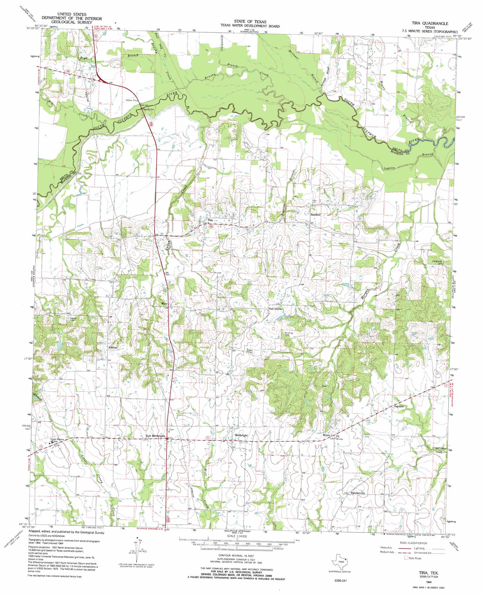
Tira Topo Map Texas
To zoom in, hover over the map of Tira
USGS Topo Quad 33095c5 - 1:24,000 scale
| Topo Map Name: | Tira |
| USGS Topo Quad ID: | 33095c5 |
| Print Size: | ca. 21 1/4" wide x 27" high |
| Southeast Coordinates: | 33.25° N latitude / 95.5° W longitude |
| Map Center Coordinates: | 33.3125° N latitude / 95.5625° W longitude |
| U.S. State: | TX |
| Filename: | o33095c5.jpg |
| Download Map JPG Image: | Tira topo map 1:24,000 scale |
| Map Type: | Topographic |
| Topo Series: | 7.5´ |
| Map Scale: | 1:24,000 |
| Source of Map Images: | United States Geological Survey (USGS) |
| Alternate Map Versions: |
Tira TX 1964, updated 1968 Download PDF Buy paper map Tira TX 1964, updated 1992 Download PDF Buy paper map Tira TX 2010 Download PDF Buy paper map Tira TX 2013 Download PDF Buy paper map Tira TX 2016 Download PDF Buy paper map |
1:24,000 Topo Quads surrounding Tira
Petty |
Roxton |
Biardstown |
Pattonville |
Deport |
Pecan Gap |
Cooper North |
Charleston |
Minter |
Cunningham |
Klondike |
Cooper South |
Tira |
Sulphur Bluff |
Mitchell Creek |
Cumby |
Gafford Chapel |
Sulphur Springs |
Dike |
Saltillo |
Miller Grove |
Brashear |
Sulphur Springs Se |
Como |
Purley |
> Back to 33095a1 at 1:100,000 scale
> Back to 33094a1 at 1:250,000 scale
> Back to U.S. Topo Maps home
Tira topo map: Gazetteer
Tira: Populated Places
Addran elevation 160m 524′Birthright elevation 155m 508′
Hatchetville elevation 156m 511′
New Birthright elevation 156m 511′
North Hopkins elevation 156m 511′
Oak Grove elevation 152m 498′
Oakdale elevation 147m 482′
Sandhill elevation 143m 469′
Shirley elevation 159m 521′
Tira elevation 143m 469′
Weir elevation 144m 472′
Tira: Streams
Acreage Slough elevation 114m 374′Big Creek elevation 116m 380′
Boyd Branch elevation 116m 380′
Brushy Creek elevation 117m 383′
Evans Branch elevation 107m 351′
Greenbrier Branch elevation 116m 380′
Logston Branch elevation 107m 351′
McGuyer Branch elevation 114m 374′
Post Oak Creek elevation 117m 383′
Vaden Creek elevation 112m 367′
Tira digital topo map on disk
Buy this Tira topo map showing relief, roads, GPS coordinates and other geographical features, as a high-resolution digital map file on DVD: