Minter Topo Map Texas
To zoom in, hover over the map of Minter
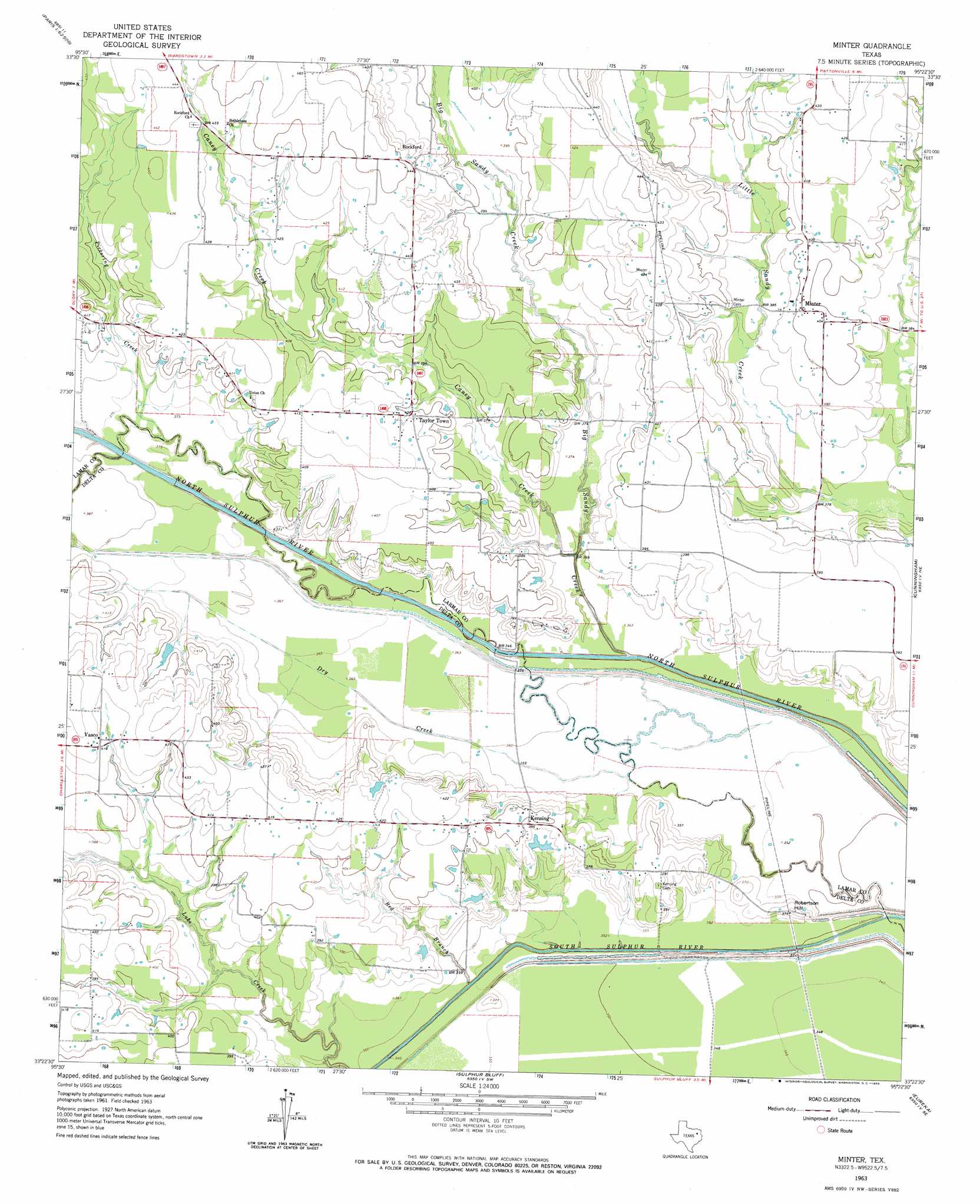
USGS Topo Quad 33095d4 - 1:24,000 scale
| Topo Map Name: | Minter |
| USGS Topo Quad ID: | 33095d4 |
| Print Size: | ca. 21 1/4" wide x 27" high |
| Southeast Coordinates: | 33.375° N latitude / 95.375° W longitude |
| Map Center Coordinates: | 33.4375° N latitude / 95.4375° W longitude |
| U.S. State: | TX |
| Filename: | o33095d4.jpg |
| Download Map JPG Image: | Minter topo map 1:24,000 scale |
| Map Type: | Topographic |
| Topo Series: | 7.5´ |
| Map Scale: | 1:24,000 |
| Source of Map Images: | United States Geological Survey (USGS) |
| Alternate Map Versions: |
Minter TX 1963, updated 1964 Download PDF Buy paper map Minter TX 2010 Download PDF Buy paper map Minter TX 2012 Download PDF Buy paper map Minter TX 2016 Download PDF Buy paper map |
1:24,000 Topo Quads surrounding Minter
Toco |
Paris |
Blossom |
Detroit |
Bagwell |
Roxton |
Biardstown |
Pattonville |
Deport |
Line Branch |
Cooper North |
Charleston |
Minter |
Cunningham |
Bogata |
Cooper South |
Tira |
Sulphur Bluff |
Mitchell Creek |
Hagansport |
Gafford Chapel |
Sulphur Springs |
Dike |
Saltillo |
Mount Vernon |
> Back to 33095a1 at 1:100,000 scale
> Back to 33094a1 at 1:250,000 scale
> Back to U.S. Topo Maps home
Minter topo map: Gazetteer
Minter: Dams
Bozman Dam elevation 118m 387′Minter: Populated Places
Kensing elevation 121m 396′Minter elevation 123m 403′
Rock Ford elevation 134m 439′
Taylortown elevation 124m 406′
Vasco elevation 128m 419′
Minter: Reservoirs
Bozman Lake elevation 118m 387′Minter: Streams
Big Sandy Creek elevation 104m 341′Caney Creek elevation 106m 347′
Dry Creek elevation 105m 344′
Pickering Creek elevation 105m 344′
Red Branch elevation 107m 351′
Minter: Summits
Robertson Hill elevation 116m 380′Minter digital topo map on disk
Buy this Minter topo map showing relief, roads, GPS coordinates and other geographical features, as a high-resolution digital map file on DVD: