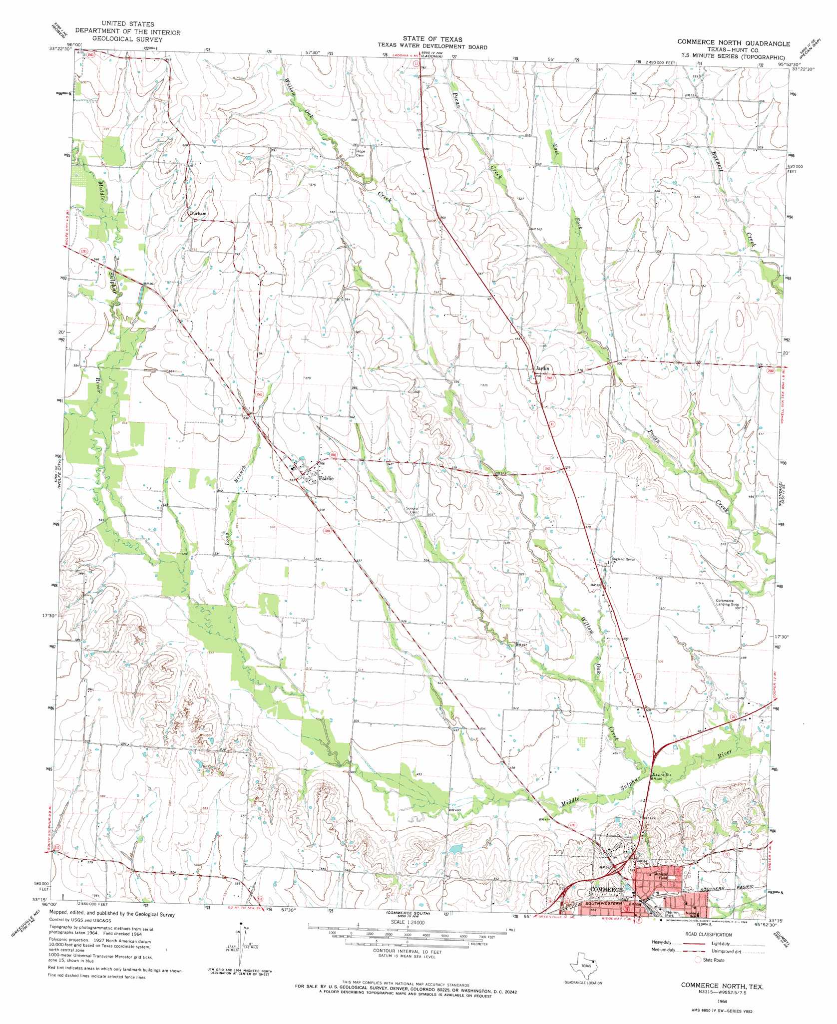
Commerce North Topo Map Texas
To zoom in, hover over the map of Commerce North
USGS Topo Quad 33095c8 - 1:24,000 scale
| Topo Map Name: | Commerce North |
| USGS Topo Quad ID: | 33095c8 |
| Print Size: | ca. 21 1/4" wide x 27" high |
| Southeast Coordinates: | 33.25° N latitude / 95.875° W longitude |
| Map Center Coordinates: | 33.3125° N latitude / 95.9375° W longitude |
| U.S. State: | TX |
| Filename: | o33095c8.jpg |
| Download Map JPG Image: | Commerce North topo map 1:24,000 scale |
| Map Type: | Topographic |
| Topo Series: | 7.5´ |
| Map Scale: | 1:24,000 |
| Source of Map Images: | United States Geological Survey (USGS) |
| Alternate Map Versions: |
Commerce North TX 1964, updated 1968 Download PDF Buy paper map Commerce North TX 2010 Download PDF Buy paper map Commerce North TX 2013 Download PDF Buy paper map Commerce North TX 2016 Download PDF Buy paper map |
1:24,000 Topo Quads surrounding Commerce North
Bonham |
Dodd City |
Honey Grove |
Petty |
Roxton |
Leonard |
Gober |
Ladonia |
Pecan Gap |
Cooper North |
Celeste |
Wolfe City |
Commerce North |
Klondike |
Cooper South |
Greenville Nw |
Greenville Ne |
Commerce South |
Cumby |
Gafford Chapel |
Greenville Sw |
Greenville Se |
Lone Oak North |
Miller Grove |
Brashear |
> Back to 33095a1 at 1:100,000 scale
> Back to 33094a1 at 1:250,000 scale
> Back to U.S. Topo Maps home
Commerce North topo map: Gazetteer
Commerce North: Airports
Commerce Municipal Airport elevation 155m 508′Commerce North: Parks
Lyndon Baines Johnson Park elevation 156m 511′Norris Park elevation 165m 541′
Commerce North: Populated Places
Durham elevation 181m 593′Fairlie elevation 169m 554′
Jardin elevation 165m 541′
Commerce North: Streams
East Fork Pecan Creek elevation 153m 501′Long Branch elevation 155m 508′
Willow Oak Creek elevation 143m 469′
Commerce North digital topo map on disk
Buy this Commerce North topo map showing relief, roads, GPS coordinates and other geographical features, as a high-resolution digital map file on DVD: