Deport Topo Map Texas
To zoom in, hover over the map of Deport
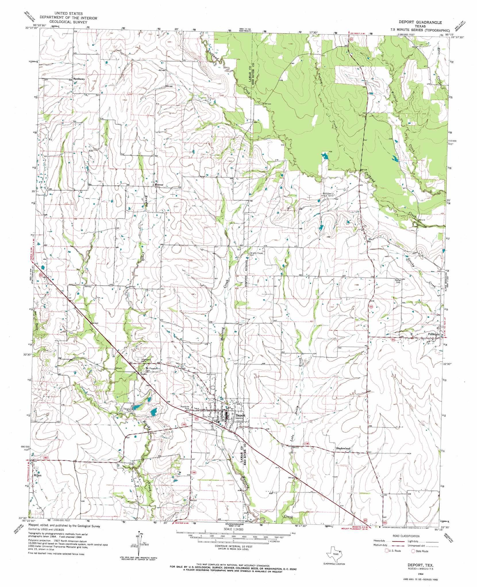
USGS Topo Quad 33095e3 - 1:24,000 scale
| Topo Map Name: | Deport |
| USGS Topo Quad ID: | 33095e3 |
| Print Size: | ca. 21 1/4" wide x 27" high |
| Southeast Coordinates: | 33.5° N latitude / 95.25° W longitude |
| Map Center Coordinates: | 33.5625° N latitude / 95.3125° W longitude |
| U.S. State: | TX |
| Filename: | o33095e3.jpg |
| Download Map JPG Image: | Deport topo map 1:24,000 scale |
| Map Type: | Topographic |
| Topo Series: | 7.5´ |
| Map Scale: | 1:24,000 |
| Source of Map Images: | United States Geological Survey (USGS) |
| Alternate Map Versions: |
Deport TX 1964, updated 1967 Download PDF Buy paper map Deport TX 2010 Download PDF Buy paper map Deport TX 2012 Download PDF Buy paper map Deport TX 2016 Download PDF Buy paper map |
1:24,000 Topo Quads surrounding Deport
Pat Mayse Lake East |
Slate Shoals |
Woodland |
Manchester |
Negley |
Paris |
Blossom |
Detroit |
Bagwell |
Dimple |
Biardstown |
Pattonville |
Deport |
Line Branch |
Clarksville |
Charleston |
Minter |
Cunningham |
Bogata |
Cuthand |
Tira |
Sulphur Bluff |
Mitchell Creek |
Hagansport |
Talco |
> Back to 33095e1 at 1:100,000 scale
> Back to 33094a1 at 1:250,000 scale
> Back to U.S. Topo Maps home
Deport topo map: Gazetteer
Deport: Dams
Old City Lake Dam elevation 128m 419′Soil Conservation Service Site 1 Dam elevation 129m 423′
Deport: Populated Places
Byrdtown elevation 164m 538′Deport elevation 126m 413′
Fulbright elevation 135m 442′
Hoover elevation 151m 495′
Milton elevation 128m 419′
Shadowland elevation 134m 439′
Deport: Reservoirs
Old City Lake elevation 128m 419′Soil Conservation Service Site 1 Reservoir elevation 129m 423′
Deport: Streams
Lake Drain Creek elevation 119m 390′Turkey Creek elevation 128m 419′
Deport digital topo map on disk
Buy this Deport topo map showing relief, roads, GPS coordinates and other geographical features, as a high-resolution digital map file on DVD: