Line Branch Topo Map Texas
To zoom in, hover over the map of Line Branch
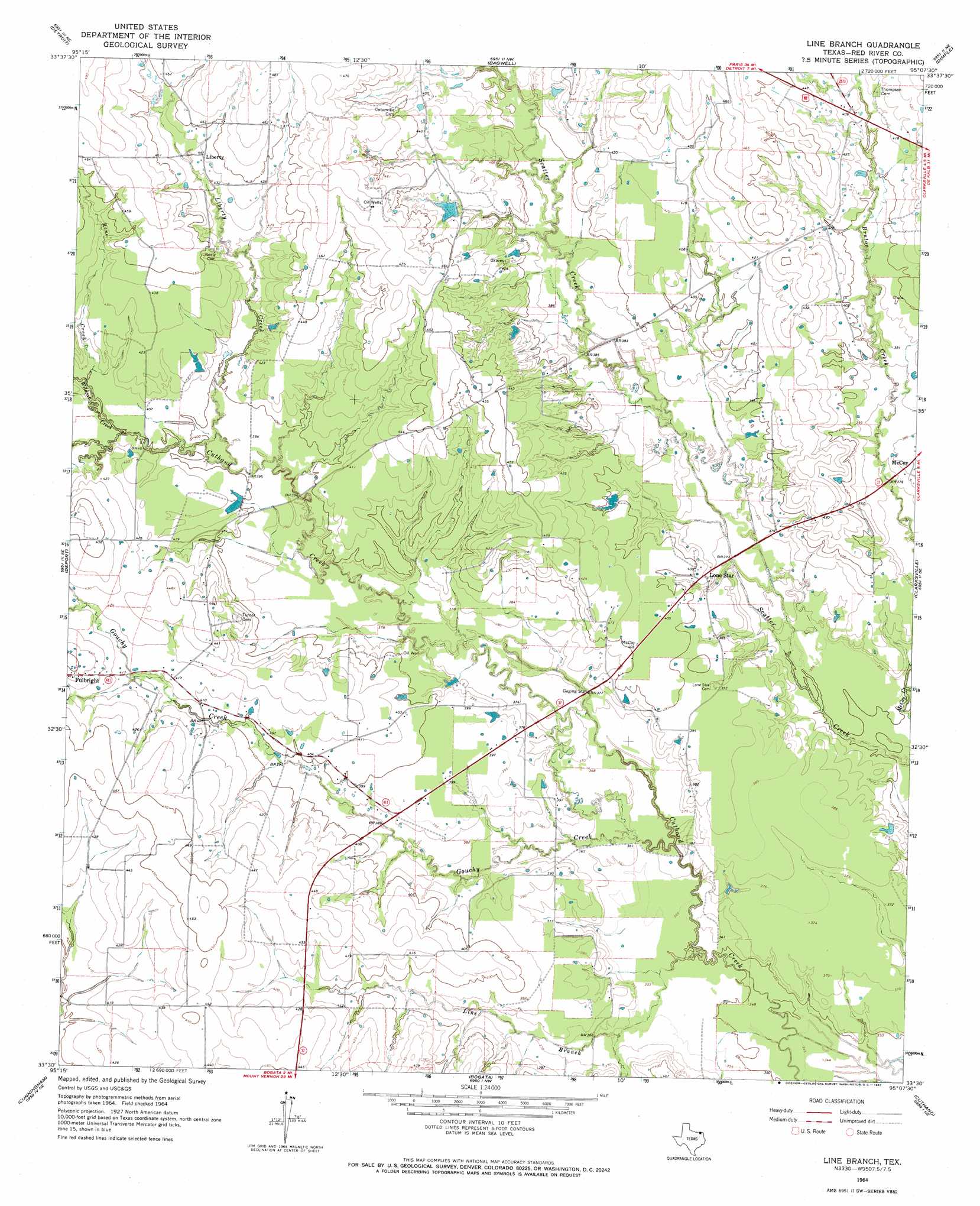
USGS Topo Quad 33095e2 - 1:24,000 scale
| Topo Map Name: | Line Branch |
| USGS Topo Quad ID: | 33095e2 |
| Print Size: | ca. 21 1/4" wide x 27" high |
| Southeast Coordinates: | 33.5° N latitude / 95.125° W longitude |
| Map Center Coordinates: | 33.5625° N latitude / 95.1875° W longitude |
| U.S. State: | TX |
| Filename: | o33095e2.jpg |
| Download Map JPG Image: | Line Branch topo map 1:24,000 scale |
| Map Type: | Topographic |
| Topo Series: | 7.5´ |
| Map Scale: | 1:24,000 |
| Source of Map Images: | United States Geological Survey (USGS) |
| Alternate Map Versions: |
Line Branch TX 1964, updated 1967 Download PDF Buy paper map Line Branch TX 2010 Download PDF Buy paper map Line Branch TX 2012 Download PDF Buy paper map Line Branch TX 2016 Download PDF Buy paper map |
1:24,000 Topo Quads surrounding Line Branch
Slate Shoals |
Woodland |
Manchester |
Negley |
Acworth |
Blossom |
Detroit |
Bagwell |
Dimple |
White Rock |
Pattonville |
Deport |
Line Branch |
Clarksville |
Annona |
Minter |
Cunningham |
Bogata |
Cuthand |
Boxelder |
Sulphur Bluff |
Mitchell Creek |
Hagansport |
Talco |
Wilkinson |
> Back to 33095e1 at 1:100,000 scale
> Back to 33094a1 at 1:250,000 scale
> Back to U.S. Topo Maps home
Line Branch topo map: Gazetteer
Line Branch: Dams
Dearborn Lake Dam elevation 128m 419′Jan-Kay Lake Dam elevation 128m 419′
Line Branch: Populated Places
Liberty elevation 134m 439′Lone Star elevation 119m 390′
McCoy elevation 118m 387′
Line Branch: Reservoirs
Deanborn Lake elevation 128m 419′Jan-Kay Lake elevation 128m 419′
Line Branch: Streams
Gouchy Creek elevation 107m 351′Liberty Creek elevation 119m 390′
Line Branch elevation 107m 351′
Reno Creek elevation 122m 400′
Wildcat Creek elevation 122m 400′
Line Branch digital topo map on disk
Buy this Line Branch topo map showing relief, roads, GPS coordinates and other geographical features, as a high-resolution digital map file on DVD: