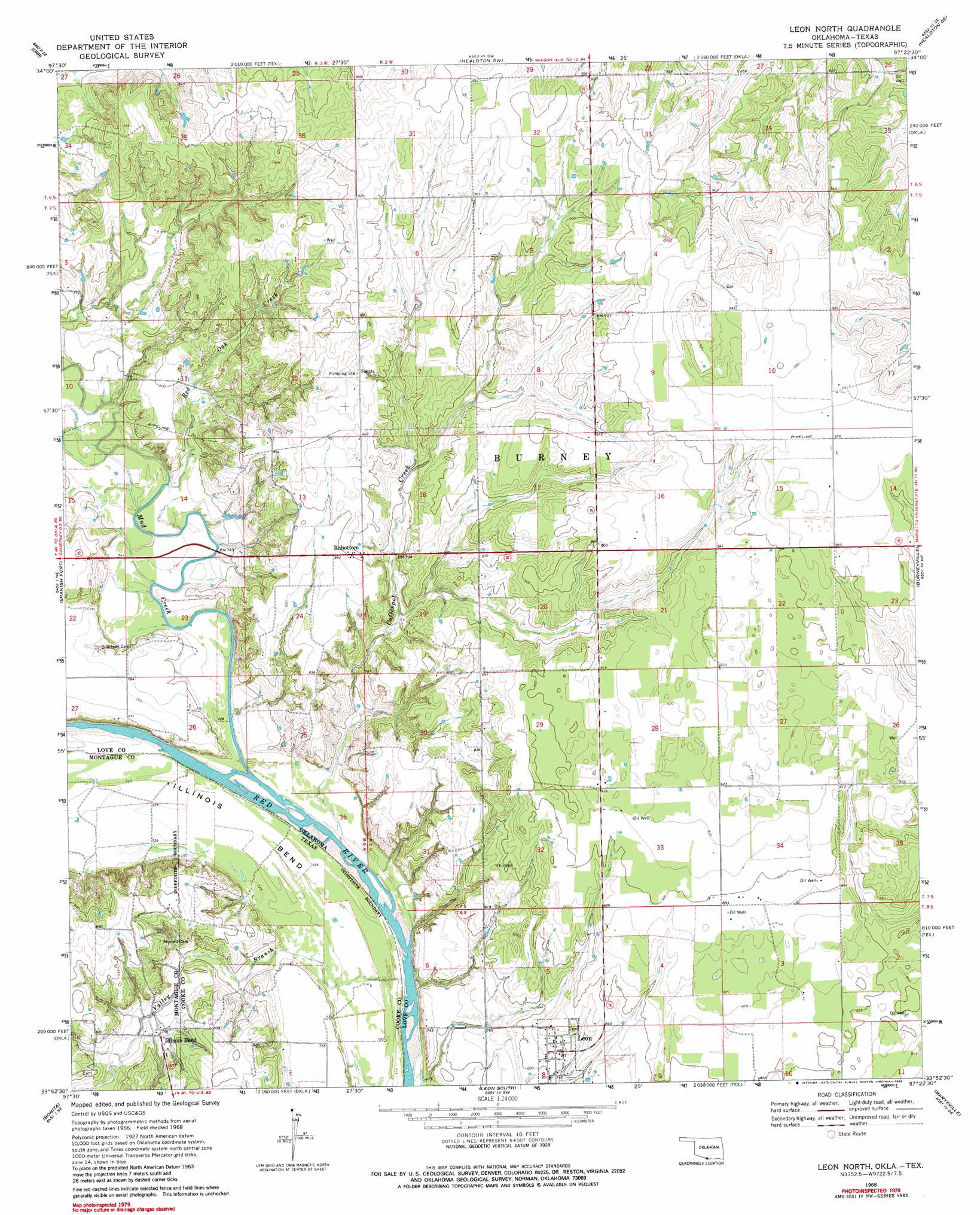
Leon North Topo Map Oklahoma
To zoom in, hover over the map of Leon North
USGS Topo Quad 33097h4 - 1:24,000 scale
| Topo Map Name: | Leon North |
| USGS Topo Quad ID: | 33097h4 |
| Print Size: | ca. 21 1/4" wide x 27" high |
| Southeast Coordinates: | 33.875° N latitude / 97.375° W longitude |
| Map Center Coordinates: | 33.9375° N latitude / 97.4375° W longitude |
| U.S. States: | OK, TX |
| Filename: | o33097h4.jpg |
| Download Map JPG Image: | Leon North topo map 1:24,000 scale |
| Map Type: | Topographic |
| Topo Series: | 7.5´ |
| Map Scale: | 1:24,000 |
| Source of Map Images: | United States Geological Survey (USGS) |
| Alternate Map Versions: |
Leon North OK 1968, updated 1971 Download PDF Buy paper map Leon North OK 1968, updated 1983 Download PDF Buy paper map Leon North OK 2010 Download PDF Buy paper map Leon North OK 2012 Download PDF Buy paper map Leon North OK 2016 Download PDF Buy paper map |
1:24,000 Topo Quads surrounding Leon North
Ringling Nw |
Ringling |
Healdton |
Lone Grove |
Ardmore West |
Grady |
Orr |
Healdton Sw |
Healdton Se |
Overbrook |
Prairie Valley School |
Spanish Fort |
Leon North |
Burneyville |
Marietta West |
Nocona |
Bonita |
Leon South |
Marysville |
Thackerville |
Montague |
Saint Jo |
Muenster West |
Muenster East |
Gainesville North |
> Back to 33097e1 at 1:100,000 scale
> Back to 33096a1 at 1:250,000 scale
> Back to U.S. Topo Maps home
Leon North topo map: Gazetteer
Leon North: Bends
Illinois Bend elevation 220m 721′Leon North: Dams
James Dula Pond 6 Dam elevation 240m 787′Leon North: Populated Places
Illinois Bend elevation 237m 777′Leon elevation 249m 816′
Rubottom elevation 260m 853′
Leon North: Reservoirs
James Dula Pond 6 elevation 240m 787′Leon North: Streams
Coffeepot Creek elevation 219m 718′Mud Creek elevation 215m 705′
Red Oak Creek elevation 219m 718′
Valley Branch elevation 215m 705′
Leon North digital topo map on disk
Buy this Leon North topo map showing relief, roads, GPS coordinates and other geographical features, as a high-resolution digital map file on DVD: