Ringling Topo Map Oklahoma
To zoom in, hover over the map of Ringling
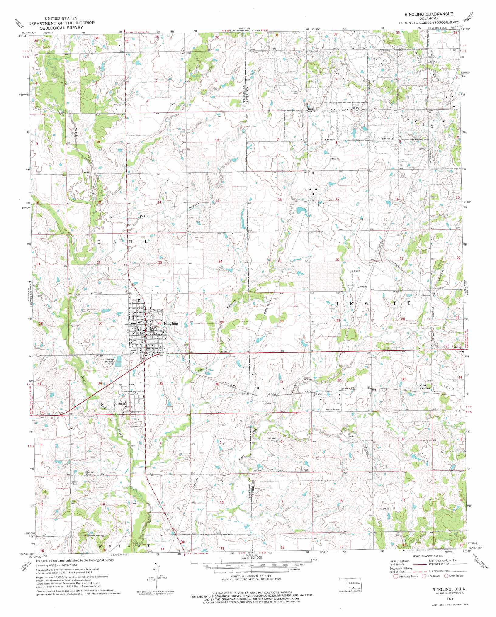
USGS Topo Quad 34097b5 - 1:24,000 scale
| Topo Map Name: | Ringling |
| USGS Topo Quad ID: | 34097b5 |
| Print Size: | ca. 21 1/4" wide x 27" high |
| Southeast Coordinates: | 34.125° N latitude / 97.5° W longitude |
| Map Center Coordinates: | 34.1875° N latitude / 97.5625° W longitude |
| U.S. State: | OK |
| Filename: | o34097b5.jpg |
| Download Map JPG Image: | Ringling topo map 1:24,000 scale |
| Map Type: | Topographic |
| Topo Series: | 7.5´ |
| Map Scale: | 1:24,000 |
| Source of Map Images: | United States Geological Survey (USGS) |
| Alternate Map Versions: |
Ringling OK 1974, updated 1977 Download PDF Buy paper map Ringling OK 2009 Download PDF Buy paper map Ringling OK 2012 Download PDF Buy paper map Ringling OK 2016 Download PDF Buy paper map |
1:24,000 Topo Quads surrounding Ringling
Harrisburg |
Velma |
Ratliff City |
Tatums |
Fox Ne |
Comanche Se |
Loco |
Cottonwood Creek |
Fox |
Milo |
Ryan Ne |
Ringling Nw |
Ringling |
Healdton |
Lone Grove |
Ryan Se |
Grady |
Orr |
Healdton Sw |
Healdton Se |
Fleetwood |
Prairie Valley School |
Spanish Fort |
Leon North |
Burneyville |
> Back to 34097a1 at 1:100,000 scale
> Back to 34096a1 at 1:250,000 scale
> Back to U.S. Topo Maps home
Ringling topo map: Gazetteer
Ringling: Populated Places
Cobalt Junction elevation 284m 931′Cornish elevation 259m 849′
Dundee elevation 300m 984′
Ringling elevation 278m 912′
Wirt elevation 294m 964′
Ringling: Streams
Fox Branch elevation 256m 839′Long Branch elevation 247m 810′
Ringling digital topo map on disk
Buy this Ringling topo map showing relief, roads, GPS coordinates and other geographical features, as a high-resolution digital map file on DVD: