Odart Mountain Topo Map Arizona
To zoom in, hover over the map of Odart Mountain
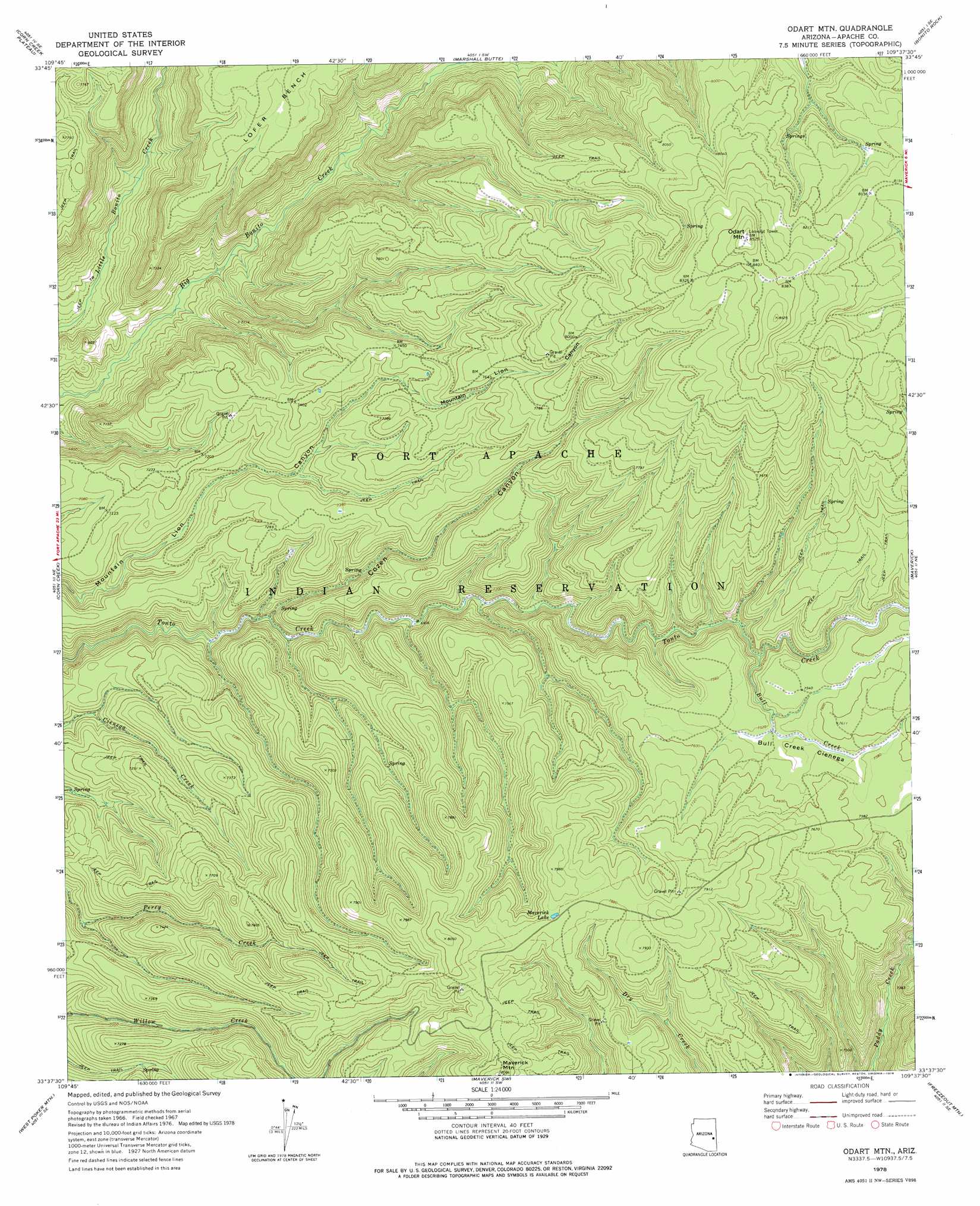
USGS Topo Quad 33109f6 - 1:24,000 scale
| Topo Map Name: | Odart Mountain |
| USGS Topo Quad ID: | 33109f6 |
| Print Size: | ca. 21 1/4" wide x 27" high |
| Southeast Coordinates: | 33.625° N latitude / 109.625° W longitude |
| Map Center Coordinates: | 33.6875° N latitude / 109.6875° W longitude |
| U.S. State: | AZ |
| Filename: | o33109f6.jpg |
| Download Map JPG Image: | Odart Mountain topo map 1:24,000 scale |
| Map Type: | Topographic |
| Topo Series: | 7.5´ |
| Map Scale: | 1:24,000 |
| Source of Map Images: | United States Geological Survey (USGS) |
| Alternate Map Versions: |
Odart Mtn AZ 1967, updated 1970 Download PDF Buy paper map Odart Mtn AZ 1978, updated 1978 Download PDF Buy paper map Odart Mountain AZ 2011 Download PDF Buy paper map Odart Mountain AZ 2014 Download PDF Buy paper map |
1:24,000 Topo Quads surrounding Odart Mountain
Alchesay Flat |
Hawley Lake West |
Hawley Lake East |
Mount Baldy |
Big Lake North |
Whiteriver |
Corn Creek Plateau |
Marshall Butte |
Bonito Rock |
Big Lake South |
Bonito Prairie |
Corn Creek |
Odart Mountain |
Maverick |
Hoodoo Knob |
Elwood Canyon |
West Poker Mountain |
Maverick Sw |
Freezeout Mountain |
Baldy Bill Point |
Natanes Mountains Nw |
Natanes Mountains Ne |
Sawbuck Mountain |
Willow Mountain |
Robinson Mesa |
> Back to 33109e1 at 1:100,000 scale
> Back to 33108a1 at 1:250,000 scale
> Back to U.S. Topo Maps home
Odart Mountain topo map: Gazetteer
Odart Mountain: Flats
Bull Creek Cienega elevation 2301m 7549′Odart Mountain: Lakes
Maverick Lake elevation 2408m 7900′Odart Mountain: Streams
Bull Creek elevation 2249m 7378′Odart Mountain: Summits
Maverick Mountain elevation 2468m 8097′Odart Mountain elevation 2598m 8523′
Odart Mountain: Valleys
Cozen Canyon elevation 2093m 6866′Odart Mountain digital topo map on disk
Buy this Odart Mountain topo map showing relief, roads, GPS coordinates and other geographical features, as a high-resolution digital map file on DVD: