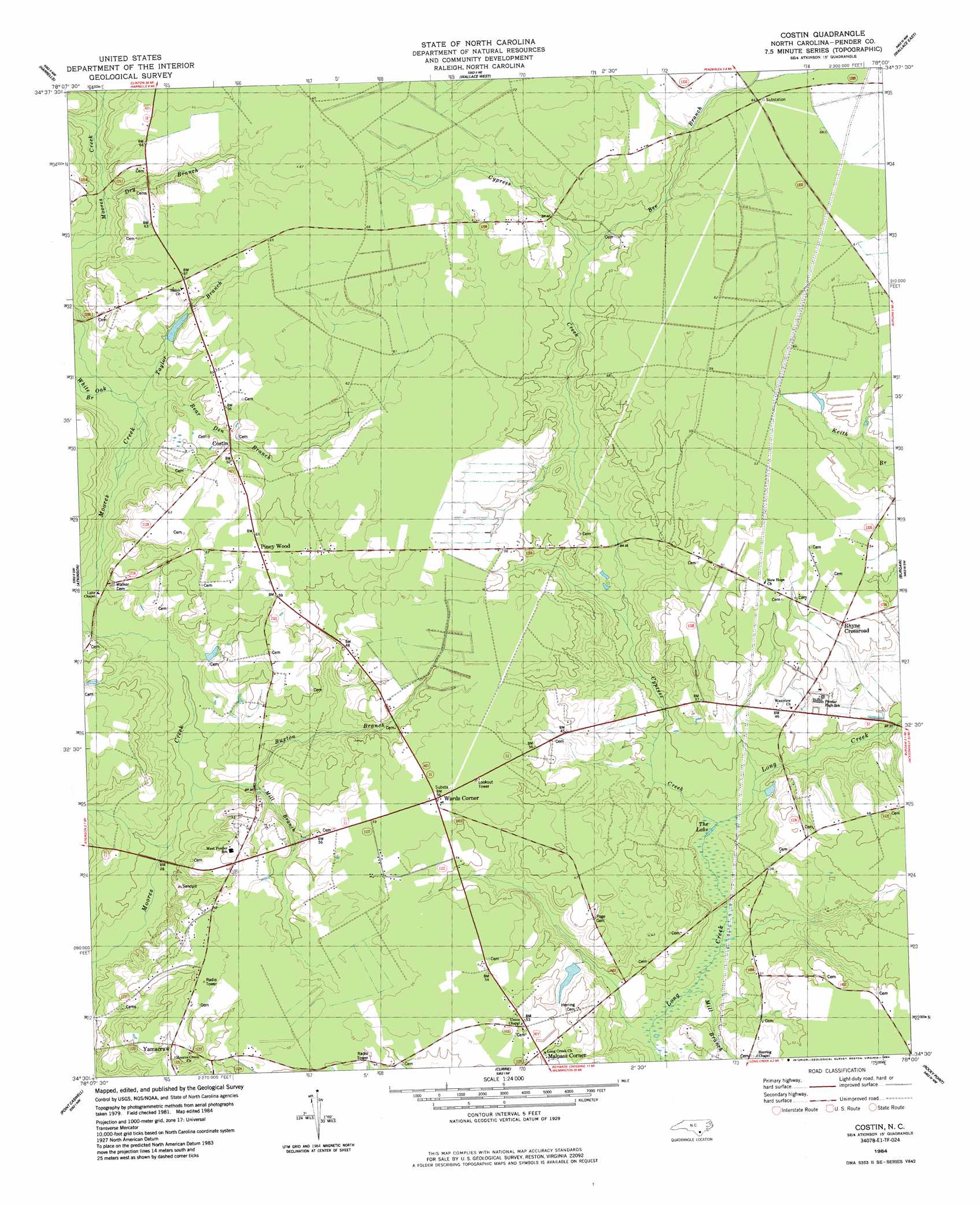
Costin Topo Map North Carolina
To zoom in, hover over the map of Costin
USGS Topo Quad 34078e1 - 1:24,000 scale
| Topo Map Name: | Costin |
| USGS Topo Quad ID: | 34078e1 |
| Print Size: | ca. 21 1/4" wide x 27" high |
| Southeast Coordinates: | 34.5° N latitude / 78° W longitude |
| Map Center Coordinates: | 34.5625° N latitude / 78.0625° W longitude |
| U.S. State: | NC |
| Filename: | o34078e1.jpg |
| Download Map JPG Image: | Costin topo map 1:24,000 scale |
| Map Type: | Topographic |
| Topo Series: | 7.5´ |
| Map Scale: | 1:24,000 |
| Source of Map Images: | United States Geological Survey (USGS) |
| Alternate Map Versions: |
Costin NC 1984, updated 1984 Download PDF Buy paper map Costin NC 2010 Download PDF Buy paper map Costin NC 2013 Download PDF Buy paper map Costin NC 2016 Download PDF Buy paper map |
1:24,000 Topo Quads surrounding Costin
Ingold |
Delway |
Rose Hill |
Charity |
Chinquapin |
Tomahawk |
Harrells |
Wallace West |
Wallace East |
Pin Hook |
Rowan |
Atkinson |
Costin |
Burgaw |
Stag Park |
Kelly |
Point Caswell |
Currie |
Rocky Point |
Mooretown |
Freeman |
Acme |
Leland |
Castle Hayne |
Scotts Hill |
> Back to 34078e1 at 1:100,000 scale
> Back to 34078a1 at 1:250,000 scale
> Back to U.S. Topo Maps home
Costin topo map: Gazetteer
Costin: Lakes
Lake Chapel elevation 11m 36′The Lake elevation 8m 26′
Costin: Populated Places
Costin elevation 16m 52′Malpass Corner elevation 16m 52′
Piney Wood elevation 19m 62′
Rhyne Crossroad elevation 16m 52′
Wards Corner elevation 17m 55′
Costin: Streams
Bear Den Branch elevation 10m 32′Bee Branch elevation 13m 42′
Buxton Branch elevation 8m 26′
Cypress Creek elevation 6m 19′
Dry Branch elevation 12m 39′
Mill Branch elevation 5m 16′
Mill Branch elevation 6m 19′
Red Bank Branch elevation 8m 26′
Taylor Branch elevation 10m 32′
White Oak Branch elevation 10m 32′
Costin digital topo map on disk
Buy this Costin topo map showing relief, roads, GPS coordinates and other geographical features, as a high-resolution digital map file on DVD:
South Carolina, Western North Carolina & Northeastern Georgia
Buy digital topo maps: South Carolina, Western North Carolina & Northeastern Georgia