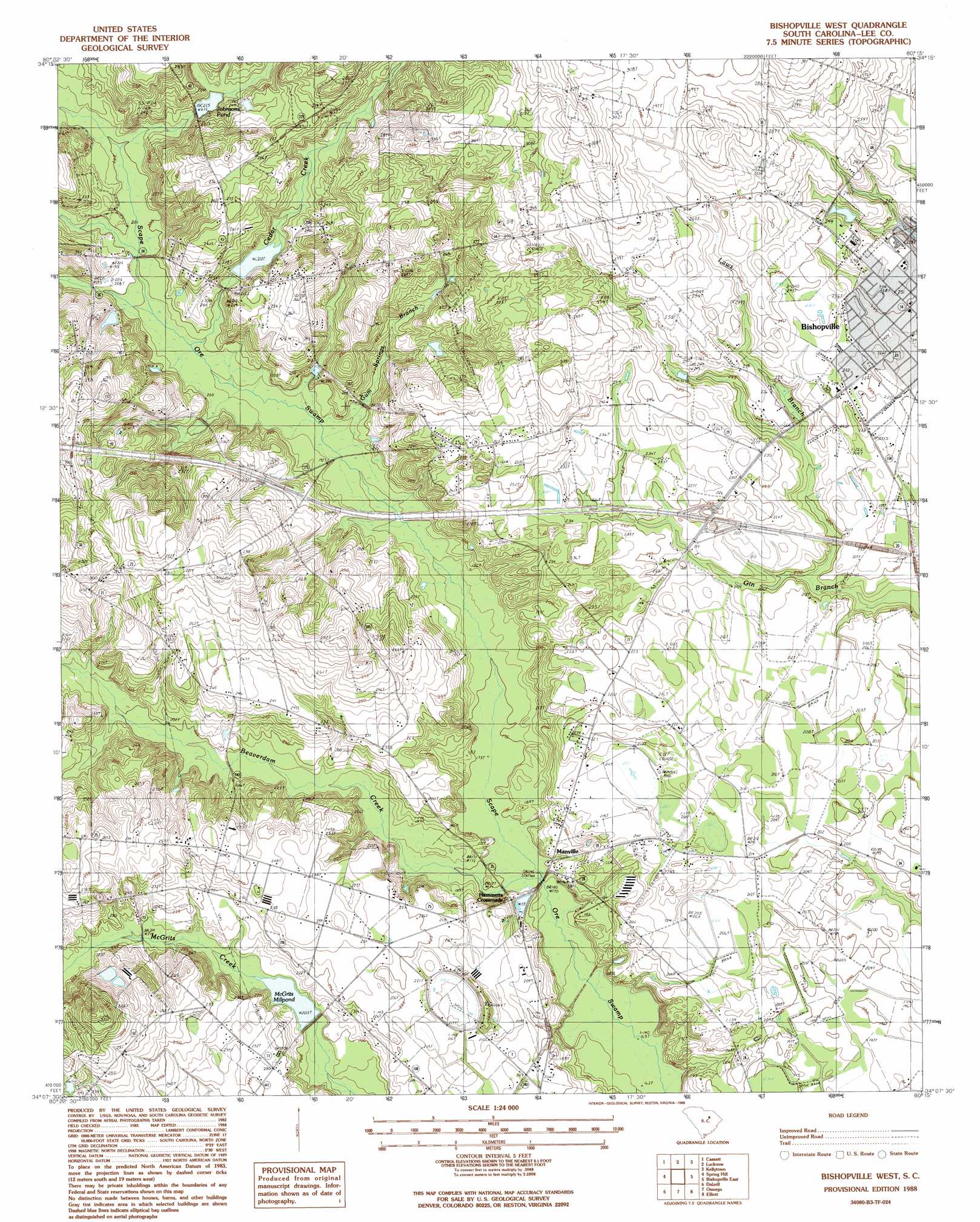
Bishopville West Topo Map South Carolina
To zoom in, hover over the map of Bishopville West
USGS Topo Quad 34080b3 - 1:24,000 scale
| Topo Map Name: | Bishopville West |
| USGS Topo Quad ID: | 34080b3 |
| Print Size: | ca. 21 1/4" wide x 27" high |
| Southeast Coordinates: | 34.125° N latitude / 80.25° W longitude |
| Map Center Coordinates: | 34.1875° N latitude / 80.3125° W longitude |
| U.S. State: | SC |
| Filename: | o34080b3.jpg |
| Download Map JPG Image: | Bishopville West topo map 1:24,000 scale |
| Map Type: | Topographic |
| Topo Series: | 7.5´ |
| Map Scale: | 1:24,000 |
| Source of Map Images: | United States Geological Survey (USGS) |
| Alternate Map Versions: |
Bishopville West SC 1988, updated 1988 Download PDF Buy paper map Bishopville West SC 2011 Download PDF Buy paper map Bishopville West SC 2014 Download PDF Buy paper map |
1:24,000 Topo Quads surrounding Bishopville West
Westville |
Bethune Nw |
Bethune |
Lake Robinson |
Hartsville North |
Camden North |
Cassatt |
Lucknow |
Kellytown |
Hartsville South |
Camden South |
Spring Hill |
Bishopville West |
Bishopville East |
Lamar |
Rembert |
Dalzell |
Oswego |
Elliott |
Lynchburg |
Wedgefield |
Sumter West |
Sumter East |
Mayesville |
Turbeville |
> Back to 34080a1 at 1:100,000 scale
> Back to 34080a1 at 1:250,000 scale
> Back to U.S. Topo Maps home
Bishopville West topo map: Gazetteer
Bishopville West: Bridges
Carters Crossing elevation 52m 170′Bishopville West: Crossings
Interchange 116 elevation 68m 223′Bishopville West: Dams
Denny Pond Dam D-1636 elevation 70m 229′Singletary Millpond Dam D-2410 elevation 69m 226′
South Carolina Noname 31013 D-2407 Dam elevation 61m 200′
South Carolina Noname 31014 D-2411 Dam elevation 65m 213′
South Carolina Noname 31019 D-2415 Dam elevation 70m 229′
Bishopville West: Parks
South Main Historic District elevation 67m 219′Bishopville West: Populated Places
Hammetts Crossroads elevation 56m 183′Manville elevation 56m 183′
McCutchen (historical) elevation 68m 223′
Rose Hill elevation 67m 219′
Spur elevation 69m 226′
Bishopville West: Reservoirs
Cedar Creek Millpond elevation 65m 213′Cedar Creek Millpond (historical) elevation 65m 213′
Denny Pond elevation 70m 229′
Johnsons Pond elevation 69m 226′
Mary Lees Pond elevation 70m 229′
McGrits Millpond elevation 61m 200′
McGuirts Millpond elevation 62m 203′
Singletary Millpond elevation 68m 223′
Bishopville West: Streams
Beaverdam Creek elevation 52m 170′Cedar Creek elevation 59m 193′
Gum Springs Branch elevation 57m 187′
Laws Branch elevation 60m 196′
Bishopville West digital topo map on disk
Buy this Bishopville West topo map showing relief, roads, GPS coordinates and other geographical features, as a high-resolution digital map file on DVD:
South Carolina, Western North Carolina & Northeastern Georgia
Buy digital topo maps: South Carolina, Western North Carolina & Northeastern Georgia